State Route 238 Drainage Study
State Route 238 Drainage Study
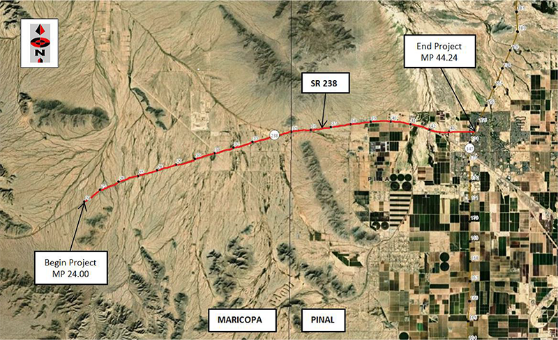
Completed 2020 - This study was located on State Route (SR) 238 in ADOT’s Central District. The study began at milepost (MP) 24.00 and ended at the intersection of SR 347 at MP 44.24 in the City of Maricopa.
The study was within Maricopa County from MP 24.00 to MP 34.99 and in Pinal County from MP 34.99 to MP 44.24. SR 238 is experiencing flooding during heavy rain storms which at times can last for days. This is also an issue for residents as they may have up to 20 miles of detour as there are no short detours available. During heavy rain the District continuously has to go to the flooding locations and clean up the site which can be quite expensive. A drainage report has been prepared for this study by ADOT Drainage Section and is included as part of this study documentation.
The purpose of this planning level assessment was to identify areas for improvement and make recommendations to improve drainage of the existing roadway. A detailed project assessment (PA) Report will need to be prepared if funding becomes available for construction. There is a potential for new right of way or temporary construction easements which have not been included in this planning level cost assessment.
Final Planning Level Assessment - December 2020