Are we there yet? A guide to highway distance signs
Are we there yet? A guide to highway distance signs
You are getting away for a long weekend in the White Mountains. Or maybe you are coming back from a vacation at Rocky Point. Either way, you are on the highway and wondering how much longer until you reach your destination.
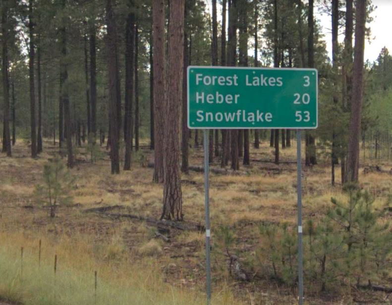
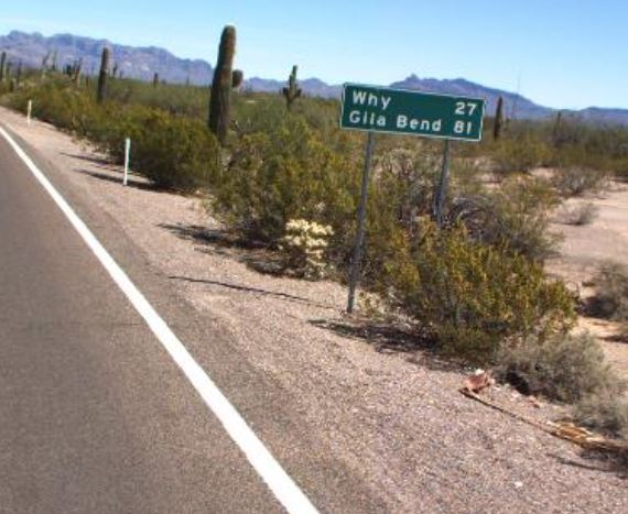
Then, a little farther down the road, you see a familiar green shape. It's a sign letting you know that you are now X miles from Pinetop-Lakeside or have Y miles left to get to Phoenix.
Distance signs are an essential part of the state highway system, but how much have you ever thought about them? Questions that occasionally pop up on our social media include why signs list the destinations they do, or what points are those signs measuring to exactly? If that is something that's ever crossed your mind, here's a primer about how exactly distance signs get the job done.
It all starts with which cities to show. Distance signs can show up to three destinations, with the bottom slot reserved for what are known as "control cities."
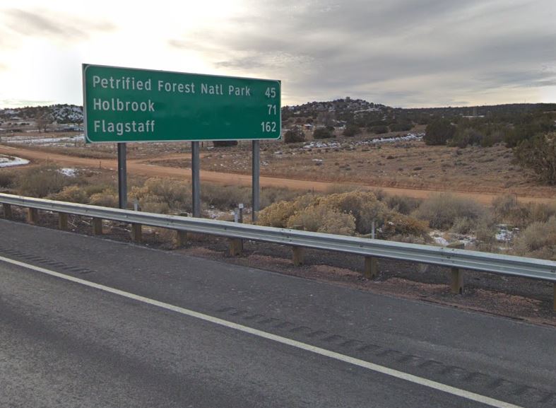
A control city is defined in Section 300 of our Traffic Engineering Guidelines and Processes as one containing a junction of two or more state or federal highways. A control city also can be one whose location can be easily determined by highway users, is on the state highway map and "whose population and character are generators of sufficient traffic to be a focal point for travel." Control cities for an interstate must meet similar qualifications, with the added stipulation that they be cities of "national significance."
The listed control city for a route should remain the same along the entire highway until that destination is reached. If there are two cities of equal significance, they can be displayed on alternating boards.
Above control cities go intermediate destinations, which must have at least one motorist service, be a traffic generator that the highway was built to service or be an important route junction. If there are two such cities along the route, both can be shown.
On a rural freeway, the top line should be reserved for the next community the freeway will pass through or the next major highway junction. After that, the next intermediate destination should be displayed. Finally, an upcoming rest area also can be listed in the top or middle slot, if desired.
So we have our destinations. But when the sign says X miles to Payson, where exactly are they measuring to?
This one is a bit easier to answer. The guideline and processes say the distance shown should be to the center of the destination, rounded to the nearest mile. And what exactly constitutes a "center?" It could be anything deemed to be significant near the center of the community, such as a major railroad junction, business district, post office, city/town hall or something similar.
In case a new sign is needed, our Guidelines and Processes reference has extensive tables listing control cities and other communities along any given state highway, plus mileage figures between the state line and destinations in neighboring states and Mexico.
And there you have it. You may not remember this the next time a helpful green sign lets you know you still have X miles left to Prescott or Y miles until Bisbee, but it's a good thing to have handy just in case anyone in the car asks. Drive safe out there!