Will the real US 180 please stand up?
Will the real US 180 please stand up?
Do state highways have a case of long-lost triplets?
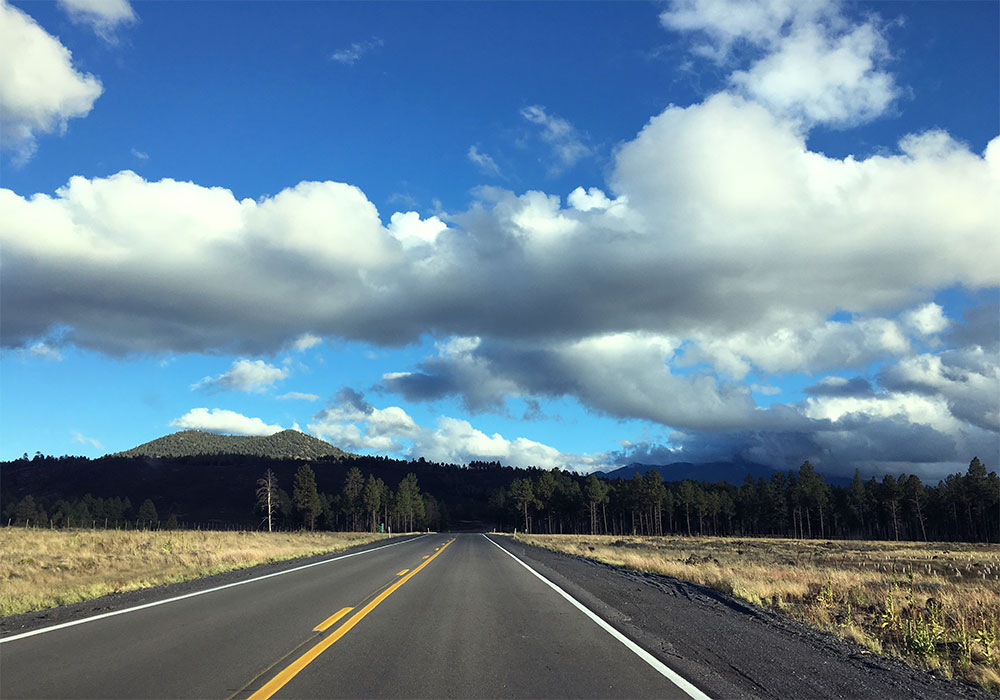
You can ask one person what they could find along US 180 and they would say it's the route that takes you northwest out of Flagstaff, like in the photo to the right. From there you can access Snowbowl, Humphrey's Peak, the Lava River Cave and eventually State Route 64 to head either to Williams or the Grand Canyon.
Ask another person and they might tell you that US 180 allows you to travel between Holbrook and St. Johns, with maybe a stop at the Petrified Forest National Park or a section of the Zuni Indian Reservation along the way.
And, funny enough, they would both be right. There's even a third person who will tell you that US 180 runs between the New Mexico state line and Alpine.
So, which is the real US 180? The one near Flagstaff, the one near Alpine, or the one between St. Johns and Holbrook? If they are all real, why do these stretches of road dozens of miles apart all have the same number?
For that answer we turned to our list of historic roads, which gives some insight into the routing of US 180 in Arizona.
That stretch between St. Johns and Holbrook is the oldest part. Long before there were highways , let alone automobiles, this route was part of an established wagon trail during Arizona's territorial days. In the earliest maps of proposed highways for the state, it also shows up. On a 1917 map found in our history of transportation in Arizona, it's listed as part of the National Old Trails Highway, coming in from New Mexico.
Starting with a map in 1926 and lasting into the early 1930s, this route was listed as being part of US 70. US 180 did exist, but funny enough, ran between the New Mexico state line and Globe – basically the route of US 70 runs today. Starting in the 1930s, the road between Holbrook and New Mexico started to be labeled US 260, something that would continued until the early 1960s when it was renumbered to the current US 180.
We'll also note that during this time the road didn't go straight between St. Johns and Holbrook, but detoured through the communities of Concho and Hunt. It wouldn't be until the early 1970s that the more direct route would be established and the Concho-Hunt portion would be relabeled as an alternate, or US 180A.
Meanwhile, the section between Flagstaff and State Route 64 would not become part of the state highway system until 1960. Initially it was known as State Route 164, something that would be changed the very next year during a renumbering.
So we've followed the numbering a bit, but why the three different segments? Well, the answer to that isn't so much that there are three US 180s, but rather the highway sometimes travels incognito.
In road numbering there is something called a "concurrence," when two or more highways share the exact same route. So, Interstate 40 between Holbrook and Flagstaff is also technically US 180 between Holbrook and Flagstaff, though I-40 gets top billing, as it were. The same thing happens between St. Johns and Alpine, where the road may be marked on maps as US 191, but it is US 180 at the same time.
No matter what stretch of US 180 you are on, you are bound to see some beautiful sights. As our list of historic roads says about the roughly 120-mile highway, "from Alpine at 8,050 feet elevation in the Apache-Sitgreaves National Forest ... to the painted deserts of Petrified Forest National Park around 5,400 feet, travelers have the opportunity to see some of Arizona’s most colorful rural landscapes in a leisurely three-hour journey."
Now that does sound like it's worth a road trip.