Freeway closure? To get where you’re going, it’s all in the timing
Freeway closure? To get where you’re going, it’s all in the timing

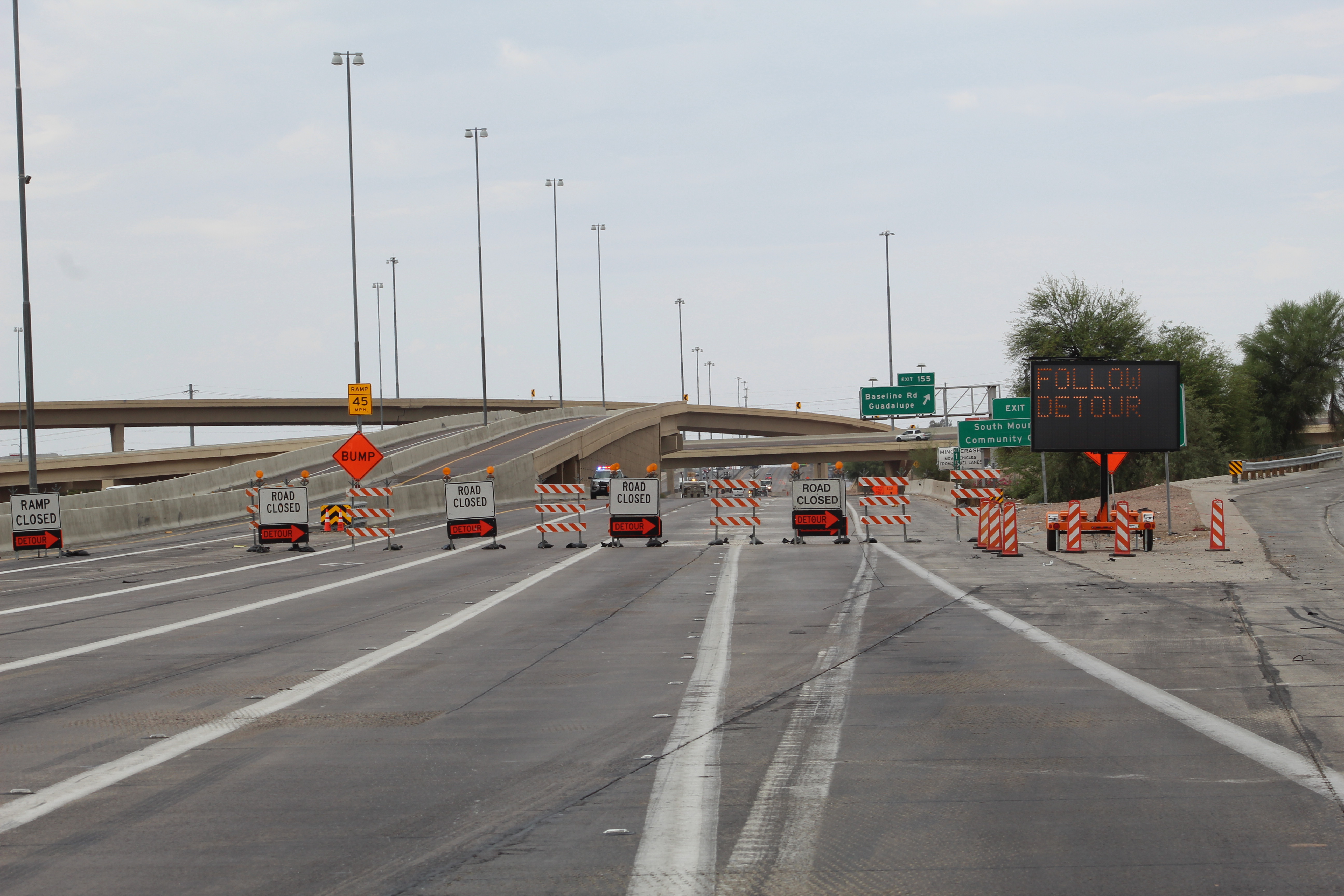
It's summer 2022 – also known as the “summer of closures” – on the Interstate 10 Broadway Curve Improvement Project. As we’ve been saying for a few weeks now, travelers should expect multiple weekend freeway closures in the project area through at least August. Our project team encourages you to plan routes ahead of time and allow extra time to get where you’re going.
We are often asked for directions to get around a freeway closure. For this project, ADOT is advising drivers to use the highways and freeways in the state highway system, rather than local roads and streets. While it may add a few extra miles or minutes to your route, highways and freeways generally provide the fastest detours. We are using our project app, The Curve, our website, i10BroadwayCurve.com, social media and other tools to share the detour routes along the state highway system with travelers, and we encourage everyone to use them.
However, on a complex project in a large metropolitan area like Phoenix, it may be a natural inclination during freeway closures for some drivers to self-detour onto local roads. For those drivers, the Maricopa Association of Governments (MAG) and ADOT are collaborating with local cities and towns in the project area on a unique program to make sure drivers can get where they’re going without too much delay and with minimal disruption to the drivers already using those local roads.
This program keeps traffic flowing by deploying traffic signal timing plans across local jurisdictions on key roads during freeway closures.
How were those signal timing plans created? Early in the project process, MAG used a traffic modeling program to determine which local roads and streets drivers would most likely use to detour themselves around freeway closures. Through the program, they identified that, among others, 48th Street, Priest Drive, Baseline Road and Southern Avenue could likely see increased traffic when I-10 is closed.
Since technology now allows for traffic signal timing to be controlled remotely through computer networks, MAG took an inventory of the types of technology installed on the signals on the identified roads to make sure their signal timing plans could be adjusted and controlled remotely. If a traffic signal needed upgraded technology, MAG worked with the local city or town to find the funding to make the upgrades.
The MAG team then looked at the expected increase in traffic during different freeway closure scenarios. On the I-10 Broadway Curve Improvement Project, freeway closures typically occur in the same areas. The MAG team studied the directions in which people were expected to travel and their possible destinations during each closure in each area. From that information, they developed signal timing plans that adjust the timing of red and green lights across a series of traffic signals along the identified local roads and streets. Now, the signals are timed to work together to keep traffic flowing along the roadway.
These signal timing plans were set into place as the first freeway closures for the I-10 Broadway Curve Improvement Project were beginning in 2021. Now, after each closure, the team reviews the data about how traffic flowed during the closure and adjusts the signal timing plans for the next closure.
It’s all part of an ongoing improvement process to make sure you get where you’re going, even when the freeway is closed.