Kilometers in Arizona? You bet!
Kilometers in Arizona? You bet!

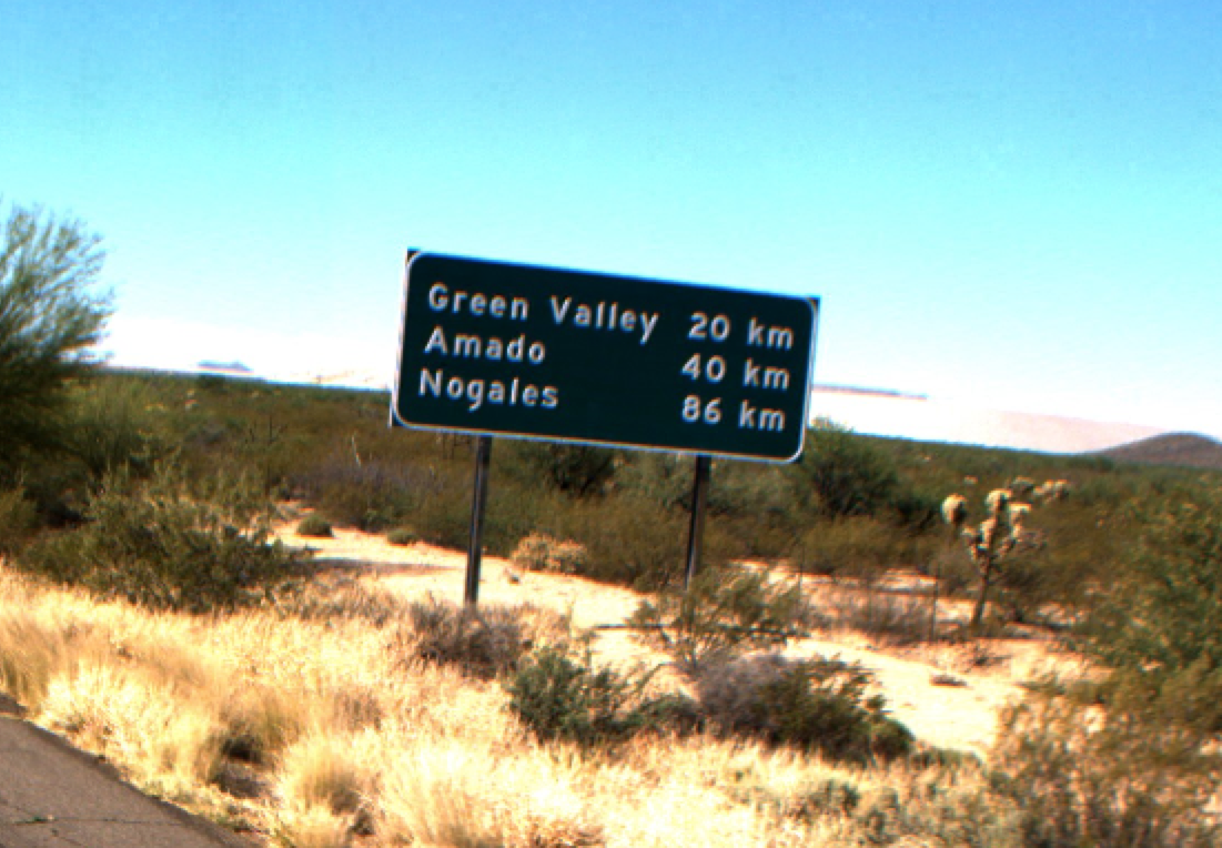
Interstate 19 runs between Tucson and Nogales in the southeastern part of our state. If you don’t travel that important trade corridor often, you may not know about its unique place in Arizona’s, nay America’s, pantheon of interesting roadways.
First opened for travel in 1962 (and fully completed in 1978), Interstate 19 is the only highway in the United States to be fully marked by kilometers.
(Bonus fun fact: Interstate 265 contains a small stretch of kilometer markings through Louisville, Kentucky, for many of the same reasons explained below.)
In 1975, Congress passed the Metric Conversion Act, declaring the metric system as the preferred method of measurement in the United States. The act itself was merely a strong suggestion to the country, however, and didn’t contain any compulsory provisions. That same year, President Gerald Ford established the U.S. Metric Board in hopes of making the act’s recommendations a reality.
A massive campaign ensued filled with public service announcements and 16 mm film strips distributed to classrooms throughout the country, readying the nation’s schoolchildren for the inevitable switch to the practically universally used metric system.
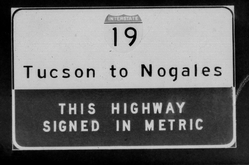
One of the very first decisions of the Metric Board was to use the nearly completed Interstate 19 as a pilot program for converting all of America’s mileposts into kilometer markers. Crews got to work metric-izing the interstate ahead of its 1978 completion. That's one of the original signs for that transition you see there top right.
As it happened, the Metric Board was dismantled by Ronald Reagan in 1982, just seven years after it was established. But more importantly, it was dismantled without the United States really making any serious effort to completely convert to the metric system. And yet, still, 38 years later, Interstate 19 continues to be marked with kilometers for its entire 63 mile- er, 102 kilometer- stretch from the southern border to Tucson. Why is that?
Thank the locals! Yes, the folks who live, work, and travel along I-19 have a special reverence for the interstate’s unique markings and have fought to preserve them since the very first whiff of conversion.
Is there anything else you’ve always wondered about Arizona’s highways? Let us know!

