Transportation Defined: Aerial photography film
Transportation Defined: Aerial photography film
Aerial photographs are primarily used for map compilation for project assessments, design-level mapping and design concept reports. They may also be used at public hearings.
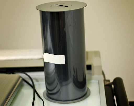
This item probably looks pretty familiar to any of you photography buffs out there. It’s a roll of film – a really big roll of film.
In fact, if you were to unroll it, the film would measure 9.5 inches by 250 feet!
But, what does this have to do with transportation, you might ask?
Remember yesterday when we blogged about Photogrammetry? We told you that the sophisticated maps created by ADOT photogrammetrists all start off as two aerial photographs.
The pair of aerial photos (called a stereomodel) is turned into a very accurate map that’s used for a number of purposes including helping engineers design roads.
Well, this is the film required to take those initial aerial photographs.
ADOT has a very large camera that is placed in an airplane specifically to get these aerial shots. After an area is flown and the photos are captured (about six exposures per mile for design level mapping), the film is developed.
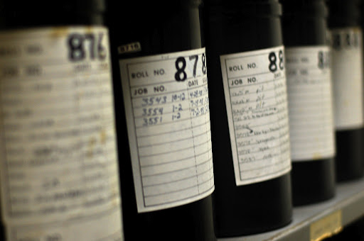
The film is archived and kept in a climate-controlled room.
Next, the very detailed photos are digitized by a powerful scanner (not your typical desktop scanner).
There’s a lot of information and detail in these photos so a large file size is required … one image equals about 267 megabytes for a black and white imagery.
From there, the digitized image is sent to the photogrammetrists so they can begin their work.
Transportation Defined is a series of explanatory blog posts designed to define the things you see on your everyday commute. Let us know if there's something you'd like to see explained ... leave a comment here on the blog or over on our Facebook page!