Interstate 10 to close in both directions between US 60 and SR 51 (April 21-24)
Interstate 10 to close in both directions between US 60 and SR 51 (April 21-24)
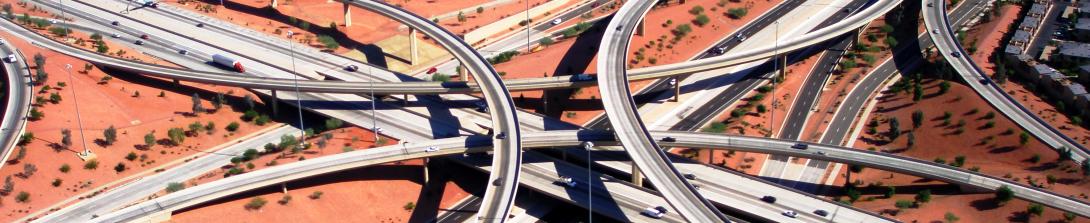
Crews removing the old 48th Street and Broadway Road bridges
PHOENIX-The Arizona Department of Transportation is advising motorists to allow extra travel time, plan to use detours and expect delays if their plans include travel on Interstate 10 in the area of SR 51 and US 60. Crews with the Interstate 10 Broadway Curve Improvement Project are removing the old 48th Street and Broadway Road bridges over I-10.
Westbound Interstate 10 between US 60 and 32nd Street and numerous off- and on-ramps will be closed from 8 p.m. Friday, April 21, to 4 a.m. Monday, April 24 for bridge removal. At the same time, the following ramps will be closed:
- The ramps from westbound US 60 to westbound I-10.
- The ramp from southbound Loop 101 (Price Freeway) to westbound US 60.
- The westbound I-10 on-ramps at Elliot, Baseline, and Broadway roads and 40th Street.
- The westbound US 60 on-ramps at McClintock Drive, Rural Road and Mill Ave.
- The westbound off-ramps at Broadway Road and 40th and 32nd streets.
Westbound I-10 detour: Use eastbound Loop 202 (Santan Freeway) or eastbound US 60 to northbound Loop 101 (Price Freeway) to westbound Loop 202 (Red Mountain Freeway) to access westbound I-10.
Drivers heading to the West Valley can bypass the work zone by using Loop 202 (South Mountain Freeway) west and north to connect with I-10 at 59th Ave.
Eastbound Interstate 10 will be closed between SR 51 and US 60 from 9 p.m. Friday, April 21, to 5 a.m. Monday, April 24, for bridge removal. At the same time, the following ramps will also be closed:
- The eastbound I-10 on-ramps at Third, Seventh, and Jefferson streets, Buckeye Road, 24th and 32nd and 40th stress, and Broadway Road.
- The loop ramp from southbound SR 143 to eastbound I-10.
- The westbound Loop 202 (Red Mountain Freeway) ramp to eastbound I-10.
- The southbound I-17 on-ramps at Seventh Avenue and Seventh Street.
- The ramp from southbound I-17 to eastbound I-10.
- The southbound SR 51 on-ramp at McDowell Road.
- The ramps from southbound SR 51 to eastbound I-10.
- The high-occupancy vehicle (HOV) ramp from eastbound I-10 to eastbound Loop 202 (Red Mountain Freeway).
Eastbound I-10 detour: Use eastbound Loop 202 (Red Mountain Freeway) to southbound Loop 101 (Price Freeway) to westbound Loop 202 (Santan Freeway) to access eastbound I-10 beyond the closure.
Drivers traveling on southbound I-17 can use westbound I-10 to eastbound Loop 202 (Red Mountain Freeway). West Valley drivers heading to the Southeast Valley can bypass the closure by using the Loop 202 (South Mountain Freeway), From I-10 and 59th Avenue, travel south and east to connect with I-10 south of Chandler Boulevard.
Phoenix Sky Harbor International Airport Access: East Valley drivers should use the entrance from 44th Street. West Valley drivers should use southbound 16th Street to eastbound Buckeye Road.
Additionally: Northbound 48th Street/SR 143 will be closed between Broadway Road and I-10 from 8 p.m. Friday, April 21 to 4 a.m. Monday, April 24, for bridge removal. Southbound SR 143/48th Street will be closed between McDowell Road and Broadway Road from 8 p.m. Friday night, April 21 through to 3 p.m. Saturday, April 22 for utility work and bridge removal. Then, Southbound SR 143 will remain closed between I-10 and Broadway Road from 3 p.m. Saturday, April 22 to 4 a.m., Monday, April 24. There will also be ramp closures in this area.
Project related photos available here.
# # #
The I-10 Broadway Curve Improvement Project is identified in the Maricopa Association of Governments’ Regional Transportation Plan, funded by a half-cent sales tax approved by Maricopa County voters in 2004 through Proposition 400. MAG identified the need for this project to reduce travel times on I-10 during peak hours; improve airport access; support ridesharing and transit; and prepare the region for future growth projections.