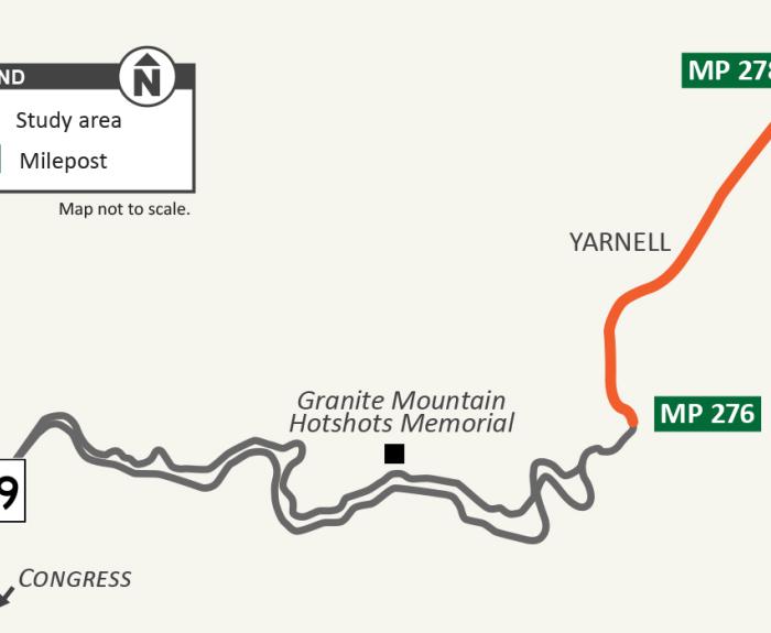
YARNELL – The Arizona Department of Transportation is hosting a community open house from 4 - 6 p.m. Tuesday, Feb. 21, to provide Yarnell residents and other stakeholders an
The 5-mile unpaved section of State Route 88 (Apache Trail) from Fish Creek Vista (milepost 222) to milepost 227 near Reavis Trailhead Road has reopened.
The Arizona Department of Transportation is working to improve the area of State Route 77, Calle Concordia to Tangerine Road. This is a pavement rehabilitation project.
The project will span between mileposts 77.38 to 82.10 in the Town of Oro Valley. Construction will begin in spring 2022 and
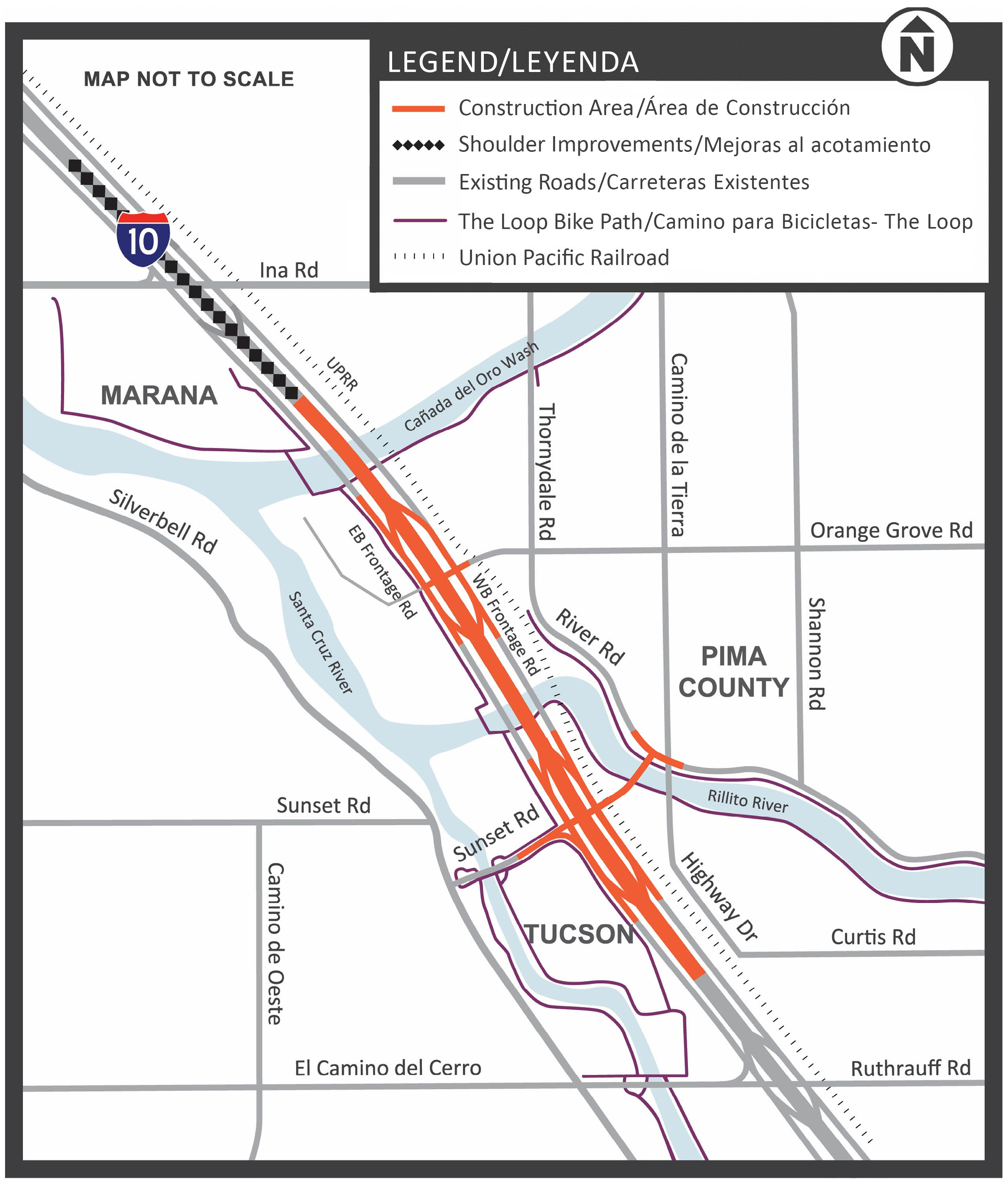
The Arizona Department of Transportation and the Federal Highway Administration (FHWA) completed a project to improve safety and traffic flow on I-10 between the Ina Road and Ruthrauff Road interchanges in Tucson.
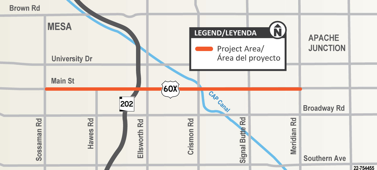
The Arizona Department of Transportation has started a construction project to improve US 60X (also referred to as Old US 60, Apache Trail or Main Street) between Sossaman and Meridian roads.
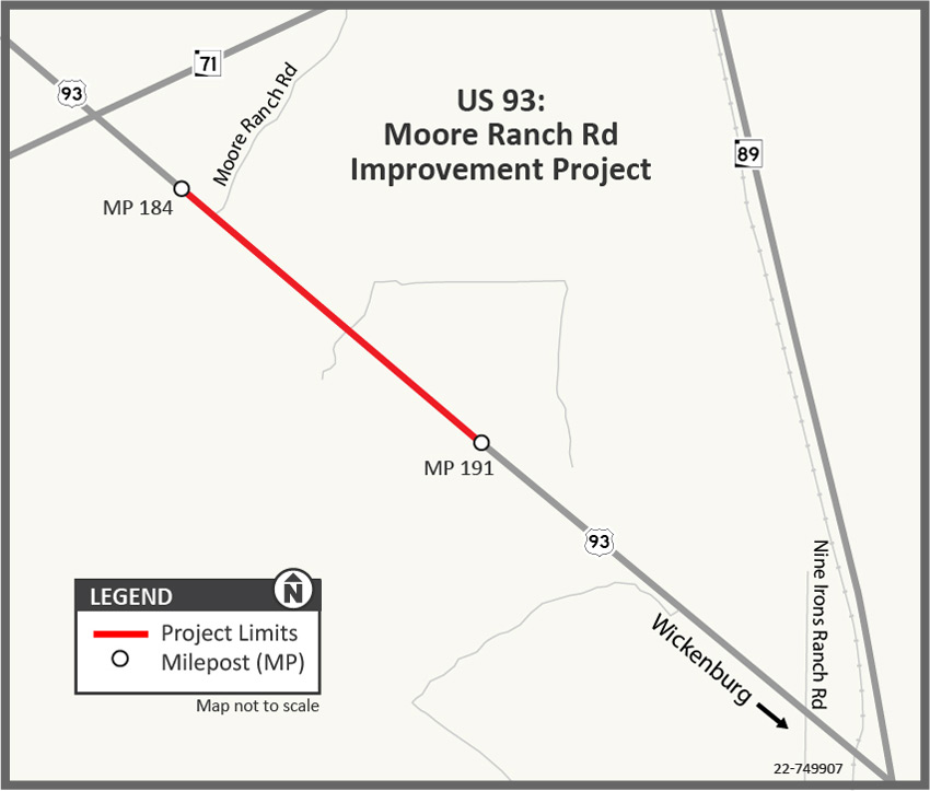
The Arizona Department of Transportation has completed a project to remove and replace the existing top layer of pavement along US 93 between Moore Ranch Road and milepost 190 (mileposts 184-190) north of Wickenburg. The purpose of the project is to improve the condition of the pavement and extend its service life.
State Route 24 (SR 24), also referred to as the Gateway Freeway, is currently a 5-mile interim roadway between Loop 202 and Ironwood Drive. This section features two lanes in each direction with a center median, bridges over Ellsworth and Mountain roads and at-grade intersections at the following locations:
