Heed the warning signs on a reopened stretch of Apache Trail
Heed the warning signs on a reopened stretch of Apache Trail

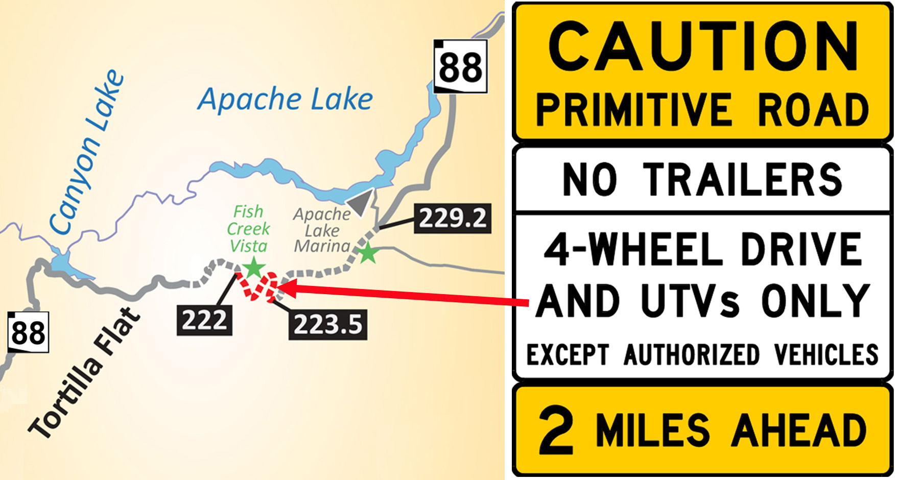
Before ADOT reopened a section of SR 88 Monday following a 5-year-closure, we installed signs that you don’t ordinarily find on a state highway:
CAUTION: PRIMITIVE ROAD
No Trailers
4-Wheel Drive and UTVs Only
That’s because this unpaved stretch of Apache Trail, between mileposts 222 and 227 east of Tortilla Flat, is anything but ordinary.
It includes a steep, narrow, winding section on Fish Creek Hill, some of it along a cliff. Conditions there can change following every rainfall, meaning today’s roadway may not resemble what you’ll encounter following the next weather event. Keep in mind that it was catastrophic rainfall in 2019 that closed this section in the first place.
The project that restored limited access on this historic highway is an interim one. ADOT continues seeking federal funding for a $33 million project needed to restore access to all vehicles.
Just how historic is the roadway? It was built so crews from the East Valley could reach the construction site for Roosevelt Dam, which was completed in 1911. Sections maintain many of the original features, including drainage systems built of stone.
Amid these warnings, there continues to be good news for motorists with passenger vehicles who want to visit this scenic area. Much of the Apache Trail is accessible without a four-wheel drive. SR 88 is paved from where the highway begins in Apache Junction and for several miles east from Tortilla Flat at milepost 213. Those taking boats to Apache Lake or reach the Reavis Ranch Trailhead can continue doing so from State Route 188 at Roosevelt Lake.
For more information on the SR 88, please visit azdot.gov/SR88ApacheTrail.
