Transportation History: The Phoenix-to-Prescott Territorial Road
Transportation History: The Phoenix-to-Prescott Territorial Road
Today there are more than 85 highways crisscrossing Arizona that will get you where you need to go. No matter if you are traveling from Winkleman to Superior, Springerville to Sanders, or Lake Havasu City to Quartzsite, there's a highway to get you there.
But it this wasn't always the case. In fact, it was 110 years ago this month that Arizona took major steps in constructing the first north-south highway across the state.
It was with some jubilation that the Arizona Journal-Miner in Prescott welcome the arrival of civil engineer F. R. Goodman on Tuesday, May 10, 1910, proclaiming that the event "practically inaugurated the work on the Territorial north-and-south highway."
As our comprehensive history of transportation in the state says, the north-south highway they reference is one of the two original state roads envisioned by the Territorial Legislature in 1909. An east-west highway would run between Duncan and Yuma. The north-south highway would go between Douglas and the Grand Canyon. To make this a reality, in 1909 the legislature put all territorial road construction under the position of the Territorial Engineer, who was required to be "a practical competent civil engineer." That person was J.B. Girand, Goodman's boss.
Goodman arrived in Prescott to oversee construction of the first 12-mile segment of the highway. The contract for the road was awarded to a company called Johnson & Shea of Riverside, California, one of four bids received.
According to the Journal-Miner, Girand was expected to arrive the next morning and to stay to oversee the work.
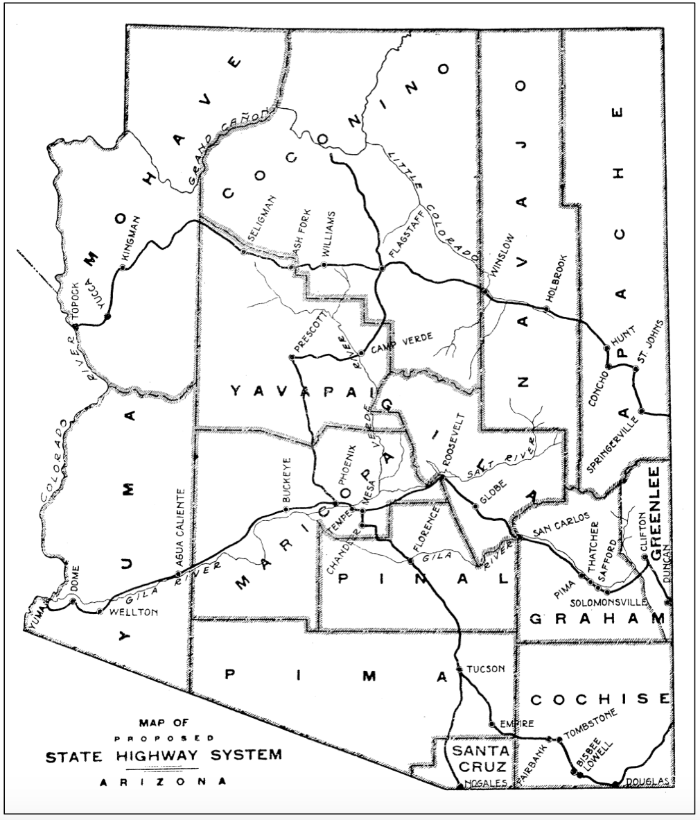
The Arizona Republican published an update on May 27, 1910, saying that work on the road was "underway and is proceeding satisfactory." There were somewhere between 30 and 40 people already working on the project, but "it is expected soon that the force will include somewhere between seventy and a hundred men." Unlike modern State Route 89, which runs southwest toward Wickenburg, this road was heading directly south and would have to go over a pass near Mount Union, like what you can see in this 1914 map of the proposed system. The maximum grade was supposed to be 6 percent.
"It will afford one of the finest scenic roadways in the west when utilized, as well as one of the most substantial," the Journal-Miner said.
As picturesque as that sounds, more than a year later it was not yet finished. On July 7, 1911, the Holbrook News reported that Girand was going to again be in Prescott to oversee the continuation of the road past the initial 12 miles. Once that segment had advanced sufficiently, similar construction would start north from Flagstaff toward the Grand Canyon, the paper reported. During the the last three years before statehood, crews completed 145 miles of road.
In the meantime, the Holbrook News said "there is now a very respectable substitute in the old road via Wickenburg ... Travelers to Prescott can get through with their automobiles very nicely now, even though the road is not what they would like, nor what the territorial highway will be when finished."
It seems that respectable substitute would become that de facto road, as a 1917 map of the state shows the route between Phoenix and Prescott going through Wickenburg and Congress. This would be the route US 89 would go in the 1920s after a shorter connector between Prescott and Wickenburg was completed. By the end of the decade, that highway would run the length of the state between Nogales and the Utah state line.
The drive for a state highway system eventually led to the myriad of routes we enjoy today. Girand got it right when he assured the Holbrook News that "the territorial highway system is growing into a gigantic undertaking, but one that will be a monument to this day and generation, a developing influence throughout the territory, the value of which cannot be overestimated."