GIS Analysis
GIS Analysis
This program is responsible for oversight of geographical information systems (GIS) related to statewide roadway inventory, the Arizona Transportation Information System (ATIS), which is ADOT’s transportation network linear referencing system (LRS). This dataset supports FHWA's Highway Performance Monitoring System (HPMS) submittal and the All Roads Network of Linear Referenced Data (ARNOLD). This linear reference system is the backbone for the Roadway Characteristics Inventory (RCI) that supports the thirty-seven (37) fundamental data elements that are a part of the Model Inventory of Roadway Elements (MIRE). Creation of the annual Highway Log and photolog imagery is vital for internal clients and contractors that work with ADOT. Tools utilized include aerial photogrammetry, GPS, cartography, online interactive mapping, remote sensing, ArcGIS, data visualization, and database maintenance related to the LRS/RCI database. This program is also responsible for agency-wide mapping and data requests.
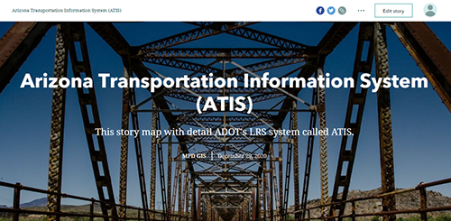
Arizona Transportation Information System (ATIS)
The authoritative roadway centerline dataset is owned and maintained within the Geospatial Analysis Section. The roadway centerline is managed as a Linear Referencing System (LRS), which becomes the backbone for how all roadway characteristics data are defined through route name and measure along a route. This dataset supports a number of annual federal reports, such as the All Roads Network of Linear-Referenced Data (ARNOLD) and the Highway Performance Monitoring System (HPMS) report.
Roadway Characteristics Inventory (RCI)
The maintenance of roadway characteristics data directly supports HPMS data needs and is largely driven by the Geospatial Analysis Section. Examples of roadway characteristics data include number of lanes, speed limits, functional classification, and more. These data are maintained all within a GIS, which can then be used for data visualization and analysis.

Roadway Characteristics Inventory (RCI)
Model Inventory of Roadway Elements (MIRE)
The GIS Section is the project lead for Model Inventory of Roadway Elements (MIRE). MIRE is an anticipated federal requirement for all DOTs to have access to MIRE fundamental data elements (FDE) by September, 2026. ADOT reports annual progress on MIRE to the Arizona Governor’s Office of Highway Safety (GOHS). There is no anticipated federal submission for MIRE data at this time.
MIRE is a recommended listing of roadway characteristics and traffic inventory elements critical to safety management. While there is no submission requirement anticipated at this time, these elements help ADOT meet the data requirements common among analytical safety tools. There are nine fundamental elements required on all paved public roads, with an additional 28 fundamental elements required on non-local paved roads.
Model Inventory of Roadway Elements (MIRE)
GIS Data
The Geospatial Analysis Section owns and maintains a number of GIS data layers, which gives data location and shape allowing visualization and location-based analysis in addition to conventional data analysis. Many of these layers are available on Arizona's statewide data clearinghouse, AZGeo. Anyone looking to acquire authoritative ADOT data should visit the AZGEO website. Users can search via keywords or browse by categories. Layers are updated yearly and metadata is provided to help users understand the proper use cases of the data. Please reach out to the GIS team at [email protected] if you have any questions about ADOT data on AZGeo.
To learn more about spatial data, visit What Is GIS?

Map Request
The Geospatial Analysis section supports ADOT teams with custom Esri web maps, dashboards and apps as well as static paper or pdf maps. Several commonly requested maps and information are available for public consumption through StoryMaps, web maps, and pdf maps.
For tourism questions, please refer to the Arizona Office of Tourism website.

Outreach
The Geospatial Analysis Section performs extensive outreach internally within ADOT as well as with other state and local agencies to increase other’s knowledge of GIS and share how ADOT data is managed. For internal ADOT customers, we offer training, mapping, and analysis services. Please reach out to the GIS team at [email protected] if you have any questions.
To learn more about how GIS can benefit any agency, visit What Can GIS Do For You?
To view quick facts about ADOT and its road network, visit the ADOT fact sheet