Highway History: State Route 85
Highway History: State Route 85
State Route 85 is commonly used by Arizonans to reach the beaches of Rocky Point, Mexico, or as a connection between Interstate 10 and Interstate 8 on trips to western Arizona and Southern California. The southern portion of the highway, from Gila Bend to the Mexican border at Lukeville, follows a corridor that helped support Arizona's economy before it was a state.
Because of the route's importance in state history, it's been designated a historic highway.
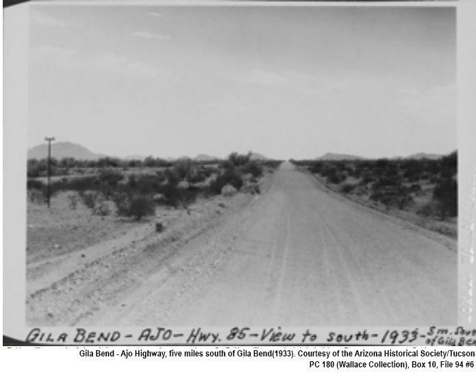
The five Cs (copper, cattle, cotton, citrus, and climate) were important to Arizona’s economy in its early years, and SR 85 became the main route to the Ajo copper mine, established in 1854. In the late 1880s and early 1900s, railroads were completed in the area to move copper across the state. As mining became increasingly important to the state’s economy, Maricopa and Pima counties worked to improve their portions of the future SR 85 from Gila Bend to the community of Why. State Route 85 was officially added to the state highway system in 1936. By 1939, the highway between Gila Bend and Why was paved, and the segment from Why to the border was completed in 1943.
The 80-mile stretch between Gila Bend and Lukeville has been designated a historic highway. Today, SR 85 extends well north of Gila Bend to Interstate 10 near Buckeye and is still critical to Arizona's economy. SR 85 has been identified as one the state's key commerce corridors. ADOT recognizes it is an important route in our transportation system and critical to the health of our state’s businesses and economic well-being.