Corridor Profile Studies
Corridor Profile Studies
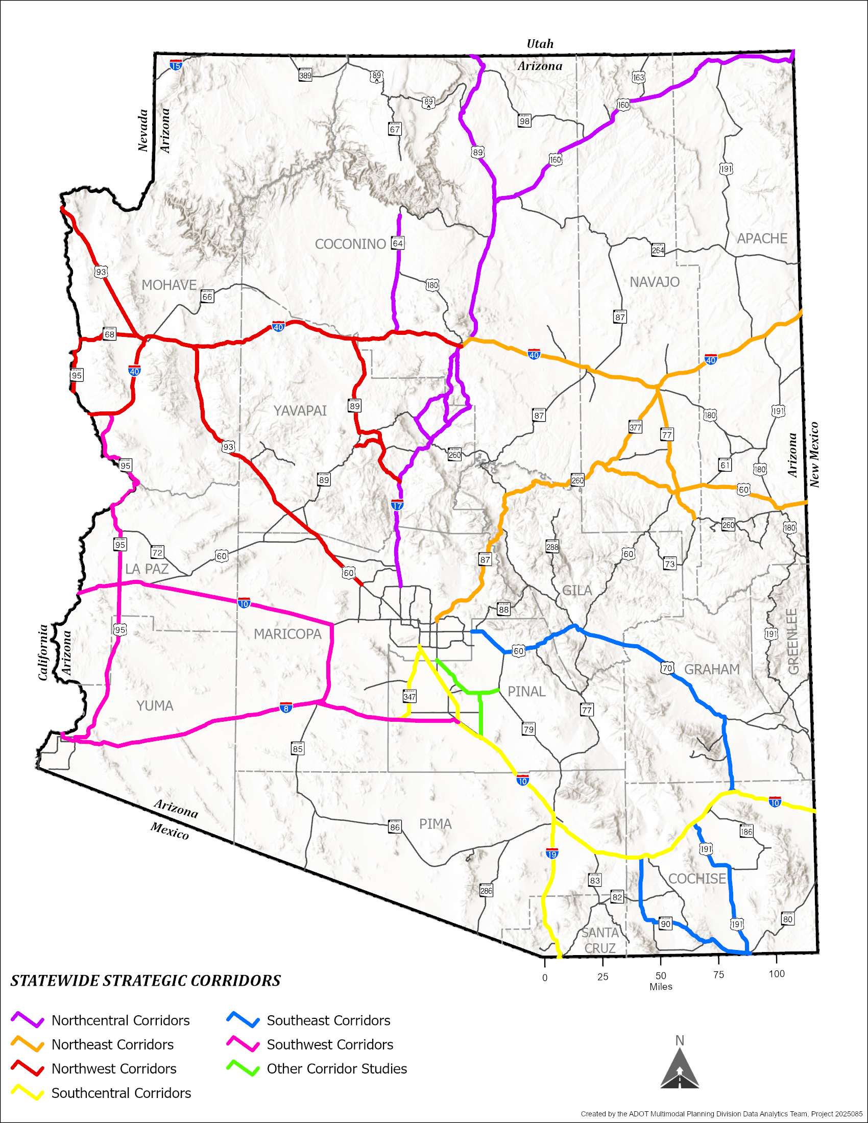
ADOT has developed a Corridor Profile Studies (CPS) program. The Statewide Map shows all the corridors that have been studied as part of the CPS program, with the corridors grouped according to how they were bundled during the latest updates made in 2022 and 2023.
The studies under this program provide a strategic vision for assessing the overall health of the state's primary highways, assisting the agency with performance-based project programming systems.
Corridor Profile Studies contain the following elements:
- inventory past project implementation proposals for each of the corridors.
- provide an overall assessment of the existing health of the corridor based on performance measures.
- propose various preliminary candidate solution sets to help improve overall corridor performance.
- recommend the most strategic preliminary improvements for the corridor.
Final Reports
Statewide Summary Report
NorthEast Corridor Studies
- I-40: I-17 to New Mexico State Line
- SR77: US 60 to SR 377
- SR87: SR 202L to SR 260; SR 260: SR 87 to SR 277; SR 277: SR 260 to SR 377; SR 377: SR 277 to SR-40B; and SR-40B: SR 277 to I-40
- SR 260: SR 277 to SR 73 and US 60: SR 260 to New Mexico State Line
Northcentral Corridor Studies
- I-17: SR 69 to I-40
- US89: Flagstaff to Utah State Line
- US160: US 89 to New Mexico State Line
- SR64: I-40 to Grand Canyon National Park
- SR179: I-17 to SR 89A; SR 89A: SR 179 to I-17; and SR 260: SR 89A to I-17
Northwest Corridor Studies
- I-40: California State Line to I-17
- US60: SR 74 to US 93 and US 93: US 60 to Nevada State Line
- SR68: SR 95 North to US 93 and SR 95 North: California State Line to Nevada State Line
- SR69: I-17 to SR 89; Fain Rd: SR 69 to SR 89A; SR 89A: Fain Rd to SR 89; and SR 89: SR 89A to I-40
Southeast Corridor Studies
- US 60: Meridian Road to US 70; US 70: US 60 to US 191; and US 191: US 70 to SR 80
- SR 90: I-10 to SR 80 and SR 80: SR 90 to US 191
Southcentral Corridor Studies
- I-19: Nogales to I-10
- I-10: Casa Grande to the New Mexico State Line
- SR 347: Peters and Nall Road to SR 84 and SR 84: SR 347 to I-8
Other Corridor Profile Studies Completed by the Planning Group in 2025
Southwest Corridor Studies
- US/SR 95: I-8 to I-40
- I-10: California State Line to SR 85 and SR 85: I-10 to I-8
- I-8: California State Line to I-10
The first round of Corridor Profile study was completed in the 2017-2018. Links to the 2017-2018 studies are listed below.