Douglas International Commercial Port-Of-Entry Connector Road Study
Douglas International Commercial Port-Of-Entry Connector Road Study
Overview
The Arizona Department of Transportation (ADOT), in partnership with the U.S. General Services Administration (GSA), Cochise County, city of Douglas and other federal, state, tribal and local agency stakeholders, is conducting an Environmental Assessment (EA) and engineering study (Design Concept Report) to evaluate the location of a new proposed connector road from State Route 80 to the planned Douglas Land Port of Entry (LPOE) for commercial vehicles.
The GSA has determined a second port of entry is needed west of Douglas for commercial vehicles to address capacity, congestion and safety issues at the existing Raul Hector Castro LPOE in downtown Douglas due to the intermingling of commercial and passenger vehicles, and pedestrians . The purpose of this study is to identify a preferred route for a new connector road to access the commercial LPOE, which will reduce congestion in downtown Douglas and improve access, travel times and safety to better serve the economic and transportation needs of the area.
Recommended Alternative
The study team has identified a recommended alternative route for the connector road, which follows James Ranch Road south of SR 80 to the planned future commercial port of entry facility.
English Map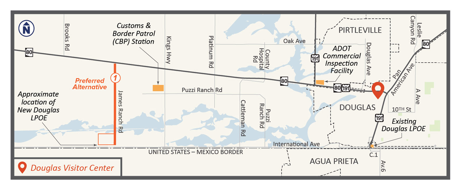
Mapa Español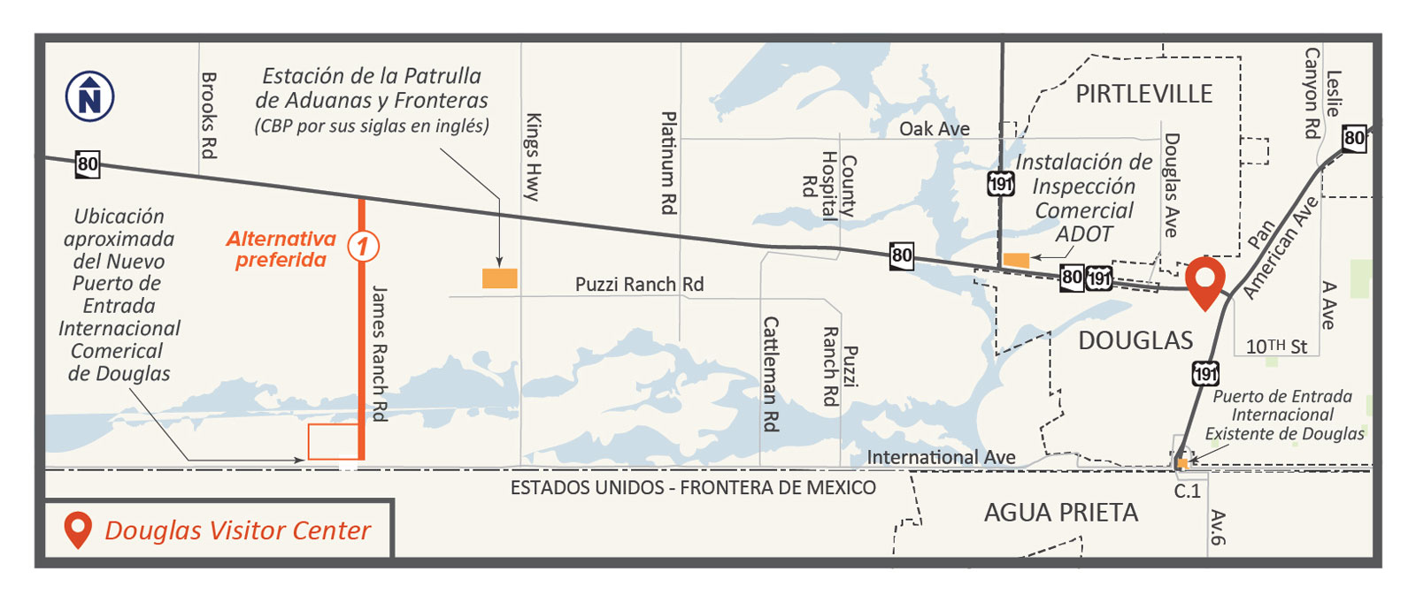
Anticipated Timeline

A public hearing was held November 19, 2024 to provide an overview of the draft Environmental Assessment and the Design Concept Report (DCR), share ADOT’s recommended alternative for a connector road and receive public comments. The final Environmental Assessment and Design Concept Report were published on Monday, April 21, 2025.
Stay Informed/Contact Us
- By email: [email protected]
- By phone: Call the toll-free Bilingual Project Information Line at 1.888.581.3135
- By mail: Attn. Douglas Land Port of Entry Connector Road Study Gordley Group 2540 N. Tucson Blvd. Tucson, AZ 85716
ADOT will provide more information about the study as information becomes available. If you would like to receive updates on the Douglas Commercial Land Port of Entry Connector Road Study, please subscribe for email updates.
NEPA Assignment Disclosure
The environmental review, consultation and other actions required by applicable Federal environmental laws for this project are being or have been carried out by ADOT pursuant to 23 USC 327 and a Memorandum of Understanding dated 6/25/2024 and executed by FHWA and ADOT.