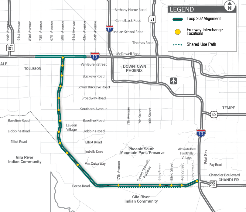
Project Map - Loop 202 (South Mountain Freeway)
Project Map - Loop 202 (South Mountain Freeway)
Map
To expedite completion of this project, the corridor has been broken down into four construction segments - I-10, Salt River, Center, and Pecos. Features within each segment are detailed below:
Preliminary design maps of the future freeway can be found below. Please note these designs are dated Feb. 7, 2017 and are subject to change.
- I-10 Improvements - 63rd to 43rd avenues
- I10 Improvements - 83rd to 63rd avenues
- I-10 to Lower Buckeye Road
- Lower Buckeye Road to Southern Avenue
- Southern Avenue to Elliot Road
- Elliot Road to Ivanhoe Street
- Ivanhoe Street to Chandler Boulevard
- Chandler Boulevard to Desert Foothills Parkway
- Desert Foothills Parkway to 32nd Street
- 32nd Street to I-10

