Full closures scheduled on US 60 between Superior and Miami July 22-23
Learn more
Detour in place from 9 a.m. to 2 p.m.
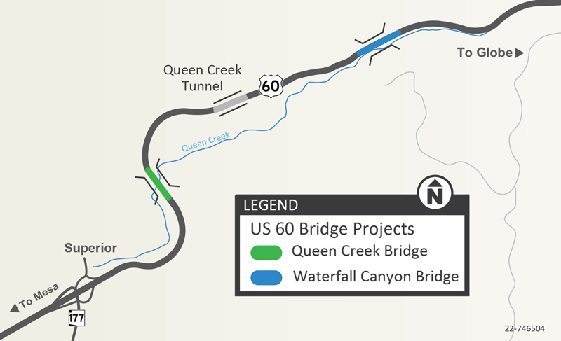
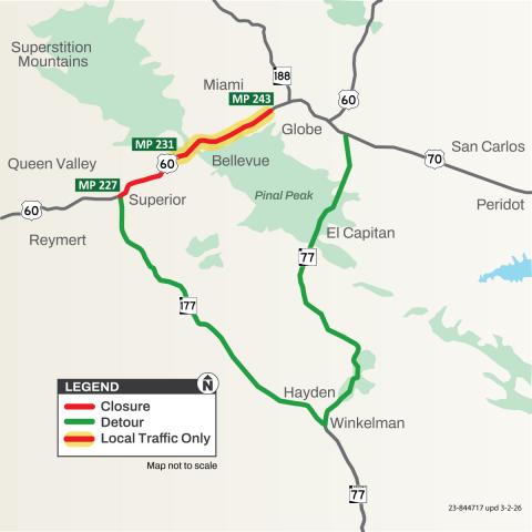
The Arizona Department of Transportation advises drivers US 60 between Superior and Miami (mileposts 227-243) will be closed from 9 a.m. to 2 p.m. Wednesday, July 22, and Thursday, July 23.
Detour: Eastbound US 60 drivers can use southbound State Route 177 through Winkelman to northbound SR 77. Westbound US 60 drivers may use southbound SR 77 through Winkelman to northbound SR 177. Due to the roughly 75-mile length of this detour, drivers may want to consider planning travel before 9 a.m. and after 2 p.m. The detour is estimated to add an additional hour for trips between Superior and Miami.
Upcoming full closures:
- Full closures of US 60 between Superior and Miami are tentatively scheduled from 9 a.m. to 2 p.m. Wednesday, July 29, and Thursday, July 30. Detours will be put in place during the full closures.
Show less