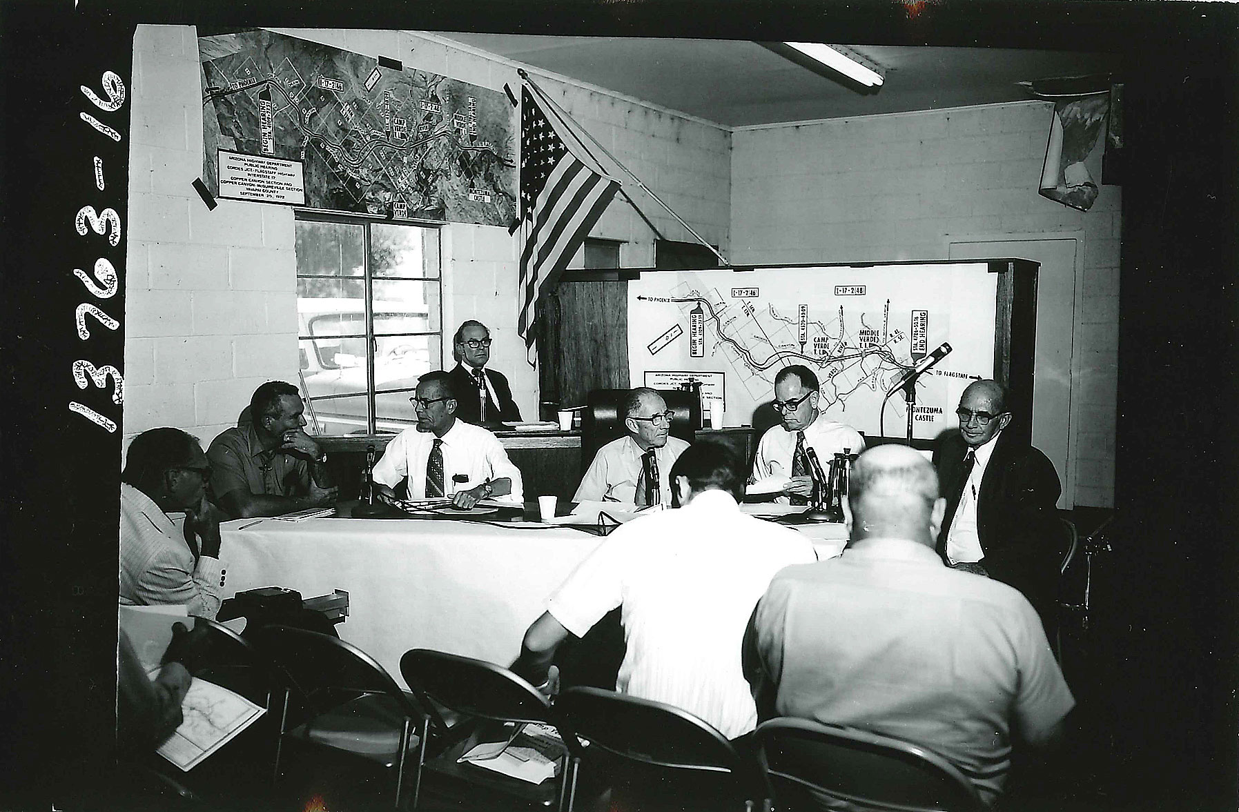
From the ADOT Archives: Interstate 17 public meeting
From the ADOT Archives: Interstate 17 public meeting
Image from the archives.
Look what we found in our archives…
These photos are almost 41 years old and show us that on Sept. 20, 1972, the Arizona Highway Department (now known as ADOT) held a public meeting in Camp Verde to discuss Interstate 17 and some proposed design features.
While the pictures might not be able to tell us exactly what was said at the meeting, we can clearly see that a lot of people showed up (yay for public participation!). They also offer a glimpse of the fashions and hairstyles of the day.
But, more importantly, the photographs remind us that I-17 (the Black Canyon Freeway) wasn’t always the interstate we know and drive today.
Curious about this route and its history, we searched the Arizona Transportation History report to find out more. Turns out, there’s a lot to learn.
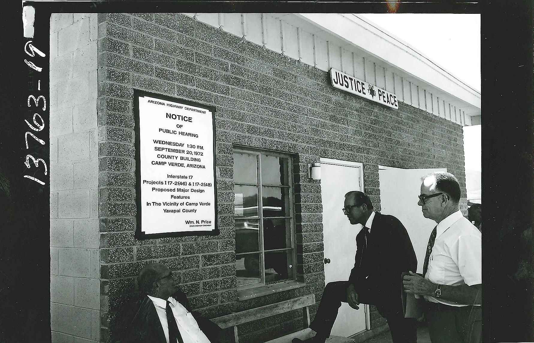
A public hearing, held in Camp Verde in 1972.
To start with, the original Black Canyon road (from before Arizona was even a state) followed an Native American trail along the Agua Fria River west of Phoenix through a gorge and then up onto the plateau that spreads from the Bradshaw Mountains to the edge of the Verde River valley, according to the report.
Fast forward to 1936, when work began to build a state highway (SR 69) between Prescott and Phoenix over the Black Canyon route. However, according to the report, World War II actually delayed completion of SR 69.
After the war, the highway, now realigned out of the canyon north of Black Canyon City and up onto the mesa, bypassed Bumble Bee and the other old mining camps, which by then were mostly abandoned. The new highway was dedicated in December 1952, though it would not be completely paved until 1955—the cause for another celebration.
After SR 69 was completed, work began on a northern extension of the road.
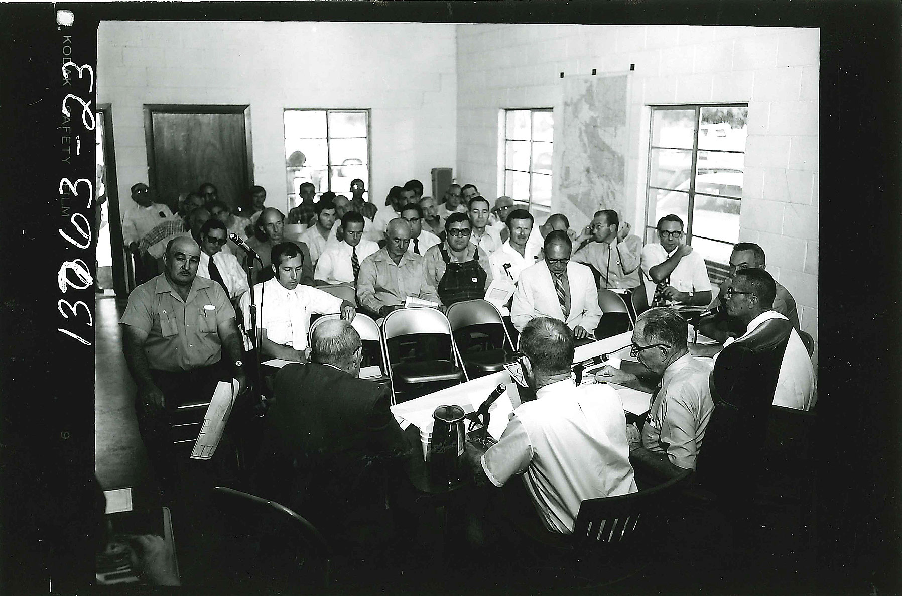
A large crowd gathered on Sept. 20, 1972.
Starting from Cordes Junction, “the new route to Flagstaff was surveyed, designed and engineered to the then-current standards of road construction in Arizona. It was built through a long series of contracts for 5- and 10-mile sections that progressed past Dugas, down into the Verde Valley, and through McGuireville up onto the broad forested plateau that surrounds Flagstaff,” states the report.
Designated as State Route 79, the new highway opened in September 1961, giving the state its first direct road from Phoenix to Flagstaff!
You’ll have to read the history report for yourself to learn the rest of the story (skip to page 99 for the Black Canyon Freeway section), but we will leave you with this passage from the report, which sums up the impact of I-17, a route that has eased travel from Phoenix to Prescott, the Verde Valley and Flagstaff:
The miles of subdivisions that make up the town of Prescott Valley and the humming commerce of Sedona are both products of the development of the Interstate system and the desire of millions of Phoenix residents for a convenient way to escape the city and the desert.
For more about the Arizona Transportation History report, check out our previous blog post on the subject.
It’s safe to say things have changed since 1912 when the Arizona Highway Department was first established. But you don’t just have to take our word … we’ve got plenty of pictures to prove it. We combed through our archives and decided to periodically post these photos from the past in a blog series we’re calling, “From the ADOT Archives.”