Northcentral

State Route 260: Rim Road to Gibson Road

State Route 260: Rim Road to Gibson Road

State Route 260: Rim Road to Gibson Road

State Route 260: Rim Road to Gibson Road

Project Overview

The Arizona Department of Transportation, in conjunction with the Federal Highway Administration, is improving the roadway along a 21-mile stretch of State Route 260 between Rim Road and Gibson Road (mileposts 282-304).

The $24.9 million project includes extending and improving drainage facilities, constructing a 5-foot shoulder on both sides of the roadway, guardrail improvements, spot pavement repairs and restriping of the roadway.

Construction is anticipated to last through winter 2025.

Project Area Map

project map

The project will occur within ADOT right-of-way. The purpose of this project is to improve roadway safety by increasing shoulder width of the existing roadway.

Project Photo

Pavement Repair Construction Project Photo State Route 260: Rim Road to Gibson Road

What to Expect

Traffic may be restricted to one lane only with alternating east- and westbound travel 6 a.m. to 5 p.m., Mondays through Thursdays and the contractor has an option to work 6 a.m. to noon on Fridays. SR 260 will have multiple flagging operations throughout the work zone affecting both directions. Drivers should expect long delays through the work zone. The speed restriction in the work zone is 25 mph and there is an 11-foot vehicle width restriction.

...

Restrictions and Closures

For information about project-related restrictions and closures, please visit az511.gov or call 511, except while driving. ADOT will provide more information about project schedules and potential traffic impacts as information becomes available. Stay informed of traffic restrictions before they occur by subscribing to receive timely traffic alerts by email. Schedules are subject to change on weather and other unforeseen factors

Stay Informed

...

Email: Subscribe to receive project updates and traffic alerts.

Email/Phone: Community Relations Project Manager Jason Stephens at [email protected] or 480.751.7104.

Teléfono: Línea de Información del Proyecto ADOT: 855.712.8530

Online: Submit a question or comment through the ADOT website. Visit azdot.gov/Contact and then select Projects from the dropdown menu.

Twitter: Follow ADOT on Twitter (@ArizonaDOT) for real-time highway conditions statewide.

SR 89A Oak Creek Canyon Improvements

SR 89A Oak Creek Canyon Improvements

SR 89A Oak Creek Canyon Improvements

SR 89A Oak Creek Canyon Improvements

This project is complete

Overview

Project Cost: $11,111,111

The Arizona Department of Transportation, in conjunction with the Federal Highway Administration, completed a project on State Route 89A in Oak Creek Canyon that addressed the following:

  • Rockfall Mitigation (completed)
  • Drainage and Sediment Control (completed)
  • Pumphouse Wash Bridge Rehabilitation (completed)

Rockfall Mitigation (completed)

The rockfall mitigation work will help reduce the potential of rocks falling onto the roadway at two locations along SR 89A. The first location is north of Sedona city limits at milepost 375, and the second location is located in the switchback section of the roadway at mileposts 388-389.

To ensure the safety of drivers and work crews during rock-removal operations, intermittent closures of some parts of the highway will be necessary. A schedule of traffic restrictions will be provided prior to work beginning.

Drainage and Sediment Control

The work consists of drainage and sediment-control improvements by reducing erosion to preserve deteriorating slopes and reduce downstream pollution. The work between mileposts 388-389 includes installing concrete barrier, pipes, retaining wall, catch basin and gabion mattresses, roadside drainage excavation and other related work.

Pumphouse Wash Bridge Rehabilitation (completed)

The Pumphouse Wash Bridge is located on SR 89A at milepost 388. Options to either rehabilitate or replace the existing bridge have been under evaluation by ADOT engineers since 2006. After extensive study, it was determined a  full replacement of the bridge would negatively impact endangered species, stream water quality and the historic nature of the bridge. These factors led to the determination that the bridge will be rehabilitated to extend its service life. Constructed in 1931, the bridge is listed on the National Register of Historic Places.

What to Expect During Construction

With the exception of daytime and overnight closures, SR 89A will remain open to traffic. Traffic restrictions using a combination of temporary traffic signals and/or flagging operation will be in place while the improvements are under construction. The roadway will be narrowed to one lane only through the work zone(s) with alternating north- and southbound travel. 

No full closures will be allowed during weekends (outside of the allowable closure periods for SR 89A) and state holidays.

**Schedules are subject to change based on weather and other unforeseen factors**

Project Area Map

project map

project map

project map

project map

project map


...

Restrictions and Closures

The roadway will be narrowed to one lane only through the work zone(s) with alternating north- and southbound travel. ADOT is committed to completing the improvements as quickly as possible, while balancing the transportation and needs of local and nearby communities.

ADOT will post information a minimum of seven days in advance of full closures and will post information about traffic restrictions as they become available.

To receive traffic alerts and other updates by email, please subscribe here.

You can also learn of real-time, project-related restrictions and closures by visiting az511.gov or call 511, except while driving.

Schedules are subject to change because of weather or other unforeseen factors. Remember to slow down and use caution around construction workers and equipment.

Background

Initially, the three improvements were going to be completed at different times by two different contractors, but all the work will now be completed by one contractor.

This helps address increasing construction costs, the challenges of working on a narrow-and-winding canyon road and the complexity of the work. It will also help better coordinate traffic impacts required to complete the work.

Stay Informed

...

By email: Subscribe to receive traffic alerts and project updates directly to your email.

Phone: Jason Stephens, ADOT Community Relations Project Manager: 480.751.7104

Teléfono: Línea de Información del Proyecto ADOT: 855.712.8530

Online: Submit a question or comment through the ADOT website by visiting azdot.gov/Contactand then select “Projects” from the dropdown menu.

I-17 Southbound: Coconino County Line - McConnell Bridge Pavement Rehabilitation

I-17 Southbound: Coconino County Line - McConnell Bridge Pavement Rehabilitation

I-17 Southbound: Coconino County Line - McConnell Bridge Pavement Rehabilitation

I-17 Southbound: Coconino County Line - McConnell Bridge Pavement Rehabilitation

This project is complete

Project Overview

Project Cost: $34,954,000

The Arizona Department of Transportation completed a pavement and bridge rehabilitation project on southbound Interstate 17 between the McConnell Drive Bridge in Flagstaff and the Coconino County line (mileposts 311-340).

The primary purpose of the project was to perform much-needed repairs and upgrades to the road surface on this heavily traveled stretch of southbound I-17.

In addition to the travel lanes and shoulders, several on- and off-ramps and nine bridges within the project area were repaved. Similar work already was performed on the northbound side of the roadway.

Additional pavement improvements occured on State Route 89A near milepost 402 and on northbound I-17 near Munds Park (milepost 323).

Project Map

I-17 Southbound Project Map

Project Photo

I-17 SB Paving

What to Expect

  • Construction is anticipated to begin late spring 2022 and be completed fall 2024.
  • Motorists should anticipate single-lane restrictions in two-mile segments. Crews will move to different locations as work is completed along the corridor.
  • Reduced speed limit through the work zone.

Restrictions and Closures

Drivers should expect southbound I-17 to be restricted to one lane around-the-clock at various locations. Lane restrictions are currently in place from mileposts 330-328, from 323-320 and from 313-311. Drivers should be prepared to slow down and proceed through the work zones with caution.

For information about project-related restrictions and closures please visit az511.gov or call 511, except while driving.

Stay Informed

...
  • EmailSubscribe to receive project updates and traffic alerts.
  • Phone: ADOT Project Information Line: 855.712.8530.
  • Teléfono: Línea de Información del Proyecto ADOT: 855.712.8530
  • Online: Submit a question or comment through the ADOT website. Visit azdot.gov/Contact  and then select Projects from the dropdown menu.
  • Twitter: Follow ADOT on Twitter (@ArizonaDOT) for real-time highway conditions statewide.

I-15 Virgin River Bridge No. 1

I-15 Virgin River Bridge No. 1

I-15 Virgin River Bridge No. 1

I-15 Virgin River Bridge No. 1

This project is complete

Overview

Project Cost: $56 million

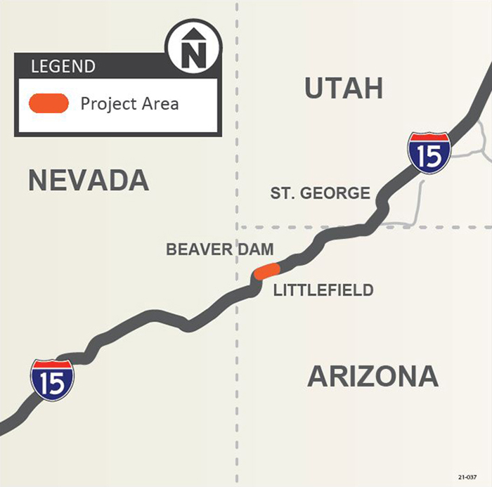
The Arizona Department of Transportation has completed a project to replace the Virgin River Bridge No. 1 along Interstate 15 with a new bridge that will increase safety and help the regional corridor to continue carrying commerce for decades to come. The bridge replacement project is near the community of Littlefield.

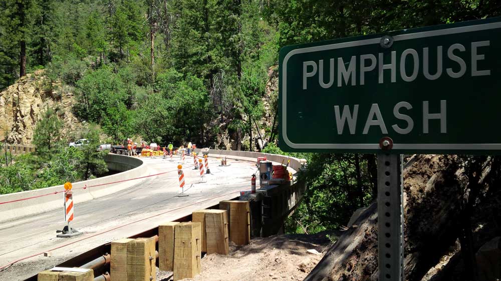
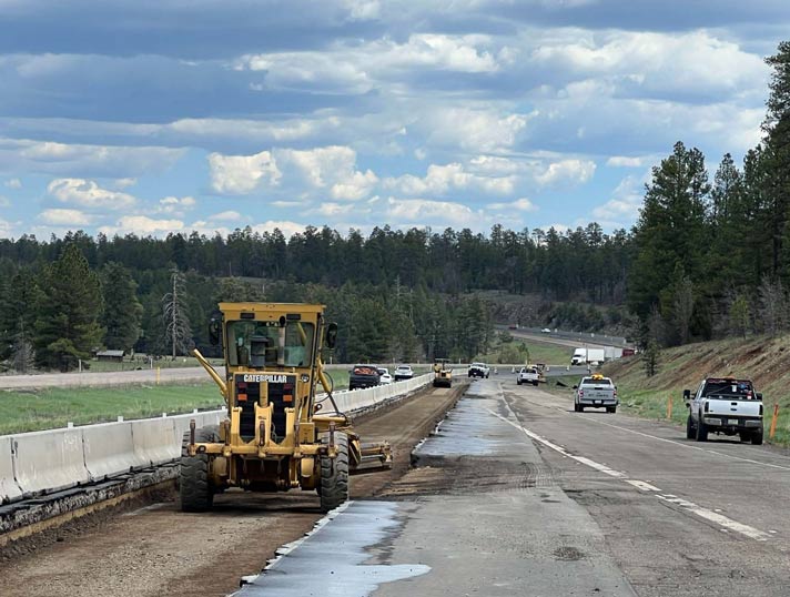
Work included replacing the abutment foundations, piers and the bridge deck of the bridge. New pavement, pavement markings, guardrail and signage also are included in the project. 

Project Map

I-15 Virgin Bridge No1 Project Map

I-15 Project Improvements - Video

About the Project


The purpose of the project was to remedy the bridge’s structural deficiencies so that I-15 can continue to accommodate truck traffic and facilitate the movement of people, goods and services while minimizing maintenance requirements. This helped ADOT meet its long-range goal of maintaining I-15 as an essential trade and truck route linking Nevada, Arizona and Utah.

Dating back to early 2014, ADOT has undertaken a series of rehabilitation projects on the I-15 Virgin River bridges, from minor repairs and resurfacing of bridge decks on bridges Nos. 2, 3 and 7 to an extensive rehabilitation of bridge No. 6 that was completed in 2016. 

In summer 2020, ADOT completed repairs and deck rehabilitation to bridges Nos. 2, 4 and 5.

Arizona’s 29-mile segment of I-15 directly connects Nevada and Utah and is a heavily traveled commercial and economic corridor linking southern California with the Rocky Mountain region
 

What to Expect During Construction

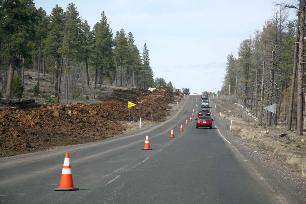
Although lane restrictions will be in place through winter 2023, one lane of traffic in each direction will be maintained throughout the project. Signs, as well as a Virgin River Bridge smartphone app available for free download on Apple and Android devices, will direct oversize vehicles to the detour route of US 93, Nevada State Route 319 and Utah State Route 56 between Las Vegas and Cedar City, Utah.

There are also restrictions to water recreationists on the Virgin River near the bridge during the project (see below).
 

River Restrictions and Closures

The closure is needed as construction crews begin replacing the existing bridge with a new bridge. The public will not be able to access or utilize the river or adjacent lands at this location during the construction project. Prohibited activities will include kayaking, boating, swimming, sightseeing and other water recreational activities.

Also, in the interest of public health and safety, crews will permanently remove the manmade pool known as “Little Jamaica” in the I-15 right-of-way under Bridge No. 1. As was noted during public involvement for the bridge-replacement project, this site frequently has trash, human waste and other types of waste and lacks water-quality monitoring. It also poses a threat to endangered species and vegetation in the vicinity.

With its location within the ADOT right-of-way and the potential health hazards, crews will remove the sandbags that helped create the pool and allow the spring to return to its natural path. Fencing will be placed around the spring to prevent future diversions.

Please avoid the area for your safety and the safety of those involved with the project. Thank you for your cooperation.


Project Schedule

February 2021 to spring 2024


Traffic Alerts

...

Lengthy restrictions on Interstate 15 begin Sept. 8 at Virgin River Bridge No. 1 near Littlefield

Smartphone app to help motorists through construction zone in far northwestern Arizona

I-15 Virgin River Bridge Construction Flyer

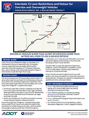
The Arizona Department of Transportation advises motorists to plan for delays on Interstate 15 in northwestern Arizona as lane restrictions begin Wednesday, Sept. 8, on Virgin River Bridge No. 1. The lane restrictions are expected to be in place through spring 2023.

Drivers should be prepared to stop and proceed through the work zone with caution while the following around-the-clock restrictions are in place starting Wednesday, Sept. 8:

  • I-15 between mileposts 8 and 9, near the community of Littlefield, will be narrowed to one lane in each direction across the bridge.
  • A vehicle width limit of 10 feet and a weight limit of 129,000 pounds will be in place.
  • The speed limit in the construction zone will be reduced to 45 mph.

A new smartphone app designed to provide traffic information and project updates to I-15 drivers is now available for free download on Apple and Android devices. The app, called Virgin River Bridge, will provide updates of construction activities that likely will impact traffic flow on I-15. 

The width and overweight restrictions mean that all vehicles wider than 10 feet or heavier than 129,000 pounds will need to use a 224-mile detour route during construction. Signs, as well as the new app, will direct oversize vehicles to the detour route of US 93, Nevada State Route 319 and Utah State Route 56 between Las Vegas and Cedar City, Utah.

Information from the app also is available on GPS navigation apps such as Drivewyze and Waze.

The $56 million bridge replacement project, which began in February, is scheduled to be completed in spring 2024.


Stay Informed

...
ADOT Virgin River Bridge App
Virgin River Bridge
Shows up-to-date traffic restrictions for the Virgin River Bridge #1 Replacement project in far northwestern Arizona.

ADOT will provide more information about project schedules and potential traffic impacts as information becomes available. Stay informed of traffic restrictions before they occur by subscribing to receive timely traffic alerts and project updates by email.

Have a question or comment?

  • By phone: Call the ADOT Bilingual Project Information Line at 855.712.8530.
  • Online: Submit a question or comment by visiting azdot.gov/Contact and then selecting “Projects” from the dropdown menu.
  • By mail: Write to ADOT Community Relations, 1655 W. Jackson St., MD 126F, Phoenix, AZ 85007