I-40/US 93 West Kingman Traffic Interchange
I-40/US 93 West Kingman Traffic Interchange
Contents
Project Cost: $106,543,210
Construction started July 2024 on a new system interchange connecting I-40 and US 93 in west Kingman.
Project Description
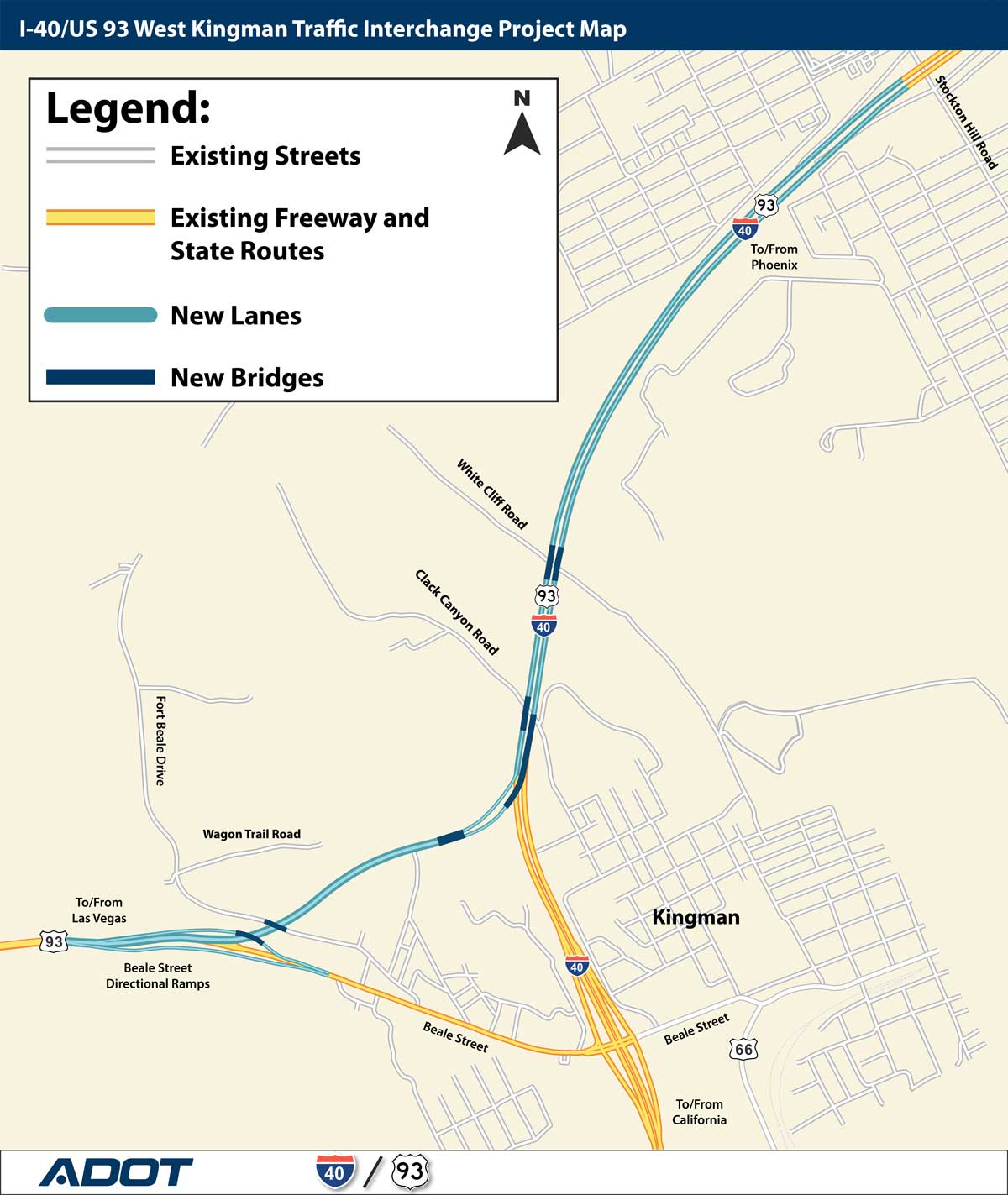
- New US 93 segment connects directly to I-40
- Free-flow connection (no traffic signal)
- New ramps maintain Beale Street access
- Increased I-40 capacity
What to Expect During Construction
- Monday through Thursday lane closures: I-40 is narrowed to one lane between Stockton Hill Road and Beale Street, (mileposts 51-48), 6 a.m. to 6 p.m.
- Expect delays up to 15 minutes
- Use caution in work zones
- Construction noise
Project Area Map
Project Purpose and Need
- Reduce congestion on I-40 and US 93
- Relieve Beale Street traffic
- Improve regional travel
Design and Construction Timeline
ADOT does not have the funds to build all the improvements of a full system interchange at one time. The project will be constructed in two phases, with the Phoenix to Las Vegas directional ramps constructed first. Phase II will construct the directional ramps between Las Vegas and California, when traffic demands warrant the improvements are needed, and when available funding can be programmed. Phase 1 construction started in July 2024 and is scheduled to finish in 2027.
Project Photos

Take a video tour of the new future I-40/US 93 system-to-system interchange
Stay Informed
Email: [email protected]