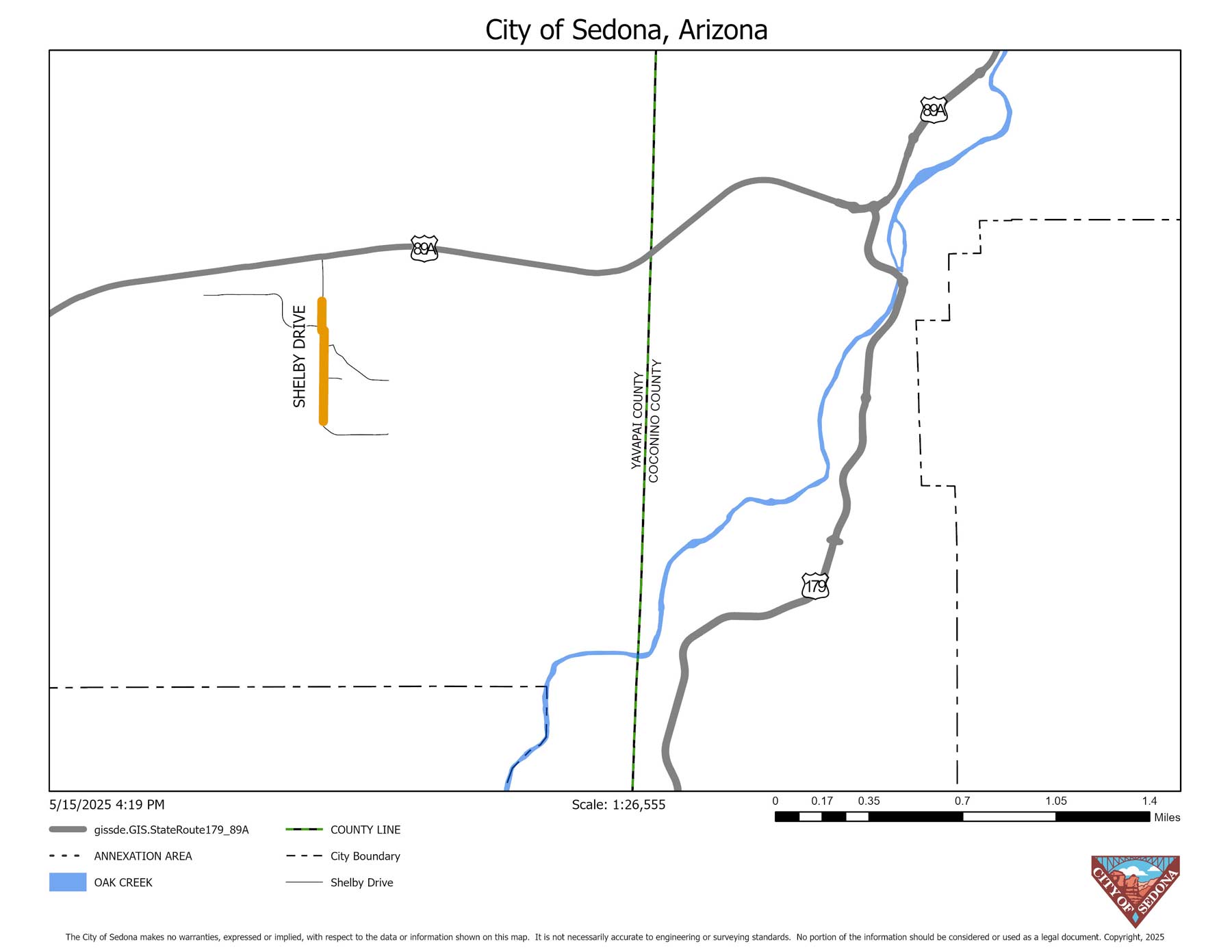
Project Cost: $2.5 Million The City of Sedona has initiated a shared-use path project along Shelby Drive between Sedona Recycles and Pyle Street. The purpose of this project is to widen the existing sidewalk on Shelby Drive from the current four-to-six-foot path to an eight-to-10-foot-wide, shared-use path.
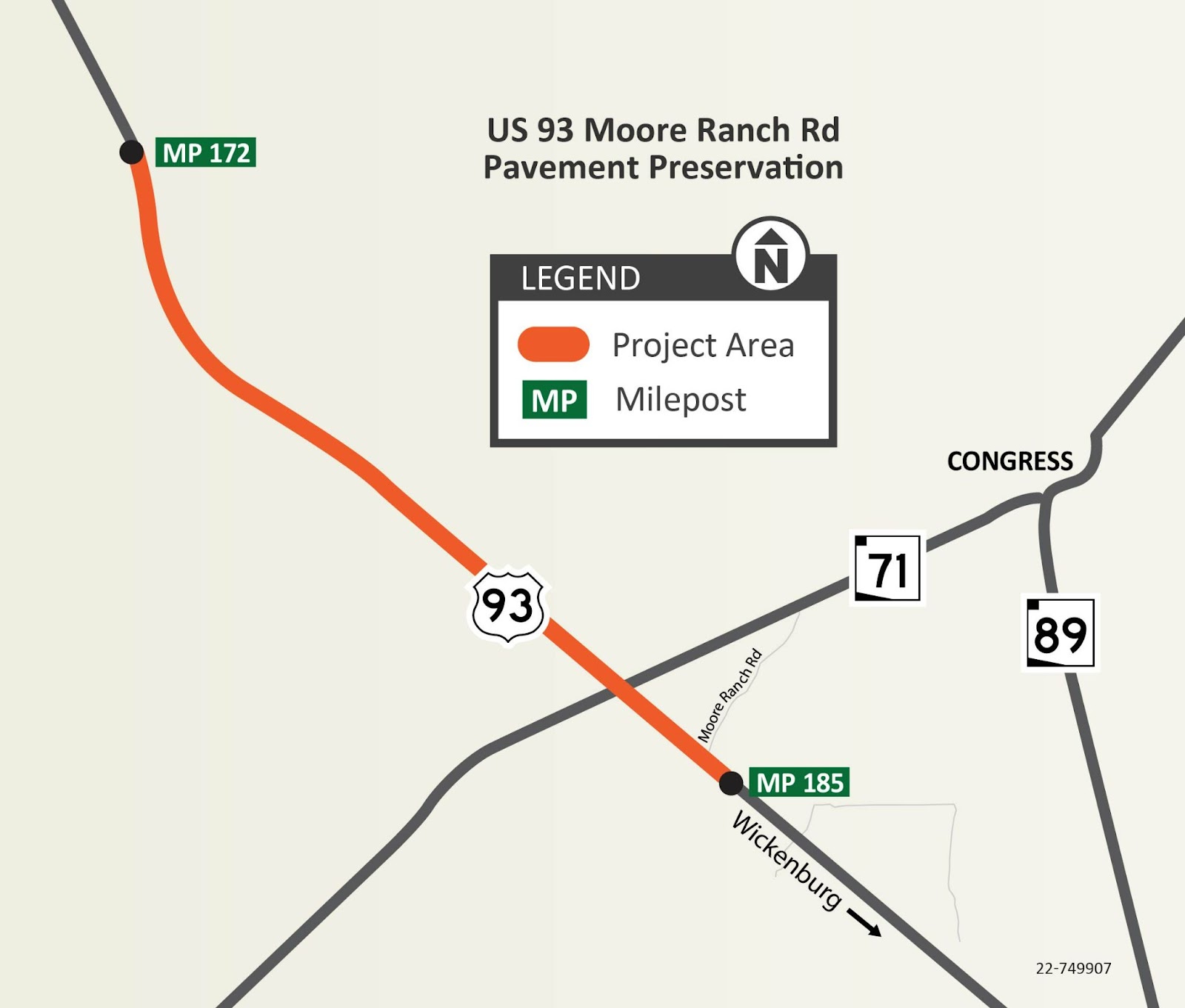
The Arizona Department of Transportation has initiated a pavement rehabilitation project on US 93 approximately 15 miles northwest of Wickenburg (mileposts 172-185). The work consists of removing and replacing the existing pavement. Additional work includes replacing guardrails and end terminals, repairing a bridge deck, replacing pavement markings and other miscellaneous work.
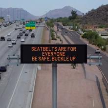
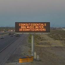
If you’re driving on Arizona highways this weekend, you may see some overhead message boards displaying a message encouraging drivers and their passengers to wear a seatbelt.
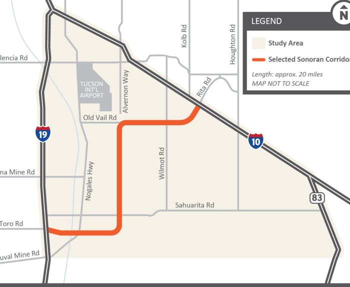
The Arizona Department of Transportation is seeking public input as it begins an engineering and environmental study of the Sonoran Corridor, a proposed freeway in the Tucson region that would connect
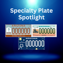
ADOT has more than 100 specialty license plates featuring a range of worthy causes or charities. To boost awareness, we showcase one specialty license plate each week on social media. Here's what we featured in May.
Our lead communicator on safety matters, Kelsey Mo, joins On the Road With ADOT this week with advice on how to safely navigate some of the challenges that come with summer in Arizona, namely monsoon storms and extreme heat.
The unofficial start to summer is here, and we want to take a moment to remind drivers who may be heading out on the roads over Memorial Day weekend to exercise caution.
First, we do hope you’ll take time during the extended weekend to remember the reason for the holiday and those who have sacrificed their lives for our country and freedom.
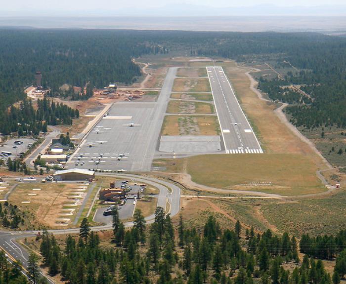
The Grand Canyon National Park Airport is hosting a virtual public meeting Thursday, May 29, to discuss a runway rehabilitation project that will result in the runway closing for about 28 days