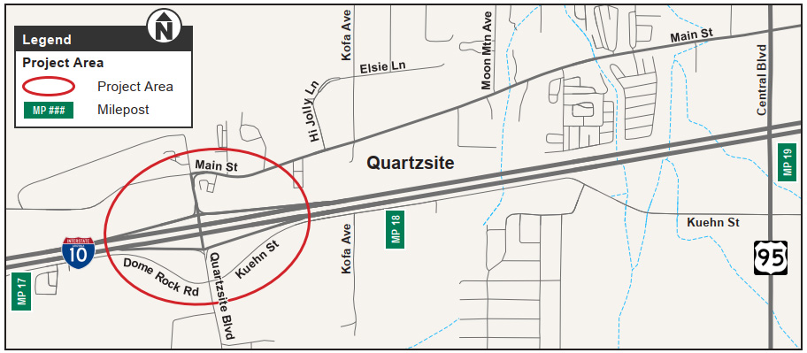
The Town of Quartzsite, in collaboration with the Arizona Department of Transportation, has initiated design improvements for the West Quartzsite Traffic Interchange at milepost 17, in the Town of Quartzsite.
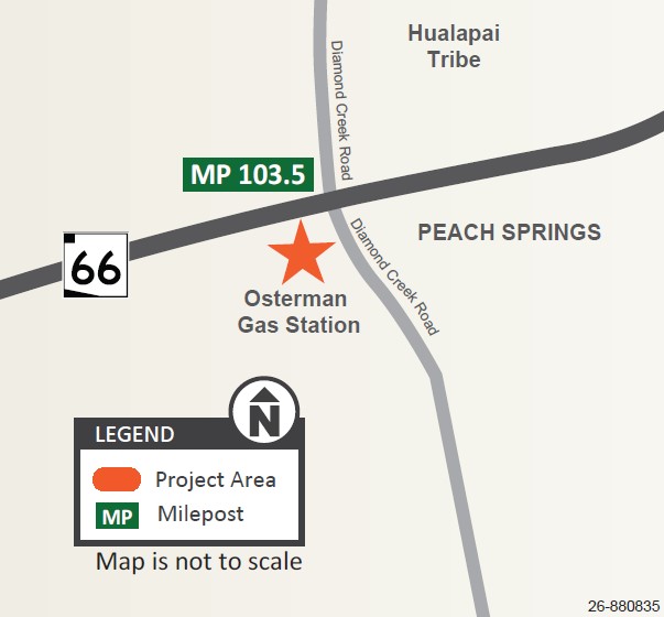
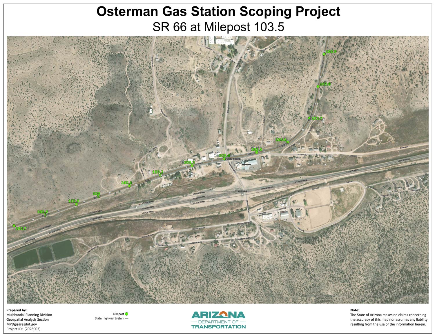
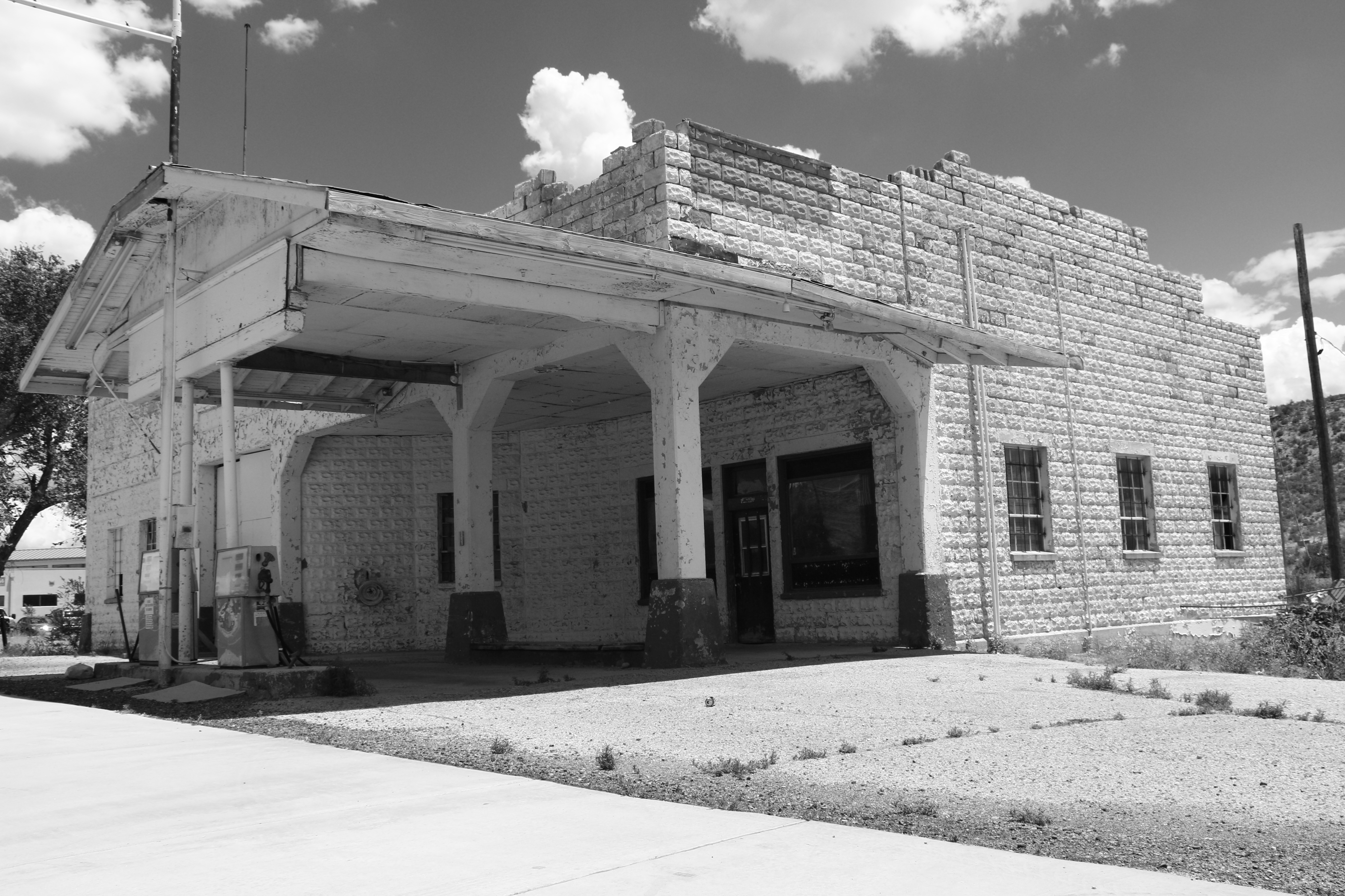
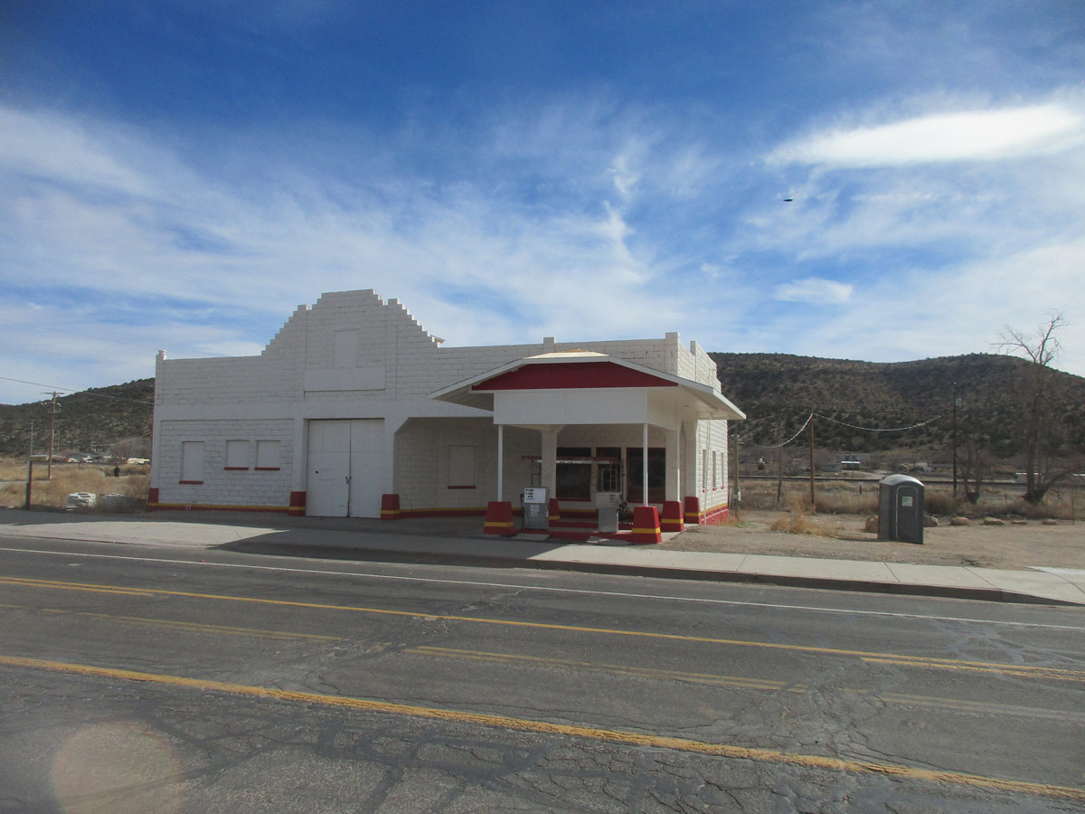
The Arizona Department of Transportation, in collaboration with the Hualapai Tribe, has initiated a project to document existing conditions and prepare a conceptual design report for the John Osterman/Shell Gas Station, which is listed on the National Register of Historic
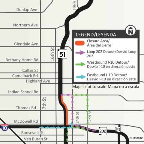
Northbound State Route 51 closed between I-10 and Indian School Road this weekend (June 19-22)
Northbound SR 51 lane restrictions planned June 23-26; northbound SR 51 closure from I-10 to Indian School Road also scheduled June 26-2
The Arizona Department of Transportation advises Phoenix area drivers to plan for the following closure and lane restrictions for bridge deck, pavement repair and diamond grinding work as part of the State Route 51 pavement rehabilitation project between Interstate 10 (Papago Freeway) and Shea Boulevard:
Northbound SR 51 will be CLOSED between I-10 (at the “Mini-Stack” interchange) and Indian School Road from 9 p.m. Friday, June 19, to 5 a.m. Monday, June 22. The following ramps also will be closed:
The westbound Loop 202 (Red Mountain Freeway) ramp to northbound SR 51
The east- and westbound I-10 ramps to northbound SR 51
The westbound I-10 HOV ramp to northbound SR 51
Eastbound I-10 Detour: Eastbound I-10 drivers may consider continuing onto eastbound Loop 202 and exiting onto northbound 24th Street before taking westbound Indian School Road to access northbound SR 51. Westbound I-10 Detour: Westbound I-10 drivers may consider taking eastbound Loop 202 to northbound 32nd Street to westbound Indian School Road to access northbound SR 51. Westbound Loop 202 Detour: Westbound Loop 202 drivers may consider taking northbound 24th Street to westbound Indian School Road to access northbound SR 51.
Map showing the detour route for the northbound SR 51 closure planned between I-10 and Indian School Road
OVERNIGHT LANE RESTRICTIONS & RAMP CLOSURE
REMINDER: The westbound I-10 HOV ramp to northbound SR 51 will continue to be CLOSED nightly from 9 p.m. to 5 a.m. until Friday morning, June 19.
UPDATED: Northbound SR 51 will now be narrowed to one or two lanes between Camelback Road and Northern Avenue (updated) overnight from 9 p.m. Thursday, June 18, to 5 a.m. Friday, June 19.
NEW: Northbound SR 51 will be narrowed to one lane between Thomas Road and Glendale Avenue nightly from 9 p.m. to 5 a.m., starting Tuesday, June 23, and ending Friday morning, June 26.
UPCOMING CLOSURE
Northbound SR 51 is scheduled to be CLOSED again between I-10 and Indian School Road from 9 p.m. Friday, June 26, to 5 a.m. Monday, June 29.
ADOT advises drivers to use caution and be prepared to slow down and merge safely when approaching and traveling through all work zones.
NOTE: The currently uneven pavement conditions and asphalt remaining on SR 51 bridge decks are a temporary result of the required asphalt removal work completed the weekend of May 8-11. This is NOT the finished surface of the freeway. The remaining asphalt will be removed during upcoming bridge work.The freeway and ramps will be resurfaced to create a smooth driving surface using a treatment called diamond grinding. ADOT appreciates your patience as the project progresses over the next several months.
Enrolled members of federally recognized tribal nations can now receive driver licenses, instruction permits and ID cards bearing a Native American designation. Those who choose this option will have
The Maricopa Association of Governments' Chief Transportation Officer returns in this week's episode to discuss how Proposition 400 has shaped the region's success through projects such as the recently completed I-10 Broadway Curve improvement, the Loop 202 (South Mountain Freeway), Loop 303 (Estrella Freeway) and State Route 24 (Gateway Freeway).
911
UPDATE: Southbound Country Club Drive (SR 87) lane restrictions between Baseline Road and Desert Lane now scheduled to begin June 22
This alert updates the end date for the northbound lane restrictions and updates the start date for southbound Country Club Drive lane restrictions
The Arizona Department of Transportation advises drivers to plan for the following restrictions as part of the pavement improvement project on Country Club Drive (State Route 87) from the Western Canal to Baseline Road:
UPDATED: Northbound Country Club Drive will continue to be narrowed to two lanes between Desert Lane and Baseline Road through 5 p.m. Sunday, June 21 (updated).
UPDATED: Southbound Country Club Drive will be narrowed to two lanes between Baseline Road and Desert Lane beginning 5 a.m. Monday, June 22 (updated), and ending 5 a.m. Thursday, July 23.
In addition to prioritizing affordability and protecting Arizona’s quality of life, Governor Hobbs’ Executive Budget proposal includes strategic transportation investments that safeguard Arizona’s