The Arizona Department of Transportation advises drivers to prepare for overnight closures of Interstate 40 starting Tuesday, April 28, as crews begin partial demolition of the Perkins Valley Road bridge (Exit 283).
Drivers should expect the following overnight restrictions from 9 p.m. to 6 a.m. starting Tuesday night, April 28, through Friday morning, May 1:
- I-40 will be closed at Perkins Valley Road (Exit 283). Traffic will use the off- and on-ramps to exit and re-enter the highway.
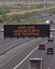
- Drivers should slow down, be prepared to make sudden stops when approaching and driving through the work zone and watch for construction workers and equipment.
The Perkins Valley Road bridge will be narrowed to one lane only with alternating north- and southbound traffic beginning Monday, April 27. Temporary traffic signals will be in place around the clock to move traffic across the bridge. This configuration will be in place for the next several months as the project continues.
Drivers should plan for delays when crossing over the Perkins Valley Road bridge.