SR 95

A tale of two 95s

A tale of two 95s

SR24-1

A tale of two 95s

A tale of two 95s

By John LaBarbera / ADOT Communications
September 13, 2021

If you spend nearly half the time we do looking at a map of our lovely trapezoidal state (which would still be A LOT), you’ll notice a meandering roadway hugging the California state line.

But what you may not realize at first glance, is that Arizona’s consistently western-most highway is actually designated with two different names.

Yes, today we are talking about US and State Route 95.

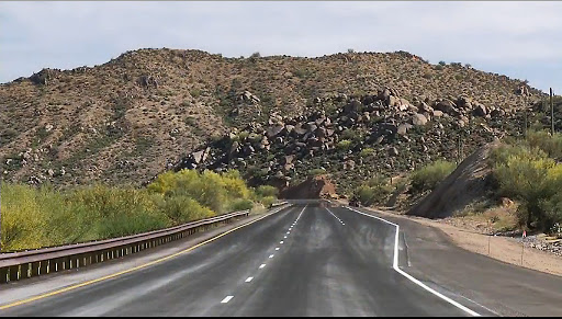
Getting its start in San Luis at the Mexican border, US Route 95 makes its way north to Yuma where it’s referred to as various local names, like Avenue B and E. 16th Street. It travels east for a good 12 miles until it kinks back northbound. US 95 makes gentle twists as it passes Kofa National Wildlife refuge before arriving at Interstate 10 in Quartzsite. After roughly 104 miles, US Route 95 meets its terminus.

But the road travels on! 

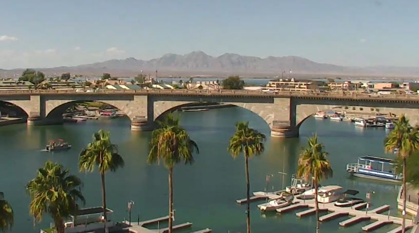
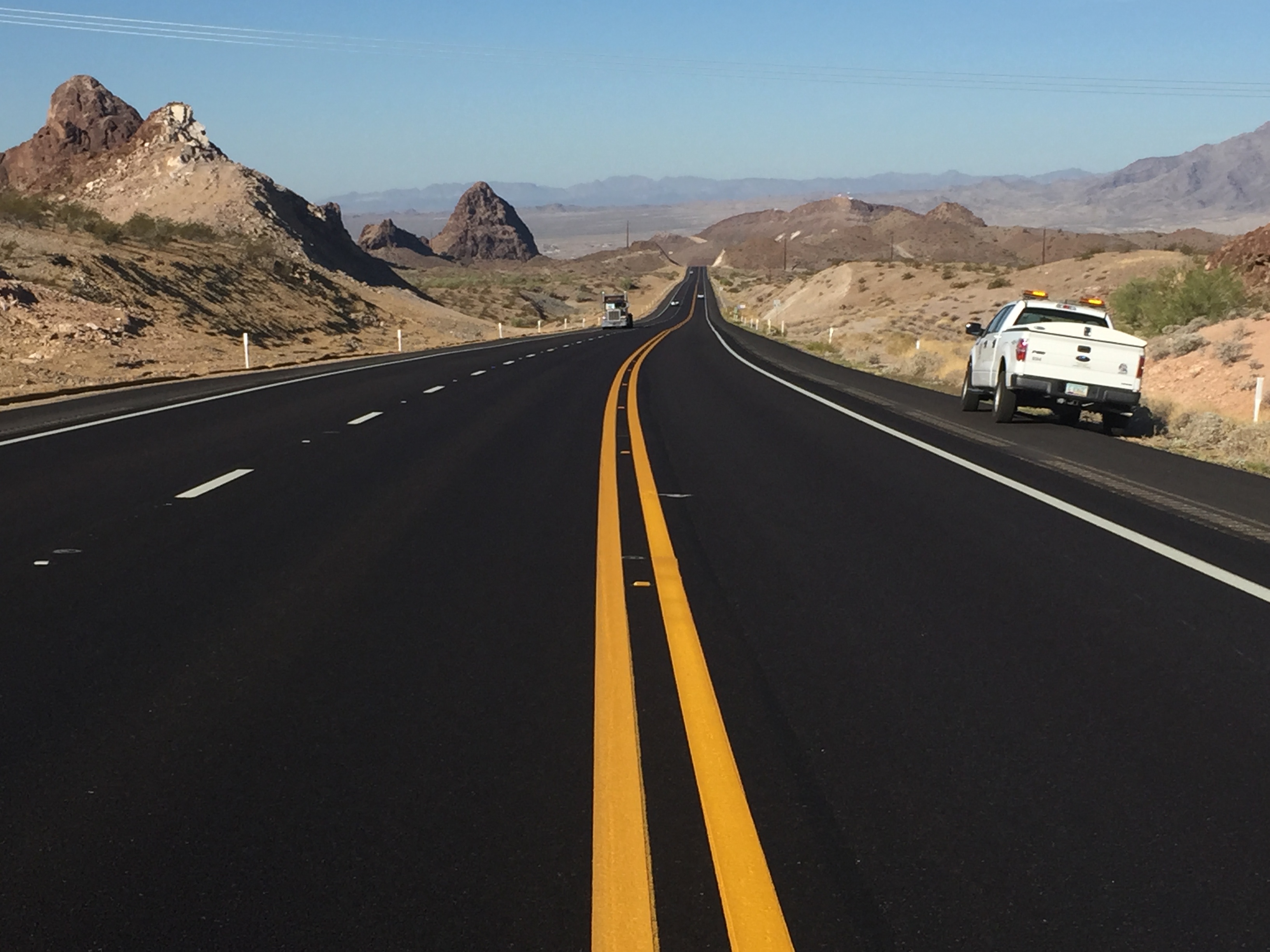
Just over the interstate, it becomes State Route 95. In Parker, the highway winks at its neighbor by first calling itself California Avenue, then Riverside Drive. Onward, over the Bill Williams River through to Lake Havasu where we catch a glimpse of the London Bridge. About 20 miles up the road, State Route 95 hits Interstate 40. There appears to be nowhere left to go.

Not so! There are 25 more marvelous miles of State Route 95. They start just over the Colorado River from Needles, California. The highway continues north into Mohave Valley and eventually Bullhead City, where it finally comes to an end at our very own State Route 68.

The only noticeable difference, of course, between US and State designated highways is where they go. US Highways can travel from state to state, sometimes (though not much anymore) spanning the entire country. State designations, by their nature, only exist within the boundaries of the state. Though (and here’s where it gets muddy), the roads themselves may continue on into another state, complete with an entirely different number.

So why does 95's designation switch between a US and state route? That's kind of hard to pin down, but it goes back to when the highway system was still developing. If you want, you can read the Federal Highway Administrations full write up, but essentially US 95 started in Idaho in the 1920s, and wouldn't go further south until 1940, when it extended all the way down to Blythe, California. In the early 1960s it was proposed to extend it from Quartzsite all the way down to the international border with Mexico at San Luis at the request of both Arizona and California.

However, the road south of Quartzsite had already designated State Route 95. According to one Arizona Highway Department document, at the end of the 1930's, it extended from San Luis up to the State Route 72 junction. It's possible that State Route 95 was a contender for the US 95 route before that was finalized. As it is, after the road south of Quartzsite received its US highway designation, everything north became State Route 95, eventually taking over what had originally been State Route 172 heading north of Parker. 

No matter what it's calling itself today, US and State Route 95 make up a unique drive along Arizona's western edge. And that's definitely worth your time.

New AZ 511 cameras along SR 95 provide traffic information for Lake Havasu City

New AZ 511 cameras along SR 95 provide traffic information for Lake Havasu City

I-17 101 traffic interchange

New AZ 511 cameras along SR 95 provide traffic information for Lake Havasu City

New AZ 511 cameras along SR 95 provide traffic information for Lake Havasu City

August 27, 2021

LAKE HAVASU CITY – Earlier this summer, while the Arizona Department of Transportation installed new remote technology to 20 traffic signals along SR 95 in Lake Havasu City to improve traffic flow, crews also installed six new cameras that can be accessed on AZ511.gov and the AZ 511 app.

Starting from the southernmost camera in Lake Havasu City and heading north along SR 95, the new cameras are located at Acoma Boulevard, Smoketree Avenue, Palo Verde Boulevard, Kiowa Boulevard, Chenoweth Road and The Shops Boulevard.

AZ 511 cameras are primarily for helping drivers see current traffic conditions so they can make informed decisions about travel. However, an added benefit of these new cameras allow visitors to ADOT’s Traveler Information website, AZ511.gov, to catch glimpses of Lake Havasu itself from the Kiowa and Acoma cameras and stunning mountain views from cameras at Chenoweth and The Shops.

These cameras were installed after ADOT updated traffic management technology along a 13-mile stretch of the highway. The technology allows engineers to monitor traffic conditions remotely, adjust signal timing, and diagnose and correct problems.

AZ 511 cameras allow highway supervisors to assess crashes, floods, snow and other issues and respond by sending crews and equipment to mitigate problems. They also allow dispatchers and DPS troopers in ADOT’s Traffic Operations Center to find the locations of crashes and other mishaps and immediately dispatch appropriate personnel.

ADOT now has more than 400 traffic cameras throughout the state, which you can see by going to AZ511.gov and clicking “Cameras” in the menu on the right.

Visit the AZ 511 website for more information and download the AZ 511 app for free on Apple and Android devices.

ADOT improving traffic flow on SR 95 in Lake Havasu with traffic signal coordination

ADOT improving traffic flow on SR 95 in Lake Havasu with traffic signal coordination

I-17 101 traffic interchange

ADOT improving traffic flow on SR 95 in Lake Havasu with traffic signal coordination

ADOT improving traffic flow on SR 95 in Lake Havasu with traffic signal coordination

May 18, 2021

PHOENIX –  Lake Havasu City residents and visitors will start experiencing a smoother flow of traffic on SR 95. Traffic signal crews with the Arizona Department of Transportation are installing updated traffic management technology on 20 signals along a 13-mile stretch of the highway 

In 2017, ADOT installed this technology along traffic signals in a 3-mile stretch of SR 69 in Prescott Valley and a 6-mile stretch of SR 69 in Prescott. The result has been an improvement in travel times by as much as 40%. It has also been implemented in Phoenix and Tucson. Using it, engineers monitor traffic conditions remotely, adjust signal timing, and diagnose and correct problems. The signals automatically adjust timing at certain times of the day based on anticipated traffic. 

Crews will be adding the remote technology from McCulloch Boulevard South to London Bridge Road. After installation, crews will monitor and make adjustments over the next month to optimize traffic flow at different times of the day.

The cost of the project is nearly $229,000.

These changes are being made through ADOT’s Transportation Systems Management & Operations Division. This division brings together traffic-engineering resources around the state to maximize resources, technology and expertise. This includes collaborating with other transportation and public safety agencies.

ADOT 'angel' helps stranded motorists

ADOT 'angel' helps stranded motorists

SR24-1

ADOT 'angel' helps stranded motorists

ADOT 'angel' helps stranded motorists

By Laurie Merrill / ADOT Communications
August 19, 2019

Shelli and Al Ortman of Yucca were headed to a doctor’s appointment in Lake Havasu City earlier this summer when their trip was suddenly cut short.

Five miles north of Lake Havasu on State Route 95, a tire on their pickup blew out.

“We were stuck,” Shelli Ortman said. “It was hot.There was nothing around.”

Al was in no condition to change a tire. Shelli's sister-in-law, Amy LaForest-Nowell, and other family members also driving to Lake Havasu City joined them on the side of the highway. None of them could help either.

They called roadside service, but before the service even returned their call, an “angel” pulled up behind them in his Arizona Department of Transportation pickup truck. It was Jeff Baumeister, a highway operations supervisor on his way home from a maintenance yard in Topock.

Not only did he change their tire, but he also was able to offer everyone ice-cold water from a cooler in his truck.

Baumeister said changing tires isn’t a regular duty, but when he spotted the stranded motorists he didn’t think twice.

jeffheadshot

“It was warm out,” Baumeister said. “I figured I’d stop to help.”

His supervisor, Gabriel Alvarado, ADOT superintendent of the Northwest District, serving much of northwestern Arizona, said it sounds like something Baumeister would do.

“It’s in his character,” Alvarado said. “Helping people is something Jeff does quite often, as do a lot of maintenance units and ADOT employees.”

Shelli and Al Ortman and  their relatives were grateful that Baumeister was in the right place at the right time. 

“We are so thankful when he pulled in behind as to help,” Shelli Ortman said. “He was so positive and kind. That’s hard to find nowadays.”

2019 will be busy year for ADOT in southern Arizona

2019 will be busy year for ADOT in southern Arizona

I-17 101 traffic interchange

2019 will be busy year for ADOT in southern Arizona

2019 will be busy year for ADOT in southern Arizona

January 28, 2019

PHOENIX ‒ Widening the last two stretches of Interstate 10 between Casa Grande and Tucson that remain two lanes in each direction. Opening a modern Ina Road traffic interchange with Interstate 10 in Marana. Launching a major upgrade to State Route 189, the 3.75-mile Nogales highway essential to trade with Mexico.

These are just some of the Arizona Department of Transportation projects finishing or starting in 2019 that are designed to make travel safer and more efficient in southern Arizona.

Four major projects that received a great deal of attention in 2018 are scheduled for completion this year:

  • ina-ew-aerial-1-28-19
    A new I-10 interchange is on track to open this spring carrying Ina Road traffic over the Union Pacific Railroad tracks and greatly improving mobility and safety in a growing area northwest of Tucson. This $128 million project also is widening Ina Road to two lanes in each direction from I-10 west over new bridges crossing the Santa Cruz River, with full project completion expected this summer.
  • Crews will finish widening 4 miles of I-10 in Casa Grande between Earley Road and Interstate 8. This $43 million project, scheduled for completion by late summer, includes replacing the original bridges over Jimmie Kerr Boulevard to accommodate three lanes in each direction.
  • Between Eloy and Picacho, crews are scheduled to complete a $72 million project widening 4 miles of I-10 to three lanes in each direction by creating new travel lanes. The improvements include a new State Route 87 interchange and a first-of-its-kind dust detection zone on 10 miles of I-10 to provide drivers with crucial safety information during dust storms. Completion is scheduled for late summer.
  • A $55 million overpass that will carry State Route 347 traffic over the Union Pacific Railroad tracks in Maricopa is scheduled for completion by the end of 2019.

Design work is set to begin by June on the largest project of 2019: a $134 million upgrade of State Route 189, which connects the Mariposa Port of Entry with Interstate 19 in Nogales and carries a large share of produce entering the United States. Planned upgrades include flyover ramps to make a smoother transition between SR 189 and I-19 and a bridge over Frank Reed Road that will improve safety near Nogales High School. The two-year project is expected to be completed in 2021.

In Tucson, construction is scheduled begin this summer on a new interchange at I-10 at Ruthrauff Road. The $101 million, two-year project will be similar to interchange improvements at Ina and Prince roads.

Other major projects expected to begin in 2019 include replacing the 70-year-old Pinto Creek Bridge on US 60 east of Superior and repaving a 7-mile section of State Route 95 north of Parker. Bidding for the Pinto Creek work will take place early this year, while paving on SR 95 began earlier this month and is expected to continue until fall.

For more information on these projects, please visit azdot.gov/projects.

Headed to Havasu? Plan extra travel time on SR 95

Headed to Havasu? Plan extra travel time on SR 95

SR24-1

Headed to Havasu? Plan extra travel time on SR 95

Headed to Havasu? Plan extra travel time on SR 95

November 4, 2017

By Caroline Carpenter / ADOT Communications

If you’re headed to the Colorado River for a day of boating, spending some time in Lake Havasu City or heading on to Bullhead City and Laughlin, plan for extra travel time on State Route 95 early next week.

Crews will be working on pavement preservation on a 14-mile section of SR 95 south of Lake Havasu City. Drivers may see delays of up to 30 minutes while traffic is guided through the construction zone with a pilot car.

Work is scheduled from 6:30 a.m. and 7 p.m. Monday, Nov. 6, and Tuesday, Nov. 7, beginning at milepost 162 (Bill Williams Bridge) through milepost 176 (Sara Park).

When driving through a construction zone, be patient, slow down and look out for construction crews and equipment.

Note from the Editor: Photo above is courtesy of the Lake Havasu City Convention and Visitors Bureau webcam.

State Route 95 project to resume in Bullhead City later this year

State Route 95 project to resume in Bullhead City later this year

I-17 101 traffic interchange

State Route 95 project to resume in Bullhead City later this year

State Route 95 project to resume in Bullhead City later this year

January 27, 2016

BULLHEAD CITY ‒ To minimize traffic delays from a safety-improvement project planned along State Route 95, the Arizona Department of Transportation will have changes in place when work resumes later this year.

The $1.5 million project includes adding a raised median to SR 95 between the Bullhead Parkway and Aviation Way intersections to enhance safety. In addition, the stretch from Aviation Way to the Laughlin Bridge intersection in Bullhead City will be repaved.

After work started in late October, ADOT halted it due to longer-than-anticipated delays caused by narrowing to one lane in each direction to set up a permanent traffic-control barrier.

After reviewing the project and traffic plan, ADOT has made modifications that include using a traffic-control barrier that can be removed when construction isn’t taking place. In addition, most work will occur at night when traffic is lightest.

The project will be put out to bid again due to the design modifications. The start date will be set after the contract is awarded.

When the project resumes, lane restrictions will still be required and motorists should expect some delays.

ADOT works to inform the public about planned highway restrictions, but there is a possibility that unscheduled closures or restrictions may occur. Weather can also affect a project schedule. To stay up to date with the latest highway conditions around the state, visit the ADOT Traveler Information Center at az511.gov or call 511.

ADOT to begin SR 95 improvements between Bullhead City and Laughlin

ADOT to begin SR 95 improvements between Bullhead City and Laughlin

I-17 101 traffic interchange

ADOT to begin SR 95 improvements between Bullhead City and Laughlin

ADOT to begin SR 95 improvements between Bullhead City and Laughlin

October 19, 2015

BULLHEAD CITY — Motorists traveling overnight on State Route 95 between Bullhead City and Laughlin, Nevada, need to prepare for delays and allow extra travel time as the Arizona Department of Transportation begins an improvement project near the Arizona-Nevada state line on Monday, Oct. 26.

As part of a $1.5 million project, ADOT will construct a raised median on SR 95 between the Bullhead Parkway and Aviation Way intersections to enhance safety along the corridor. In addition, the stretch from Aviation Way to the Laughlin Bridge intersection in Bullhead City will be repaved.

Work will take place nightly from 6 p.m. Sunday to 5 a.m. Friday. While one travel lane will remain open in each direction, motorists should be prepared for delays of up to 15 minutes.

The first phase of work will include setting up traffic control barrier and removing the existing asphalt.  

The speed limit will be reduced and drivers should be alert for construction workers and equipment.

The project is expected to be completed in May 2016.

ADOT works to inform the public about planned highway restrictions, but there is a possibility that unscheduled closures or restrictions may occur. Weather can also affect a project schedule. To stay up to date with the latest highway conditions around the state, visit the ADOT Traveler Information Center at az511.gov or call 511.

Work on a new climbing lane along SR 95 is underway

Work on a new climbing lane along SR 95 is underway

SR24-1

Work on a new climbing lane along SR 95 is underway

Work on a new climbing lane along SR 95 is underway

February 4, 2015

An example of a climbing lane on SR 87.

Did you happen to see this ADOT news release from yesterday? It’s about a new project that’s set to add a climbing lane along State Route 95…

Longtime blog readers know that climbing lanes can help ease congestion up steep hills by providing more room for vehicles traveling past slower traffic. Since the new project includes the construction of a climbing lane, we thought it’d be the perfect time to point you to this previous post from about two years ago.

Here’s an excerpt that explains climbing lanes:

Next time you’re traveling uphill only to get stuck behind a slow-moving vehicle or truck, you’ll appreciate the concept of a climbing lane.

A climbing lane is an “extra” lane that’s used for short distances in certain areas to improve safety, ease congestion and prevent delays. These lanes help facilitate the passing of trucks and slow moving vehicles whose speed drops because of the sustained steep grades.

More about the project on SR 95
ADOT has begun construction of a northbound climbing lane on SR 95 to improve traffic flow through the Mohave Mountains region, about 10 miles north of Lake Havasu City (mileposts 190-195). Construction crews are scheduled to begin roadway blasting activities Monday Feb. 9 through early March. Project work hours are from 7 a.m. to 5 p.m. weekdays.

ADOT advises motorists to plan ahead for delays up to 20 minutes in both north- and southbound lanes, slow down and be aware of construction workers and equipment. Flaggers will be stopping and directing traffic during this work.

Crews recently began off-roadway clearing and excavating activities on the $5.1 million project. The improvement work also includes widening the shoulders and repaving the entire roadway within the project limits. Construction is expected to be completed this summer.

For more information on the latest highway conditions in the area, please visit the ADOT Traveler Information Center at az511.gov or call 511.


Construction on new climbing lane along SR 95 north of Lake Havasu City is underway

Construction on new climbing lane along SR 95 north of Lake Havasu City is underway

I-17 101 traffic interchange

Construction on new climbing lane along SR 95 north of Lake Havasu City is underway

Construction on new climbing lane along SR 95 north of Lake Havasu City is underway

February 3, 2015

PHOENIX — The Arizona Department of Transportation has begun construction of a northbound climbing  lane on State Route 95 to improve traffic flow through the Mohave Mountains region, approximately 10 miles north of Lake Havasu City (mileposts 190-195). 

Construction crews are scheduled to begin roadway blasting activities Monday Feb. 9 through early March. Project work hours are from 7 a.m. to 5 p.m. weekdays.

ADOT advises motorists to plan ahead for delays up to 20 minutes in both north- and southbound lanes, slow down and be aware of construction workers and equipment. Flaggers will be stopping and directing traffic during this work.

Crews recently began off-roadway clearing and excavating activities on the $5.1 million project. The improvement work includes constructing the passing lane, widening the shoulders and repaving the entire roadway within the project limits. Construction is expected to be completed this summer.

ADOT works to inform the public about planned highway restrictions, but there is a possibility that unscheduled closures or restrictions may occur. Weather can also affect a project schedule. To stay up-to-date with the latest highway conditions around the state, visit the ADOT Traveler Information Center at www.az511.gov or call 511.