Bridges

New pedestrian bridge now open over I-17

New pedestrian bridge now open over I-17

New pedestrian bridge now open over I-17

New pedestrian bridge now open over I-17

August 17, 2012

By Kimberly Noetzel
ADOT Public Education Manager

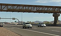
The Phoenix-area's newest pedestrian bridge is in place over Interstate 17 just north of Happy Valley Road.

ADOT installed the 160-ton, 600-foot long bridge over two nights in June next to the Central Arizona Project (CAP) canal.

Working in partnership with the CAP, city of Phoenix and Federal Highway Administration, ADOT designed and built this bridge to provide long-term connectivity for the CAP's multi-use recreational trail. Because the city of Phoenix will maintain the bridge, ADOT designed it to require only minimal maintenance after installation.

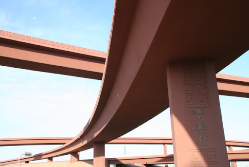
When you drive under or walk over the bridge, you might wonder why a new structure looks so … weathered. The answer? Weathering steel. Crews used weathering steel which, by design, gives outdoor structures a rustic appearance. Better yet, it never needs to be painted, which significantly reduces maintenance costs.

Weathering steel has what’s known as a "sacrificial surface." This means it rusts only on the outside. The base metal (structural component) does not rust. If you hail from the eastern United States, you might know that some big, old steel bridges need to be replaced over time because they rust all the way through and weaken...

But, with weathering steel, the load-bearing capacity and long-term durability of a bridge or other structure are not compromised.

In the Metro-Phoenix climate, the weathering process usually takes about six months and a couple of good rains. But for this project, we’ll let you in on a little secret: to jump start the weathering process crews sandblasted the steel and hosed it down prior to installation, making our new bridge look older than it really is to complement the natural environment.

The bridge, which is accessible from the CAP trail, is now open.

Bridge replacement project under way in Bylas

Bridge replacement project under way in Bylas

Bridge replacement project under way in Bylas

Bridge replacement project under way in Bylas

August 1, 2012

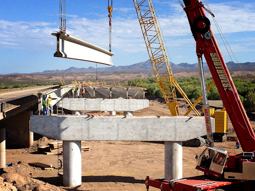
The new US 70 Gila River Bridge at Bylas is being constructed adjacent to the old bridge.

This might sound cliché, but ADOT really is getting rid of the old to make room for the new…

It’s happening right now on the San Carlos Apache reservation as ADOT crews construct a new bridge to replace the US 70 Gila River Bridge at Bylas.

That existing 23-span steel girder bridge will remain in use until the new, 15-span precast concrete girder bridge is constructed just adjacent to it (so, technically we’re not getting rid of the old until after we finish constructing the new, but you get the point).

About the project
The bridges (old and new) are located on US 70, about one mile west of the Bylas community. The existing bridge – constructed in 1957 to carry US 70 traffic over the Gila River – is 1,829 feet and among the longest bridges in Arizona. It has served its purpose well, but after 55 years of use, the bridge is outdated and doesn’t meet modern standards.

It’s time for an update
The $12.7 million replacement will not only give drivers a new bridge with wider travel lanes and emergency shoulders, but the project also includes intersection improvements and a pedestrian walkway.

Work began in February and is expected to wrap up by the fall. That’s when the new bridge will open to traffic and the old bridge will be demolished. Crews will come back in spring 2013 to pave the bridge and new highway approaches. But don’t worry, the bridge will be drivable this fall – it just won’t have asphalt pavement because it will be too cold to pour the pavement.

P.S. You know how we love to document bridge demolitions here on this blog, so you better believe we’ll have more on this project as it continues. We promise to bring you video coverage the bridge demo later this year!

Florence Bridge: A Monument of Treachery

Florence Bridge: A Monument of Treachery

Florence Bridge: A Monument of Treachery

Florence Bridge: A Monument of Treachery

July 27, 2012
Blog Default

By Danelle Weber
Public Information Officer

The bridge crossing the Gila River outside Florence has quite a few distinctions in its history. It was the first bridge to cross a major river in Arizona. It was the only bridge in Arizona to cross the Gila River for much of its early history. It has also been rebuilt three times … talk about high maintenance!

The first try
Before Coolidge Dam was built and before the canal system began siphoning the river’s water supply, Gila River was quite formidable. It ranged from 150 to 1,200 feet wide and from two to 40 feet deep. It could pump 6,070 cubic feet of water per second into the Colorado River.

For a long time, the most popular story to tell about the river included a stagecoach driver, a soldier, two nuns, and a gambler. (We know — it sounds like the start of a bad joke.)

While trying to ford the river, the driver had his passengers hang on the outside of the carriage to keep the current from carrying away the stagecoach. According to the story, while the nuns prayed and the gambler cursed, the soldier was the only one to encourage to the driver.

Needless to say, it used to be a bit of a problem to cross Gila River, especially when it was flooding.

By 1885, Florence residents, miners and business owners were hungry for the means to cross the river safely and regularly. The price tag was well over $15,000, which would be nearly $20 million by today’s standards. It was 965 feet long and 16 feet wide. It had redwood piles, pine decking and a 30-ton iron truss. Just about everyone couldn’t be happier about the bridge. Everyone, that is, except for Territorial Gov. Conrad Zulick, who felt the bridge was “a wanton misappropriation of public funds.”

It was to everyone’s surprise and chagrin that a wooden bridge would suffer serious damage from swiftly running water and seasonal fires.

Once more, with feeling
By 1905, it was obvious that the bridge would need to be redone. In 1910, the first territorial engineer, James B. Girand, took on Florence Bridge and rebuilt it — this time with concrete and steel. Despite his best efforts to make the bridge as formidable as the river, however, a severe winter storm in 1914 washed away both approaches.

The newly minted concrete bridge was now a concrete island.

It was repaired, of course. Then, another storm in 1915 badly damaged it again. And again in 1916.

And again in 1917.

Senator Marcus Smith, one of Arizona’s first two, said the bridge had become a “monument to the treachery of the river.”

The feds step up to the plate
In 1916, Congress passed and President Wilson signed the Federal Road Aid Act. Is it any wonder that Arizona would try to get its hands on the very first federal monies it could to solve that thorn in its side, Florence Bridge? Because of Gila River’s treachery, Florence Bridge holds the distinction of being the first transportation project in Arizona to receive federal funds.

Federal Aid Project No. 1, as the rebuilding project was called, dug in its heels and attempted to fix Florence Bridge once and for all. The project extended the bridge by 750 feet. They were confident this extension would do the trick.

Well, the river saw our mere human attempts to tame it and raised us a raging current and another four decades of near-constant damage. Touché, river.

Starting from scratch … again
By the 1950s, the Arizona Highway Department had had enough of the money pit that was Florence Bridge and made plans to redesign and replace it entirely. The new structure was higher, wider, and longer than the 1910 version. At 1,507 feet long, it was made of 30 50-foot spans. The new bridge had a steel I-beam stringer superstructure and concrete substructure and piers. The deck was 35 feet wide and featured steel balustrade guardrails.

Since its completion in 1957, the bridge has only required two alterations: one in 1995 to replace the guardrails, and one in 2000 to repair the superstructure. Both seem fairly minor when you consider the continual repairs that used to be necessary. It seems that we have finally built a bridge worthy of crossing Gila River.

This article is part of ADOT’s Transportation History series in honor of Arizona’s centennial. The source for the information in this article comes from the ADOT-researched text “Arizona Transportation History” and the Arizona Historic Bridge Inventory.

Hoover Dam bypass bridge receives honor

Hoover Dam bypass bridge receives honor

Hoover Dam bypass bridge receives honor

Hoover Dam bypass bridge receives honor

April 19, 2012

Photo courtesy of Federal Highway Administration, Central Federal Lands Highway Division (FHWA/CFLHD)

If you follow us on Facebook, you might have seen the photo we posted yesterday as part of our “Where in AZ?” series...

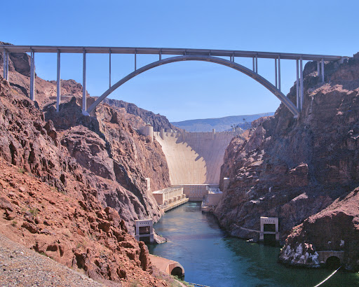
It was a pretty cool shot taken from very high up ... 900 feet above the Colorado River, in fact! Yes, our crew was at the Mike O’Callaghan-Pat Tillman Memorial Bridge and snapped the photo.

The bridge is truly a marvel and is seen as a very important link between Arizona and Nevada for travel and commercial transportation, allowing traffic to bypass the Hoover Dam.

So, when we heard the bridge had been honored with the American Society of Civil Engineer’s (ASCE) 2012 Outstanding Civil Engineering Achievement award, we were not surprised.

The announcement was made last month during the ASCE’s annual gala. From the ASCE’s website ...

“(The bridge) was constructed in a harsh environment where temperatures reached triple digits during the day. The structure is the highest and longest arch concrete bridge in the Western hemisphere and features the world’s tallest concrete columns.

Because of the 800-foot gorge below with rock cliffs, steep canyon walls and winds of up to 70 miles per hour, the contractor used two 2,500 foot long cableways connected to 330 foot high towers on each side of the canyon to transport the construction crews and 50 tons of equipment and material into place during the construction.

Due to the high heat, concrete was poured from mid-air at night and was cooled with liquid nitrogen filled tubes. The bridge is part of the five-mile long bypass that consists of four lanes of roadway, eight bridges, interchanges in both Arizona and Nevada and over 3.6 million cubic yards of shot rock excavation.

The project was built for $240 million without a dispute or claim by contractors. Obayashi Corporation and PSM Construction USA were contractors for the bridge while HDR, T.Y. Lin International and Jacobs Engineering were the design and support team. The project is owned by the Arizona Department of Transportation, the Nevada Department of Transportation, the U.S. Bureau of Reclamation, the Western Area Power/Administration and the National Park Service. The Central Federal Lands Highway Division of the Federal Highway Administration was the project and program manager.”

Big congratulations to all involved! More information on the bridge can be found online.

Building a Freeway: Soffit Fills and Waste Slabs

Building a Freeway: Soffit Fills and Waste Slabs

Building a Freeway: Soffit Fills and Waste Slabs

Building a Freeway: Soffit Fills and Waste Slabs

March 21, 2012

When you’re building bridges, there’s more than one way to get the job done...

We told you a few months ago about a method that utilizes false work and sand jacks. Today, we’re going to fill you in on a different approach … the key terms to remember are soffit fills and waste slabs.

If you recall, false work is what secures the bridge structure as it is being built and until it can stand on its own.

A soffit fill (basically a big pile of dirt) acts much in the same way.

After the bridge piers and abutments are cast, the area in between is filled with dirt. That dirt is piled right up to the height of where the bridge deck eventually will sit … this soffit fill will act as the false work, providing a strong foundation to build the bridge on top of.

With the dirt in place, a thin concrete slab – the waste slab – is poured on top (see video above). The flat, smooth surface is what crews will build upon, but the waste slab won’t be a part of the finished bridge. No, the job of a waste slab is to simply give crews a form on which to pour more concrete.

Maybe a little analogy right about now might help you get the picture. Take a second and think about making a pie (trust us!).

Your counter top is acting as the soffit fill – giving you a surface to work on. Now imagine your pie pan as the waste slab – it’s giving you a form to shape your crust, but after the pie comes out of the oven, you’re not going to need the pan … your piece of pie will stand on its own!

OK, with us still? You’ve got your counter top (soffit fill) and your pie pan (waste slab), but before you place the pie crust you want to make sure it won’t stick to the pan … maybe you’ll use some non-stick cooking spray?

That’s kind of what crews use out in the field. They spray a thin wax coating over the waste slab so when they pour the concrete for the actual bridge structure on top, it won’t stick. Because remember the waste slab is just that – waste. It’s only there to temporarily provide a surface for the building of the bridge, but eventually it will be removed along with the soffit fill.

From there, crews complete a number of additional steps...

Keeping with our pie analogy – there’s “filling” involved with some bridges. In the case of the bridge being built at the Loop 303 and Waddell Road, the crews are actually building “lost decks,” so named because the materials ADOT uses in the framework will remain inside the bridge structure for the lifespan of the bridge.

These “lost decks” are inside the bridge and give it strength, but also allow for some open space, because a bridge of this size made entirely of concrete would be too heavy.

After the filling is inside, all that’s left to do is place the top crust, a.k.a. the top deck, which is what motorists will eventually drive on.

Crews will then bring in heavy-duty equipment to remove the soffit fill and the waste slab, but we’re going to save that for another blog post … so stay tuned!

Bridge work progresses at Loop 303/Waddell Road

Bridge work progresses at Loop 303/Waddell Road

Bridge work progresses at Loop 303/Waddell Road

Bridge work progresses at Loop 303/Waddell Road

March 15, 2012

A view of the dirt soffit that works to support the Waddell Road bridge structure during construction.

Last week we were asked on Facebook to provide an update on the Loop 303 project – specifically the bridge construction at Waddell Road.

We’re happy to oblige! We also are glad to report that the bridge construction is progressing as planned.

Crews are scheduled to pour the southbound stem walls this week and the northbound stem walls in early April. By the way, stem walls are supporting structures that join the foundation with the vertical walls built on the foundation.

With stem walls in place, crews will move onto deck work.

Interestingly, they’ll be forming “lost decks,” so named because the materials ADOT uses in the formwork will remain inside the bridge structure for the lifespan of the bridge.

Looking ahead, the schedule calls for deck pours in late April and, by May, drivers should see crews excavating the dirt mound that sits out there today.

That dirt mound actually plays a very important role: It’s a dirt soffit that is supporting the bridge structure during the construction process until the bridge can support itself.

Loop-303-Waddell-Rd-Bridge-work2

Another look at the work being done near Waddell Road.

For this project, ADOT is using the dirt-soffit method – which saves both time and money – during bridge construction instead of the false work method that most people are accustomed to seeing.

The dirt-soffit method can be used because the bridges being built do not need to maintain traffic flow during the construction process.

The Waddell Road Bridge should be complete this summer and Waddell Road will re-open. Then, work will move a mile south to Cactus Road and repeat the process during bridge construction there. Fear not local motorists: We will not close Cactus Road until we have fully re-opened Waddell Road!

Stay tuned to the blog for more on the Loop 303 project ... next week we’ve got a video coming your way that helps explain how crews build a bridge from the ground up!

Today in Arizona Transportation History

Today in Arizona Transportation History

Today in Arizona Transportation History

Today in Arizona Transportation History

February 16, 2012

The new Navajo Bridge stands right alongside the historic one.

We’ve really enjoyed celebrating Arizona’s transportation history this week on the blog…

And, as we promised, we plan to keep the history theme alive throughout the state’s Centennial year. 

One way we plan to do so is to celebrate important milestones in our state’s transportation history through a new series: Today in Arizona Transportation History -- a semi-regular feature we’ll run all year long spotlighting what happened on that particular day in transportation history.

We’ll get started today … but we’re going to have to cheat a little on this one since we didn’t kick off the series last month!

Jan. 12, 1929

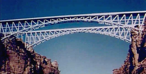
Back in 1929 on Jan. 12, the Navajo Bridge – complete with a 616-foot arch – opened to traffic.

Located on US 89A in northern Arizona’s Marble Canyon, the bridge was the only span to cross the Colorado River between the Green River in Utah and Topock Gorge in Arizona – a distance of some 600 miles! Because of that, the bridge was able to make a big impact on transportation and the economy of the northernmost part of the state.

This account comes from the National Parks Service website:

“It was an historic day when, on January 12, 1929, the bridge was opened to traffic. At the time, it was the highest steel arch bridge in the world and made traveling between Utah and Arizona much easier. No longer did travelers have to contend with the moods of the Colorado River at Lees Ferry.”

The bridge’s official dedication happened a few months later in June and according to NPS, it was an astounding event…

“Nearly 7,000 people in 1,217 automobiles arrived for the celebration. Speeches were given by the governors of Arizona, New Mexico, and Utah and by the President of the Mormon Church. Bands, choral groups, and Native American dancers were also a part of the festivities. It was reported that airplanes flew under the bridge and as Prohibition was in effect, the bridge was christened with a bottle of ginger ale. The bridge was known as the Grand Canyon Bridge for five years following the dedication. In 1934, after great debate in the Arizona legislature, the official name was changed to Navajo Bridge.”

The Navajo Bridge still stands today, but you can’t drive across it because now it serves as a pedestrian bridge. However, there is a newer Navajo Bridge that you can drive. It’s located just adjacent to the historic bridge, about 150 feet downstream. ADOT built the new bridge to safely handle today’s traffic loads.

Expansion joints give bridges room to breathe

Expansion joints give bridges room to breathe

Expansion joints give bridges room to breathe

Expansion joints give bridges room to breathe

February 10, 2012

Bridge expansion joints allow concrete to expand and contract without cracking.

When we blogged about quiet pavement back in December, we got a lot of comments

We received plenty of questions, too, which we’ll attempt to answer here on the blog in the coming weeks – starting with one on bridge expansion joints.

But, before we get to the question let’s first take a look at what bridge expansion joints are.

Basically, expansion joints help give bridges a little “breathing” room.

Bridges made of concrete are going to expand and contract slightly for a number of reasons, including temperature changes, shrinkage of the concrete, settlement, ice and even the weight of vehicles.

Bridge expansion joints are what allow the concrete to naturally expand and contract without cracking. The rubber expansion joints are placed at the end of a bridge where it meets up with the freeway. These connectors give the concrete just enough space to move and avoid concrete cracks.

When crews are building bridges and installing the expansion joints they’re able to embed them in the concrete and make the transition flush … drivers don’t notice they’re driving over anything.

But, when asphalt rubber is placed on that bridge and the adjoining freeway, crews can’t just pave right over the joint – they need to leave a little gap to allow for the expansion joint.

In these cases, some drivers might notice a little bump. It’s a little more noticeable in the winter months as the concrete contracts and the joint expands (the opposite happens in summer). This is where our question comes in … we were asked by one of our readers if anything can be done.

To seek out the answer we turned to Tim Wolfe, ADOT’s Phoenix Maintenance District Engineer for an explanation.

He said that on smaller expansion joints crews can weld steel plates on top of the expansion joint “opening” to make for a smoother transition. In some cases ADOT crews also will mill the asphalt rubber around the gap so it “feathers” off near the expansion joint.

However, on larger bridges there are wider joints meant for taking a lot of expansion. The only option there is to remove the joint and replace it with a new one that sits a little higher. That option is a very costly fix for something that’s not a structural or safety issue. Bridge structures are inspected by ADOT and if taken at the posted speed limit bridge expansion joints should not pose any sort of safety hazard.

ADOT continues to evaluate options to improve the quality of the riding surface.

An update on the I-17 bridges in Munds Park

An update on the I-17 bridges in Munds Park

An update on the I-17 bridges in Munds Park

An update on the I-17 bridges in Munds Park

January 30, 2012

The northbound bridge is complete. Work on the southbound bridge (visible in this photo just behind the new bridge) will begin in the spring.

Last week we received a blog comment requesting an update on the I-17 bridges that span over Pinewood Boulevard in Munds Park. We thought it was a great suggestion and figured a blog post was in order!

But, first a little refresher …

You might remember we blogged about the bridges back in May. That’s when the first phase of construction was in full-swing and crews were working on the northbound bridge.

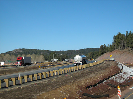
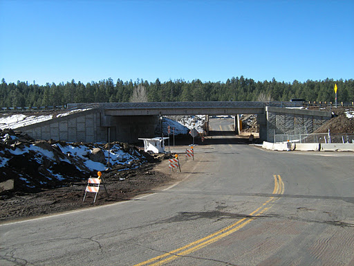
We told you then that this project is going to update the bridges initially built in 1958 … back when there wasn’t much development in the area. When the job is finished this fall, there will be two new bridges that will be long enough to accommodate today’s traffic levels and wide enough for a future third lane in each direction on I-17. The project also includes a new sidewalk on Pinewood Boulevard that will allow pedestrians to cross safely underneath I-17.

Where we’re at today

munds-park2

I-17 traffic over the new bridge.

The northbound bridge is complete and the project is in winter shutdown except for some electrical work being done.

Work on the southbound bridge will begin when the weather warms sufficiently in the spring.

When construction resumes, the southbound bridge will be demolished, then reconstructed and I-17 will be repaved through the work zone.

While this work is being done, the southbound bridge will be closed and motorists will be detoured over to the northbound lanes of I-17.

ADOT takes a look back at 2011

ADOT takes a look back at 2011

ADOT takes a look back at 2011

ADOT takes a look back at 2011

January 3, 2012

2011's accomplishments include several projects.

The new year officially is here, but before we dive into 2012 we’re going to take a quick look back.

ADOT’s Public Information/Media Relations team came up with a great list of the state’s major transportation accomplishments from 2011 and we thought we’d share it here on the blog!

From new freeway openings to the approval of ADOT’s Long Range Transportation Plan, here's a look at some of the highlights …

Phoenix Area Freeways:

Loop 303 Opens

ADOT widened major stretches of Phoenix area freeways in 2011 and opened the first new segment of freeway to be built under the Maricopa Association of Government’s 20-year Regional Transportation Plan. Fourteen miles of Loop 303 were opened in May between Interstate 17 and Happy Valley Parkway in Peoria, allowing drivers for the first time to use Loop 303 to make the 39-mile trip between I-17 and I-10.

HOV Lane Additions

Drivers benefited from two accelerated projects to add High Occupancy Vehicle lanes along Loops 101 and 202. The final 30 miles of HOV lanes along Loop 101 between State Route 51 in north Phoenix and I-10 in Tolleson were opened in stages during the year and completed in November. Meanwhile, in the Chandler area, 12 miles of carpool lanes were completed this fall along Loop 202 Santan Freeway between I-10 and Gilbert Road.

I-10 Widening in West Valley

Another significant milestone was marked in August with the completion of ADOT’s three-year initiative to reconstruct and widen I-10 between Loop 101 and Verrado Way. Those projects modernized I-10, transforming what had been a limited highway with two lanes in each direction into a modern freeway that now provides as many as five lanes in each direction – including carpool lanes.

State Highway System:

Mescal Road/J-Six Ranch Road Bridge

Just over six months after a fiery crash damaged the Mescal Road/J-Six Ranch Road bridge, ADOT swiftly rebuilt the bridge to reconnect the Cochise County communities of Mescal and J-Six Ranch, which were separated by I-10 and depend on the overpass for convenient access to goods, services and neighbors. While the bridge was out of service, residents and workers in the Benson-area communities were required to take lengthy detours around I-10 to reach the other side of the highway. Federal Highway Administration emergency relief funds, a shortened time frame for designing the replacement bridge and a quick construction bid process all helped put the project on the fast track. A typical bridge construction project can take up to two years.

State Route 260 Widening

Continuing a decade-long commitment to expand the capacity of SR 260, ADOT completed a project to widen the highway starting 15 miles east of Payson from Little Green Valley to Thompson Draw. The $20 million project is the fourth of six projects to construct a four-lane divided highway from Star Valley to the top of the Mogollon Rim.

State Route 87 Improvements

ADOT fulfilled its commitment to complete SR 87 improvements before the Memorial Day weekend and in time for the busy tourism season in the Rim Country. The $11.8 million reconstruction and widening project included the addition of a third southbound lane to enhance safety and traffic flow along the uphill stretch during drives between Payson and the Phoenix area. The improvements were the latest in a series of projects during the last two decades to enhance travel on SR 87, which is now a divided four-lane highway between Mesa and Payson.

US 93 Widening Project

Shortly after ADOT completed a $71.3 million widening project on the US 93 approach to the new Hoover Dam bypass bridge in 2010, the first Desert Bighorn Sheep were spotted in February using one of the three wildlife crossings that were constructed to protect motorists and provide a safe crossing for the native animals. The project earned ADOT several honors this year, including the Arizona Chapter American Public Works Association Award, 2011 Public Works Project of the Year and FHWA’s 2011 Exemplary Ecosystem Initiative Award for the agency’s creative and innovative solution to balance motorists’ safety, while protecting wildlife and connecting ecosystems.

Hassayampa River Bridge Project

Just in time for the Fourth of July weekend, ADOT completed a $3.9 million bridge project over the Hassayampa River on I-10, approximately 40 miles west of downtown Phoenix. This area is a major route for travelers heading to and from California along I-10.

Overnight Bridge Demolition

On a late April night in southern Arizona, ADOT tore down two bridges in 10 hours – no small task. ADOT had already planned to remove the old Marsh Station bridge, which required a 67-mile overnight detour for motorists on I-10 east of Tucson. About three weeks before the demolition was set to occur, two semi trucks collided under the overpass at the Mescal Road/J-Six Ranch Road bridge. The bridge was badly damaged from the resulting fire and would have to be replaced.

Planning and Programming:

Long Range Transportation Plan

For more than two years, ADOT worked toward developing the state’s Long-Range Transportation Plan, a blueprint that looks 25 years into the future to determine how to plan for and fund transportation projects that keep up with Arizona’s needs. The State Transportation Board formally approved the Long Range Transportation Plan, also known as What Moves You Arizona, in November, allowing ADOT planners to move ahead with their work to develop a transportation system that will carry Arizona into the future. The award-winning program was nationally recognized for planning and involving the public.

Intercity Rail Study

In October, ADOT kicked off the public outreach phase of its intercity rail study. The study’s goal is to identify if there is a need for intercity rail along I-10 between Phoenix and Tucson. Over the course of a month, ADOT gathered information, data and comments. The agency will provide its findings to the public and to policymakers, so they can make an informed decision about how to move forward. ADOT is looking at all options, which include rail, transit—and the option to build nothing at all. The study will be complete in 2013.

Bicycle Safety Action Plan

As part of our public safety plan, ADOT is developing a Bicycle Safety Action Plan to help keep cyclists safe on Arizona’s highways. The goal is to reduce the number of bicycle crashes with motor vehicles and improve safety for both cyclists and drivers.  The goal of the Bicycle Safety Action Plan is to reduce the total number of bicycle crashes on Arizona highways by 12 percent by 2018.

Safe Routes to School

This year, nearly $3.5 million in grant funding was distributed by ADOT for 21 Safe Routes to School projects for schools and communities statewide. Eight of these projects, totaling $2.8 million, were designated for infrastructure improvements, such as the construction of sidewalks, crosswalks, bike lanes, signage and striping. An additional 13 projects, totaling $720,000, went toward non-infrastructure elements, such as providing bike helmets to students, safety education and law enforcement. All Safe Routes to School projects are designed to get kids walking or biking and adopt healthy habits.

Motor Vehicle Division and Enforcement and Compliance Division:

Motor Vehicle Division

MVD continued to improve the quality of customer service at MVD offices by shortening the wait times for the more common motor vehicle and driver license transactions, while serving over 3.5 million customers at MVD’s 54 offices or satellite/specialized offices in 2011 The average wait time per transaction was approximately 19 minutes, compared to over 45 minutes just five years ago. Throughout the year, MVD also provided transaction assistance to returning soldiers with the U.S. Army Intelligence Command at Fort Huachuca in southern Arizona. ADOT also launched several new specialty license plates, including the long-awaited Arizona Centennial plate.

Enforcement and Compliance Division

ADOT officers conducted Operation Bullhead, joint-agency commercial vehicle enforcement operation in Mohave County at the request of Bullhead City officials. ADOT officers recovered stolen vehicles identified during inspections. The enforcement division also created a Single Trip Overweight International Border Permit program for produce transporters out of Mexico and assisted local law enforcement with scrap metal yard investigations.

Other Accomplishments:

Grand Canyon National Park Airport

In June, the Grand Canyon National Park Airport, owned and operated by ADOT, began daily 737 airline service from McCarran International Airport in Las Vegas. Travelers can now book a flight on Vision Airlines out of Las Vegas to the Grand Canyon. The new service is the first step in a larger vision to make it easier for all tourists to visit the canyon. The Transportation Security Administration was also stationed at the airport this year, making it easier for airline companies to fly into the airport, since they no longer have to provide their own passenger screening.