SR 89

ADOT completes safety improvements to SR 89 in Yarnell

ADOT completes safety improvements to SR 89 in Yarnell

I-17 101 traffic interchange

ADOT completes safety improvements to SR 89 in Yarnell

ADOT completes safety improvements to SR 89 in Yarnell

August 23, 2023

New lane configuration benefits pedestrians and drivers

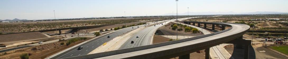
PHOENIX – The Arizona Department of Transportation has completed a project designed to slow traffic and eliminate lane changes on State Route 89 in Yarnell as part of a collaboration with the Yavapai County community to enhance safety for pedestrians and drivers.

The main safety feature of the project reconfigured the roadway with new lane striping that only allows one lane of traffic in each direction plus a center turn lane. In addition to eliminating a small number of parking spaces along the roadway, this configuration improves visibility for drivers and pedestrians while slowing traffic. 

ADOT made the changes after a roadway safety assessment and public input process that began in 2022. A multidisciplinary team of traffic safety engineers and other specialists analyzed past crashes, current roadway uses and configurations along a two-mile section of SR 89 in Yarnell to offer recommendations.

ADOT administered a community survey and held a community meeting earlier this year at which residents and businesses shared concerns about and suggestions for SR 89, which serves as Yarnell’s main street.

Other safety enhancements began in 2022, with ADOT installing new speed limit signs and additional pedestrian crossing signs that are more visible during daytime and nighttime hours. The signs were installed for both northbound and southbound traffic approaching Yarnell on SR 89.

The recently completed project also included removing the top layer of pavement and replacing it with a new chip-seal surface.

While the major work on the project is complete, drivers should expect limited restrictions in September while crews install permanent lane markings.


ADOT sharing SR 89 safety study recommendations in Yarnell Feb. 21

ADOT sharing SR 89 safety study recommendations in Yarnell Feb. 21

I-17 101 traffic interchange

ADOT sharing SR 89 safety study recommendations in Yarnell Feb. 21

ADOT sharing SR 89 safety study recommendations in Yarnell Feb. 21

February 7, 2023

Public invited to community open house

February 7, 2023

YARNELL – The Arizona Department of Transportation is hosting a community open house from 4 - 6 p.m. Tuesday, Feb. 21, to provide Yarnell residents and other stakeholders an opportunity to learn more about a recently completed safety study on State Route 89.

The informal event will allow participants to ask ADOT representatives questions about the roadway safety assessment that began in 2022, following a fatal crash involving a vehicle and a pedestrian. The study was conducted by a multidisciplinary team of traffic safety engineers and other specialists who analyzed past crashes, along with current roadway uses and configurations along the 2-mile segment of SR 89 in Yarnell (mileposts 276-278). The study identifies potential safety concerns for drivers and pedestrians, along with possible changes in signing, striping, and other safety improvements.

The final road safety assessment report is available at azdot.gov/Yarnell.

The community open house will be held at the Yarnell Regional Community Center, 22302 AZ-89. Participants can attend the informal event any time during the two-hour open house.

ADOT has already installed additional pedestrian crossing signs with improved reflectivity that is more visible during nighttime and daylight hours. These signs have been installed for both northbound and southbound drivers as they approach Yarnell on SR 89.

Improvement project at SR 89 and Road 1 North progresses with traffic shift

Improvement project at SR 89 and Road 1 North progresses with traffic shift

I-17 101 traffic interchange

Improvement project at SR 89 and Road 1 North progresses with traffic shift

Improvement project at SR 89 and Road 1 North progresses with traffic shift

August 26, 2021

CHINO VALLEY – Traffic along SR 89 in Chino Valley has been shifted at the intersection with Road 1 North as the Arizona Department of Transportation makes progress to improve traffic flow.

Since early July, crews have been working installing a new right turn lane on northbound SR 89 to eastbound Road 1 North, laying detection sensors for a new traffic signal, and adding left turn lanes in each direction on Road 1 North. 

Now, traffic has been shifted to the east side of the intersection while crews continue to make improvements. The new traffic pattern should be in place until early October. Two lanes in each direction are being maintained while work is occurring.

Drivers should continue to plan for short-term lane closures for signal installation, roadway paving and striping during nighttime operations of 8 p.m. to 6 a.m. Sundays through Fridays. No weekend or holiday work is planned.

Drivers should also continue to use signed detour routes for Road 1 North access.

The $850,317 project is expected to wrap up by the end of the year.

For more information on the project, visit azdot.gov/SR89ChinoValley.

SR 89 renamed in honor of Granite Mountain Hotshots

SR 89 renamed in honor of Granite Mountain Hotshots

SR24-1

SR 89 renamed in honor of Granite Mountain Hotshots

SR 89 renamed in honor of Granite Mountain Hotshots

By Ryan Harding / ADOT Communications
July 21, 2021

A 56-mile stretch of State Route 89 between Wickenburg and Chino Valley was recently renamed the “Granite Mountain Hotshots Memorial Highway” in honor of the brave firefighters who were lost battling the Yarnell Hill Fire on June 30, 2013.

The naming of the highway was approved by the Arizona State Board of Geographic and Historic Names. ADOT produced the signs which were officially unveiled at public events hosted by the city of Prescott marking the eighth anniversary of the tragedy.

One sign is posted in the northbound direction of SR 89 near Wickenburg at the southern end. Another sign is posted in the southbound direction of the highway in Chino Valley at the north end. Two more signs (one for each direction) have been put up near Prescott.

Learn more about who the Granite Mountain Hotshots were and the state park created in their honor in Yarnell at azstateparks.com/hotshots.

Work underway to improve SR 89 and Road 1 North in Chino Valley

Work underway to improve SR 89 and Road 1 North in Chino Valley

I-17 101 traffic interchange

Work underway to improve SR 89 and Road 1 North in Chino Valley

Work underway to improve SR 89 and Road 1 North in Chino Valley

July 7, 2021

CHINO VALLEY, AZ – The Arizona Department of Transportation has started a project to improve traffic flow at the intersection of SR 89 and Road 1 North in Chino Valley.

The project will add a right-turn lane on northbound SR 89 to eastbound Road 1 North, add left turn lanes on Road 1 North, and install a new traffic signal and detection sensors.

Two lanes of traffic will be maintained on SR 89 during daytime hours. Drivers should plan for short-term lane closures for signal installation, roadway paving and striping during nighttime operations of 8 p.m. to 6 a.m. Sundays through Fridays. No weekend or holiday work is planned.

Drivers should plan for round-the-clock phased closures of east- and westbound access to Road 1 North during the project and use signed detour routes for Road 1 North access.

The $850,317 project is expected to wrap up by the end of the year.

For more information on the project, visit azdot.gov/SR89ChinoValley.

ADOT: Don’t park illegally along SR 89 when visiting state park honoring ‘Hotshots’

ADOT: Don’t park illegally along SR 89 when visiting state park honoring ‘Hotshots’

I-17 101 traffic interchange

ADOT: Don’t park illegally along SR 89 when visiting state park honoring ‘Hotshots’

ADOT: Don’t park illegally along SR 89 when visiting state park honoring ‘Hotshots’

April 21, 2021

PHOENIX – For those planning on visiting the Granite Mountain Hotshots Memorial State Park near Yarnell this year, the Arizona Department of Transportation reminds visitors not to park illegally along State Route 89, putting themselves and others at risk.

The shoulders of state highways are reserved for emergencies only. Parking along them causes distractions to drivers along the highway and can prevent emergency vehicles from gaining access to those who need help.

The state park remains a popular place for visitors from all around to pay respects and learn about the 19 brave firefighters who gave their lives battling against the Yarnell Hill Fire. Parking along the highway is not the best nor safest way to pay those respects.

With more than 25,000 annual visitors to the state park, the parking lot can fill up fast. The Yarnell Fire Department, however, is helping by providing a shuttle service to the park on the weekends when the memorial park sees the most visitors.

The shuttle service runs Fridays-Sundays every half hour from 8 a.m. to 5 p.m. Proceed past the park into Yarnell and park at the Yarnell Fire Department. The last dropoff at the park trailhead is 1 p.m., and the last pickup at the park trailhead is 5 p.m.

To learn more about Granite Mountain Hotshots Memorial State Park and the shuttle service, visit azstateparks.com/hotshots.

Visiting the site of the Granite Mountain Hotshots? Honor them by doing it safely.

Visiting the site of the Granite Mountain Hotshots? Honor them by doing it safely.

SR24-1

Visiting the site of the Granite Mountain Hotshots? Honor them by doing it safely.

Visiting the site of the Granite Mountain Hotshots? Honor them by doing it safely.

By Ryan Harding / ADOT Communications
April 9, 2021

Planning to visit Granite Mountain Hotshots Memorial State Park in Yarnell to pay respects and learn about the 19 brave firefighters who gave their lives battling against the Yarnell Hill Fire?

Make sure you do it by not parking illegally along State Route 89, putting yourself and others at risk.

With signs near the parking lot summarizing the tragedy of June 30, 2013, and a memorial at the top of the Weaver Mountains for those who are in shape to hike up the hill, the park provides multiple opportunities for Arizonans and others across the country to honor and remember those men.

Parking illegally along the shoulders of SR 89 to get to the park, however, is not the best nor safest way to show that honor. The shoulders of state highways are reserved for emergencies only. Parking along them causes distractions to drivers along the highway and can prevent emergency vehicles from gaining access to those who need help. 

Plus, it puts you and your family and friends at greater risk right next to the highway.

With more than 25,000 annual visitors to the state park, the parking lot can fill up fast. Thankfully, the Yarnell Fire Department has risen to the occasion by providing a shuttle service to the park on the weekends when the memorial park sees the most visitors.

The shuttle service runs Fridays through Sundays every half hour from 8 a.m. to 5 p.m. Proceed past the park into Yarnell and park at the Yarnell Fire Department. The last dropoff at the park trailhead is 1 p.m., and the last pickup at the park trailhead is 5 p.m.

To learn more about Granite Mountain Hotshots Memorial State Park and the shuttle service, visit azstateparks.com/hotshots.

Adopt a Highway: Congress RVers keep SR 89 grand

Adopt a Highway: Congress RVers keep SR 89 grand

SR24-1

Adopt a Highway: Congress RVers keep SR 89 grand

Adopt a Highway: Congress RVers keep SR 89 grand

By Mary Currie / ADOT Communications
April 5, 2021

The Escapees North Ranch RV Club is located just about smack dab between Wickenburg and Congress Junction along State Route 89. Fun fact: This long-time multigenerational community for travelers and year ‘round residents operates the country’s oldest, largest and most economical private mail forwarding service for club members, something it's done in cooperation with the United States Postal Service since 1985.

The park was built by volunteers and still operates today on the expert skills, knowledge and labor of its dedicated members.

Twenty-nine years ago the club adopted two miles of SR 89 between mileposts 263 and 265, near the park entrance. These days Charles and Grace Ann Carter help organize cleanups with park residents while Yvonne “Voni” Ensley works behind the scenes to ensure volunteer registration and litter bag counts are submitted back to ADOT – a critical task in this operation that she’s taken on for many years. 

I had the pleasure of meeting 26 of the volunteers who gave up two hours on a recent brisk morning to help. Teams split up to canvas the right-of-way east and west of the park, where there was no shortage of litter devastating the beautiful scenery. Thirty full bags of trash and a variety of debris were collected. Some of the litter found was already bagged and either tossed or lost by travelers. Cardboard boxes, glass bottles and a well-used pet bed were just a few items cleared away. We marveled over a couple of unique items found: a colorful orb made of blown glass and a brand new metal joist.

When I asked Carter what motivates the group to continue serving the program all these years, he told me the club is made up of many volunteers.

“Most of us are, or were full-time RVers and have volunteered in state parks and national parks for years. Many of our members can be found volunteering in the hospital, museum and other places as needed around Wickenburg. Our ham radio club has furnished communications for parades, runs and bicycle races from Prescott to Congress. We also have several volunteers who participate in search and rescue, and Amateur Radio Emergency Service/Radio Amateur Civil Emergency Service communications to assist police, fire, city and county emergency responders.” 

Nola Cook, a 30-year resident, RVer and supporter, came out to welcome the group as they trickled back to the clubhouse. She told me she no longer volunteers for litter cleanups but has no shortage of improvement projects to tend to in other areas like the park’s cactus garden. Cook and her late husband were some of the original volunteer builders that made this park what it is today: a well kept home that many enjoy.  

Over the past three decades volunteers have uncovered lots of treasures and potential hazards while picking up litter in this area. 

“Car and house keys, car and truck parts, tools, building materials, even a case of unopened beer cans. You name it, we've probably found it in the last 29 years,” Carter said.

Some good advice and a bit of inspiration was offered for others considering a highway adoption: “Wear good lace-up boots or shoes, leather gloves and be sure to watch out for snakes and especially for traffic. Above all, have fun.”

Roadside litter is an unfortunate truth and becoming an increasing problem in Arizona. You can prevent a driving hazard for others and from losing your valuables by covering truck beds when hauling open truck loads. Double-check tools, equipment and furniture that can fly out or bounce out of the vehicle endangering drivers around you. 

Hundreds of unadopted miles are available on state highways throughout Arizona. To start your own volunteer group and care for a two mile segment of state highway in your community, visit the Adopt a Highway Volunteer program. If you live in Maricopa County check out Don’t Trash Arizona for more facts about litter and litter reduction.

Thank you to the Escapees North Ranch RV Club and each of the volunteers who welcomed me. ADOT celebrates with you and appreciates your twenty nine years of volunteer service. Arizona - Keep it Grand. 

Throwback Thursday: Ash Fork is at the right place

Throwback Thursday: Ash Fork is at the right place

SR24-1

Throwback Thursday: Ash Fork is at the right place

Throwback Thursday: Ash Fork is at the right place

By David Rookhuyzen / ADOT Communications
February 4, 2021

It seems like we can't get enough of talking about old US Route 66. Though it has been a defunct designation in Arizona for 35 years now, the legacy of the great Mother Road continues to inspire and inform us today.

Perhaps that can be seen nowhere clearer than in the towns left along its route. Which brings us to this photo. As you might be able to see, this is an undated photo of Ash Fork, which today sits at the junction of State Route 89 and Interstate 40. There's no date on it, but we figure that there are enough context clues – unpaved roads, vintage vehicles, buildings, old time gas pumps – to give someone enough information to track down a rough year. If that person is you, please give us your best guess! The only thing we can say for sure is that it was in a collection of photos that predate 1950. 

But, this was a good opportunity to look into the history of Ash Fork and where it came from. It's origins are actually tied to transportation, but predate the Main Street of America by decades. It's also been very fortunate to always sit at important junctions.

In his "Roadside History of Arizona" state historian Marshall Trimble says the town was founded in 1882, when Cooper Thomas Lewis built a small grocery store next to the local railroad tracks. Skip forward a few years and the community was also graced with a post office and Wells Fargo station. In 1893 the townsite moved to the southside of the rail line because all the buildings at the original townsite on the north side were destroyed by a fire.

The early 1890s also had plenty of good in store, as a rail line connected it with Prescott and eventually Phoenix. The aptly named Santa Fe, Prescott and Phoenix line may have been longer that the competing route going through Black Canyon, but as our Arizona Transportation History says, it was actually quicker and more comfortable. This established rail route, which also went through Wickenburg, may have also been a factor when the original Phoenix-to-Prescott road was built in the early 20th century.

Trimble also says that the connecting of Phoenix and Prescott via the railroad is where many historians date the closing of Arizona's frontier period.

In the 1920s, with arrival of the automobile age and the start of the famous US 66, Ash Fork became one of many towns served by the motorists now traveling between Los Angeles and Chicago. Ash Fork even boasted the Hotel Escalante, of the famouse pit stops/restaurants/hotels run by tourism magnate Fred Harvey.

The community was hit by a series of setbacks, such as the railroad line moving 10 miles to the north in the 1950s, and Interstate 40 deciding to bypass it in the 1970s. 

Though the highway doesn't run through town any more, Ash Fork still sits were State Route 89 meets I-40, meaning there is still a need for gas, snacks and a place to stop. As this photo and modern Ash Fork could tell you, location really is everything.

Throwback Thursday: The rocky road to Prescott

Throwback Thursday: The rocky road to Prescott

SR24-1

Throwback Thursday: The rocky road to Prescott

Throwback Thursday: The rocky road to Prescott

By David Rookhuyzen / ADOT Communications
August 6, 2020

Going uphill is a fact of driving some Arizona highways, especially as you go from the Sonoran desert in the south up to the mountains or onto the Colorado Plateau. From the earliest days of transportation, that has always been the case. 

Which brings us to this excellent photo from 1932 we found in our archives. As the caption tells us, this shot of rocks beside – and on – the road is Yarnell Hill along the Phoenix-to-Prescott Highway. 

Anyone who has driven from Congress to Yarnell, or vice versa, is familiar with this particular portion of what is now State Route 89. If you take it today, you ascend roughly 1,000 feet in a little under 4 miles. And that's the modern road with today's vehicles. Imagine doing it on a graded dirt road in the car you see in the background. We also don't envy the crews that had to remove those hefty boulders from the road without the benefits of a frontloader. 

And how about that Phoenix-to-Prescott Highway? We told you about this highway in another blog post, where it was one of the original north-south roads envisioned by Arizona's territorial government in 1909. That route originally was planned to run directly south from Prescott to Phoenix, which includes some notoriously steep terrain. By 1917, the route between Prescott and Wickenburg, and then on to Phoenix, became the better option. That's the route US 89 would take in the 1920s as it climbed from Nogales to the Utah state line, and it's still the way State Route 89 will get you to Prescott. 

Times may have changed, but rock removal along state highways remains a concern for ADOT. In March 2020, crews were busy clearing boulders from along State Route 89A near Jerome and – you guessed it – on State Route 89 near Yarnell.