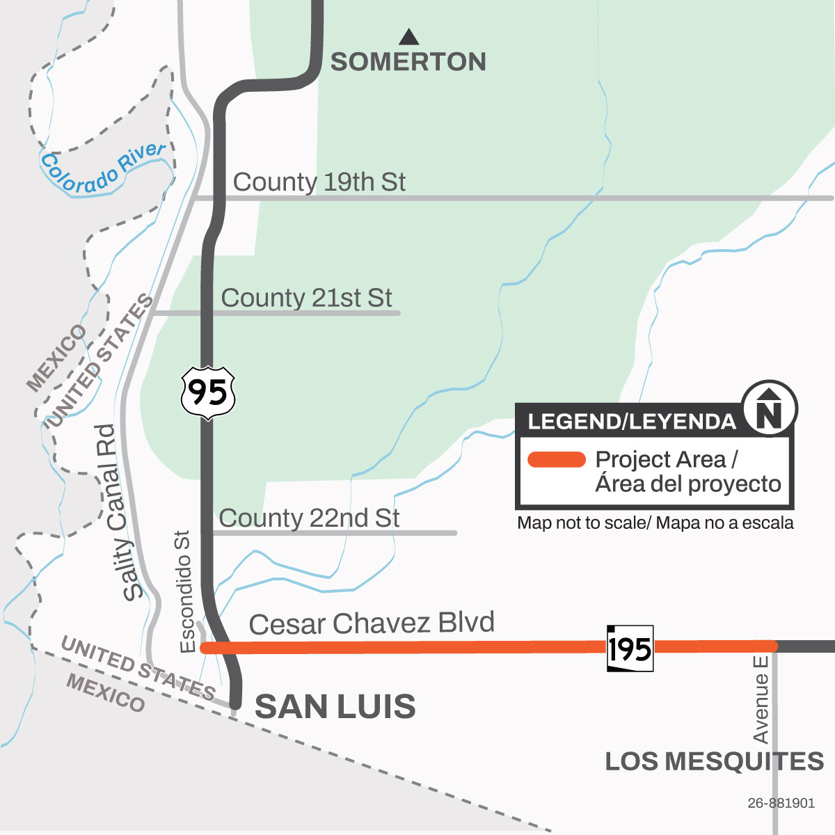
The City of San Luis, in coordination with the Arizona Department of Transportation began a project to reconstruct 5 miles of Cesar Chavez Boulevard between Escondido Street and Avenue E.
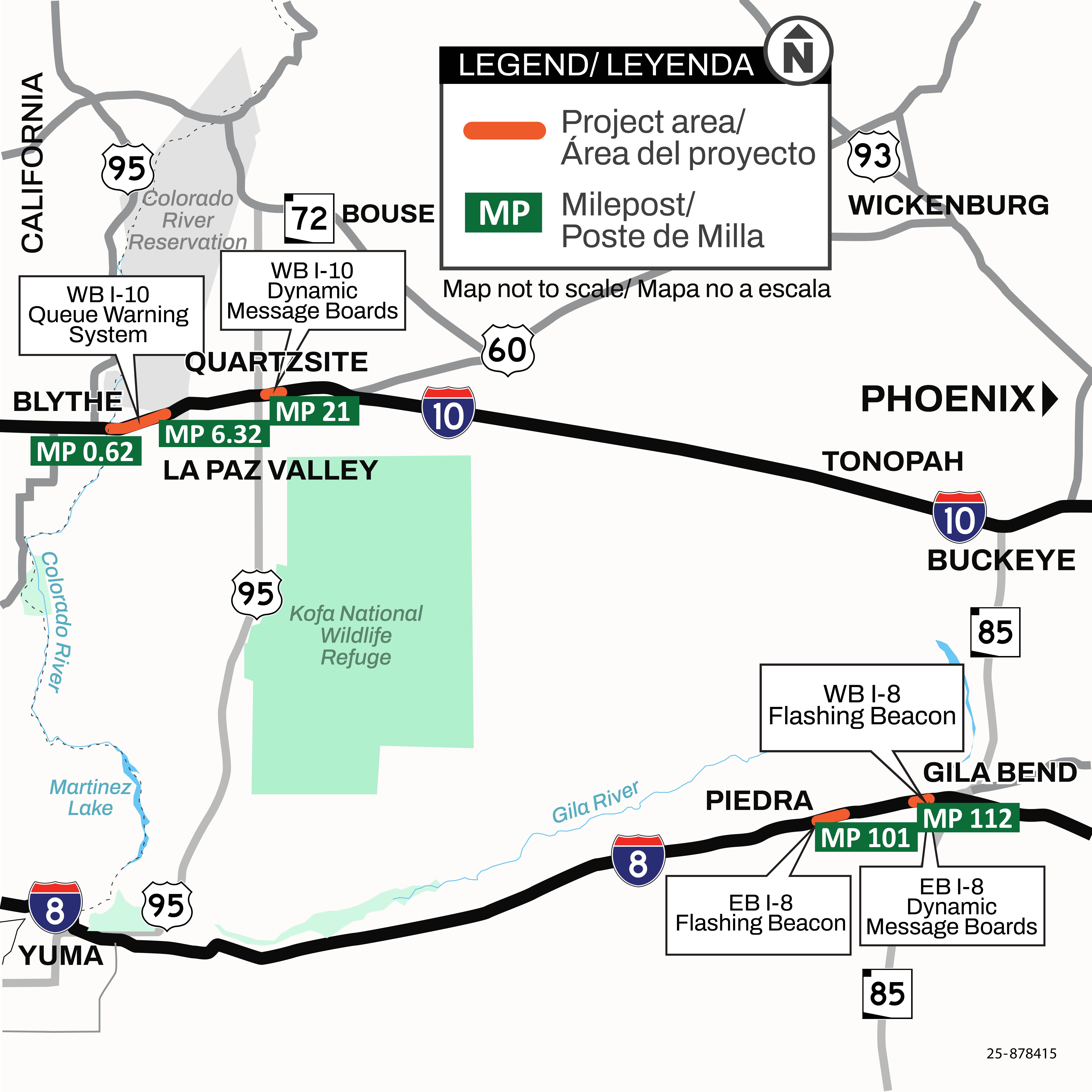
The Arizona Department of Transportation is starting a project to install Queue Warning and Dynamic Message Board systems and flashing beacons on Interstate 10 and I 8 within La Paz and Maricopa counties.
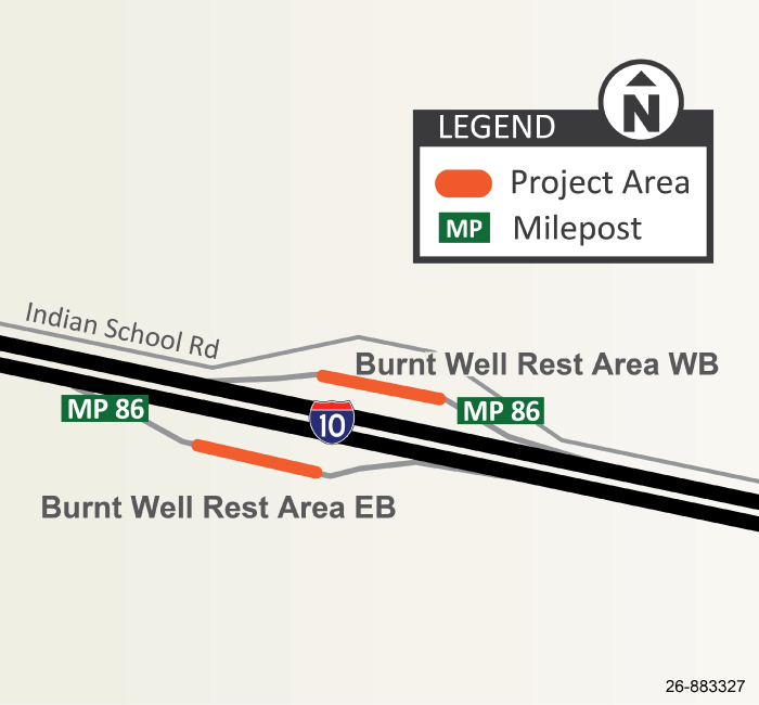
The Arizona Department of Transportation is starting a truck parking expansion project at the Interstate 10 Burnt Wells Rest Area, located at milepost 86 in Tonopah.
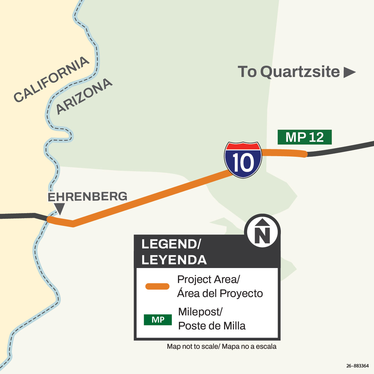
The Arizona Department of Transportation is tentatively scheduled to begin a pavement rehabilitation project on Interstate 10, between the California/Arizona border and Dome Rock Road in La Paz County in late fall 2026.
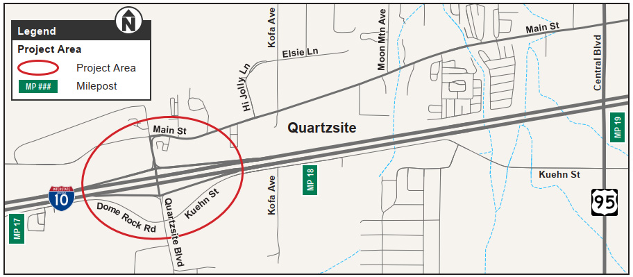
The Town of Quartzsite, in collaboration with the Arizona Department of Transportation, has initiated design improvements for the West Quartzsite Traffic Interchange at milepost 17, in the Town of Quartzsite.
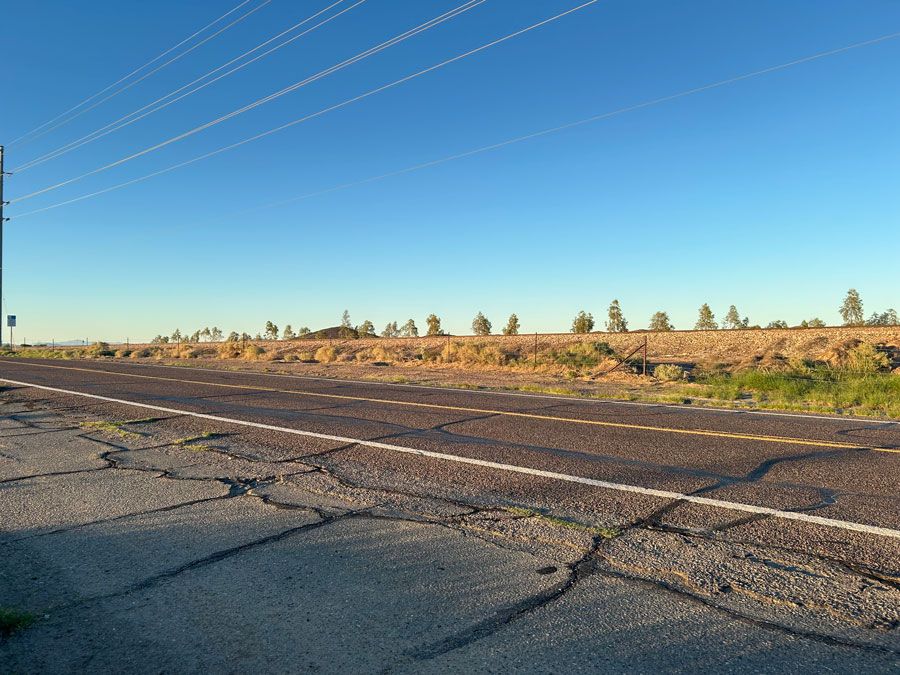
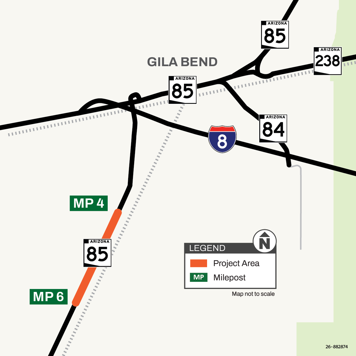
The Arizona Department of Transportation is designing a project to make drainage improvements at existing concrete box culverts on State Route 85, south of Gila Bend between mileposts 4 and 6.
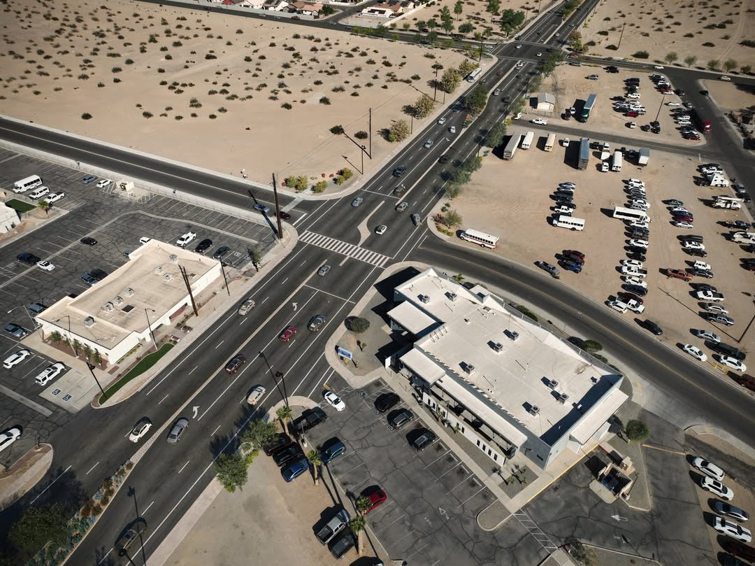
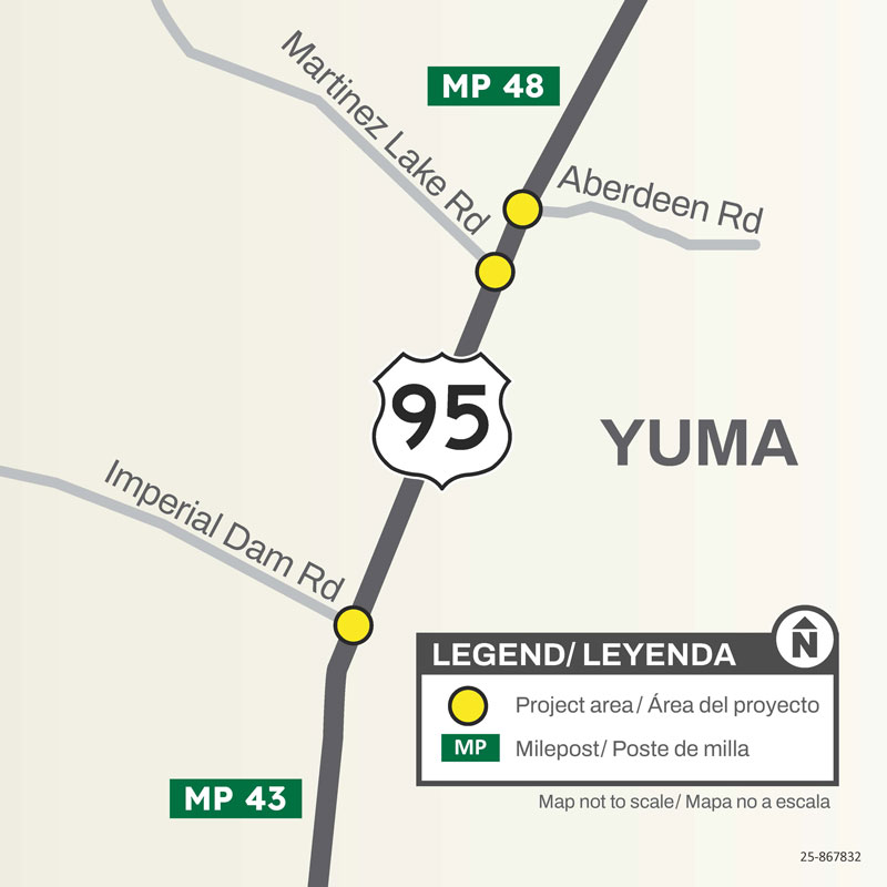
The Arizona Department of Transportation began an improvement project at the US 95 intersection between Imperial Dam Road and Aberdeen Road, north of Yuma.
The Arizona Department of Transportation is designing a project to widen US 95 between the Wellton-Mohawk Canal (milepost 38.5) and Imperial Dam Road (milepost 43.4).