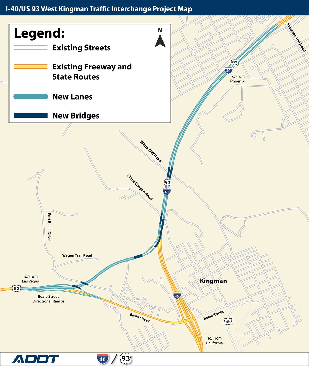
I-40 Kingman Project Map
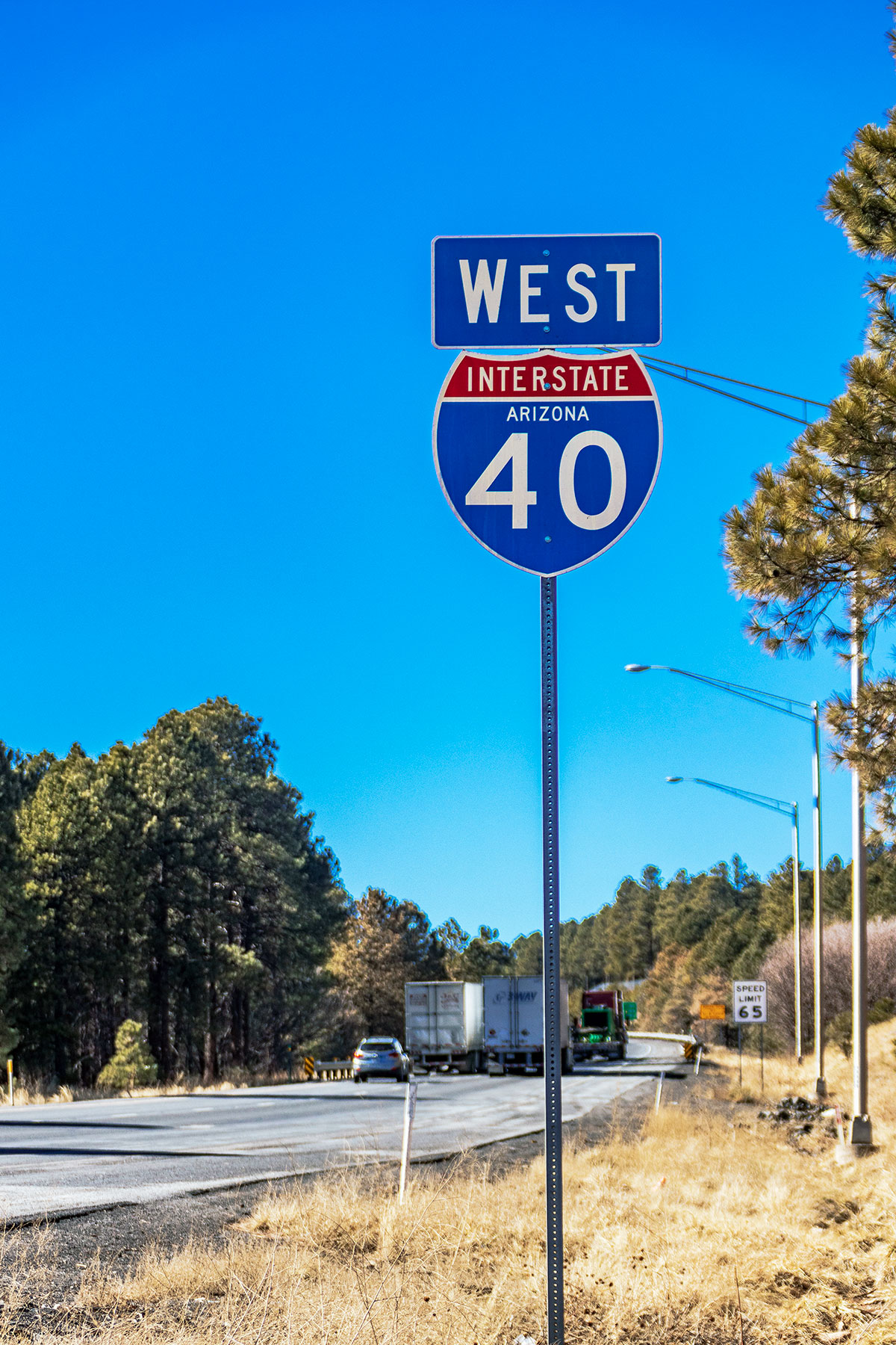
W I40 sign

Project Cost: $106,543,210

In July 2024 the Arizona Department of Transportation started construction on a new system-to-system traffic interchange that will create a free flowing connection between Interstate 40 and US 93 in west Kingman. Construction is expected to be completed in approximately 2.5 years, through early 2027.
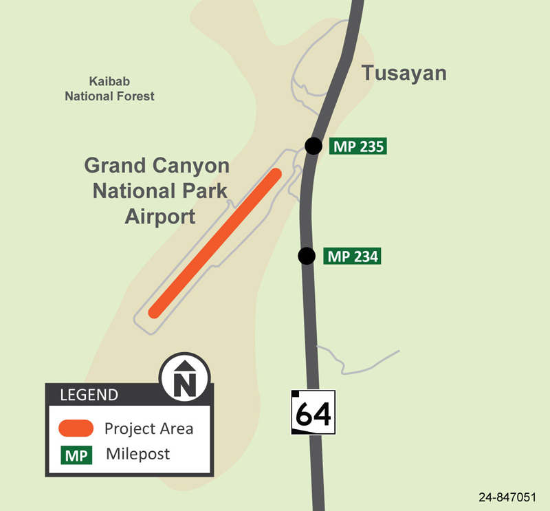
Map Grand Canyon National Park Airport Runway Rehabilitation Project
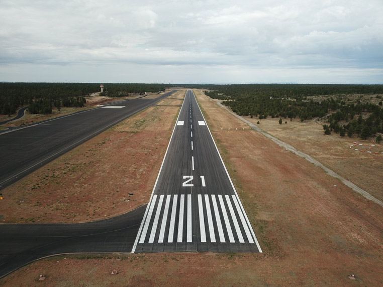
Grand Canyon Airport Runway 21 Looking South
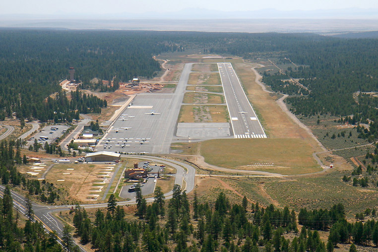
Grand Canyon Airport
The Grand Canyon National Airport has completed a significant runway rehabilitation project designed to improve safety and operational efficiency for all users and extending its lifespan.
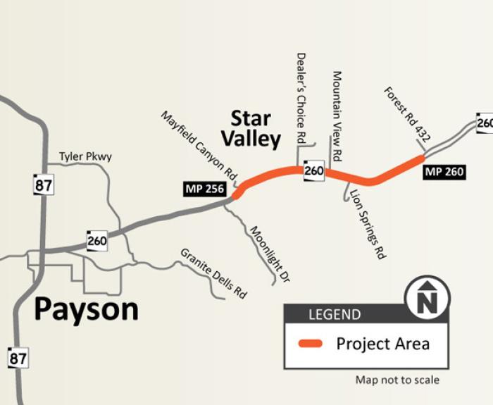
A graphic of a map of the project area.
Drivers should be prepared for delays of up to an hour at a time on SR 260 from 10 a.m. to noon on these days between Walters Lane and Gila County Yard (mileposts 256-257) while crews remove loose
911

Drivers should plan for extra travel time through the project corridor during overnight and weekend work

ADOT advises drivers to use caution and be prepared to slow down, follow the posted speed limit and merge safely when approaching and traveling through all work zones. Drivers should allow for extra travel time and watch for construction personnel and equipment as work progresses in the State Route 347 Improvement Project corridor.

Weeknight Work

  1. Thursday, Sept. 17: Southbound SR 347 will be narrowed to one lane from Mammoth Way to Casa Blanca Road from 8 p.m. Thursday, Sept. 17, to 5 a.m. Friday, Sept. 18, for paving.

  2. Monday, Sept. 21: Northbound SR 347 will be narrowed to one lane from Casa Blanca Road to Mammoth Way nightly from 8 p.m. to 4 a.m. beginning Monday, Sept. 21, through Wednesday, Sept. 23, for materials testing.

  3. Monday, Sept. 21: Southbound SR 347 will be narrowed to one lane from Mammoth Way to Casa Blanca Road nightly from 8 p.m. to 5 a.m. beginning Monday, Sept. 21, through Wednesday, Sept. 23, for materials testing.

  4. Thursday, Sept. 24: Northbound SR 347 will be narrowed to one lane from Casa Blanca Road to Mammoth Way from 8 p.m. Thursday, Sept. 24, to 4 a.m. Friday, Sept. 25, for paving.

  5. Thursday, Sept. 24: Southbound SR 347 will be narrowed to one lane from Mammoth Way to Casa Blanca Road from 8 p.m. Thursday, Sept. 24, to 5 a.m. Friday, Sept. 25, for paving.

Weekend Work

  1. Starting Friday evening, Sept. 18: Northbound SR 347 will be narrowed to one lane from Casa Blanca Road to Mammoth Way 24/7 beginning 8 p.m. Friday, Sept. 18, to 4 a.m. Monday, Sept. 21, for paving.

  2. Starting Friday evening, Sept. 18: Southbound SR 347 will be narrowed to one lane from Mammoth Way to Casa Blanca Road 24/7 beginning 8 p.m. Friday, Sept. 18, to 5 a.m. Monday, Sept. 21, for paving.

Project Lookahead

Daytime and overnight lane restrictions will be in place the weekends of Sept. 26 and Oct. 3. More detailed information will be provided as the construction schedule is finalized.

The project schedule is subject to change due to weather or other unforeseen circumstances.

To sign up for project updates and traffic alerts to stay in the know, please visit the project website at azdot.gov/sr347.

Real-time highway conditions are available on ADOT’s Arizona Traveler Information site at AZ511.gov, the AZ511 app (download for Apple or Android devices) or by calling 511. Drivers can set their own alerts on the AZ511 app in order to be notified when there is an incident, lane restriction or closure.
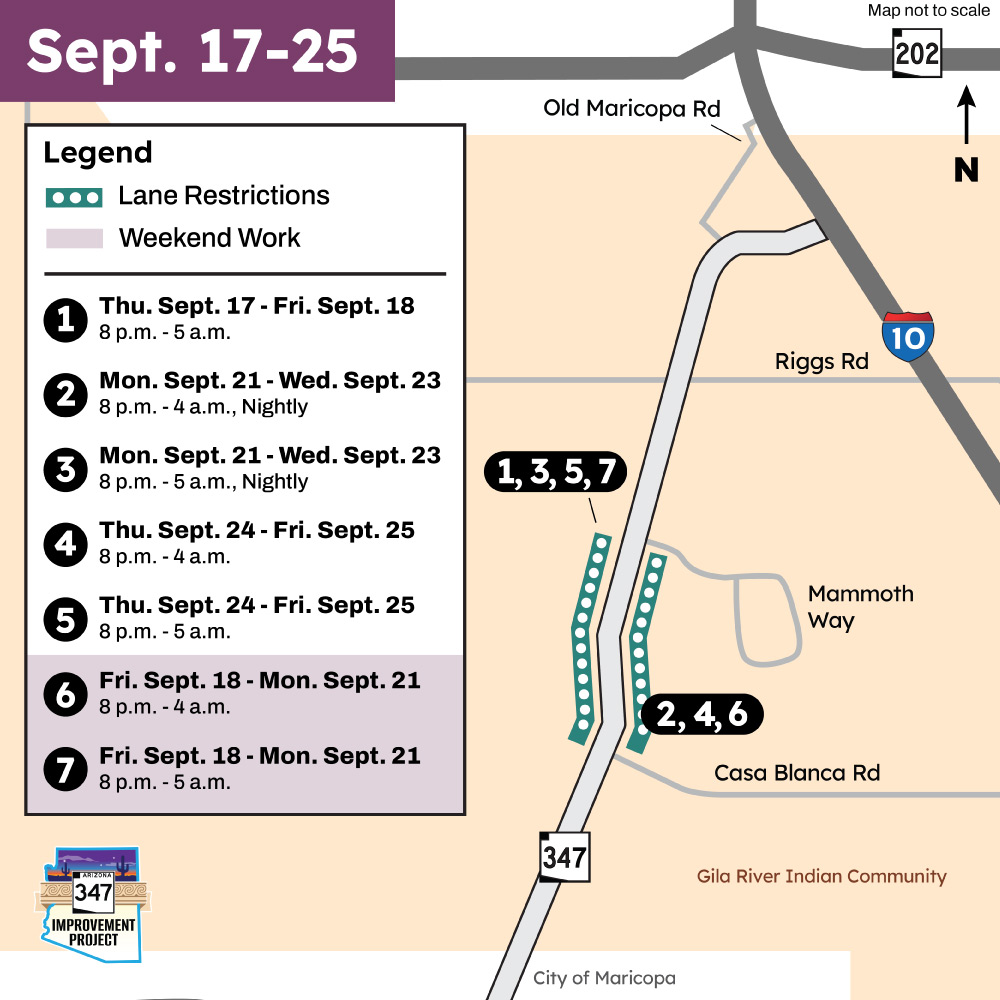
Detour Map for SR 347 Improvement Project showing lane restrictions scheduled Sept. 17-25

Close alert
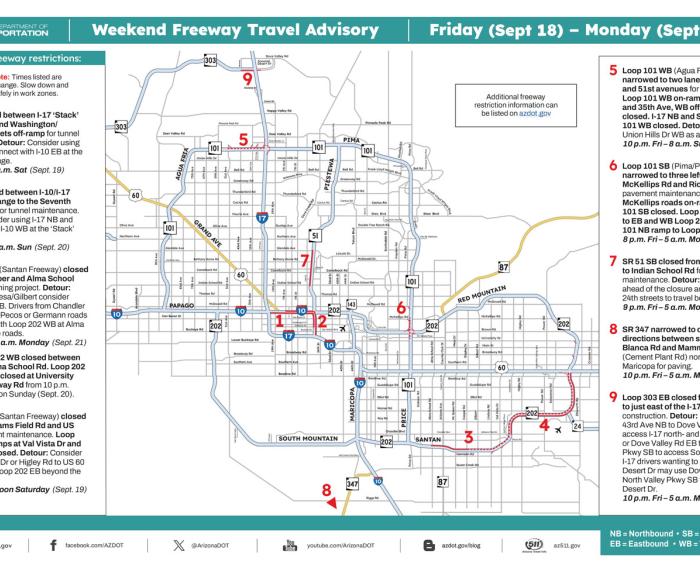
Map of weekend freeway travel advisory
Closures or lane restrictions for improvement projects are scheduled along several freeways in the Phoenix area this weekend (Sept. 18-21), according to the Arizona Department of Transportation
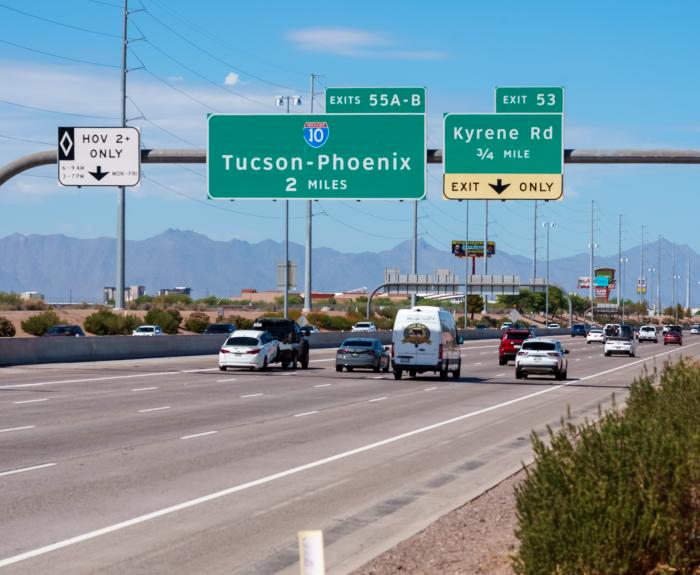
Photo of overhead signs on Loop 202 Santan Freeway
The Arizona Department of Transportation invites the public to a virtual meeting Tuesday, Oct. 6, to share plans for a project that will widen Loop 202 (Santan Freeway) between Interstate 10 and Loop
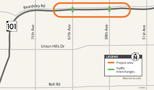
Study Map Loop 101: 67th and 59th Avenues Traffic Interchange Improvements Study
The Arizona Department of Transportation, in coordination with the Maricopa Association of Governments, and the city of Glendale, has begun a project to design improvements to the Loop 101 (Agua Fria Freeway) interchanges at 67th and 59th avenues.
Join us in the great outdoors for a special cleanup along Arizona’s legendary Route 66, also known as the Mother Road, Main Street of America and the Will Rogers Highway.
Photo of SR 51 at Camelback Road showing all lanes now open
The Arizona Department of Transportation has lifted lane restrictions on northbound State Route 51 near Camelback Road following a 7-week project that replaced about 700 feet of damaged pavement and
Beginning September 12, Arizona law, A.R.S. 28-3173, adjusts the time frame to update your MVD photo from 12 years to 16 years. Those with a standard driver license or ID and an old photo may receive a letter in the mail explaining it is time to update your photo.