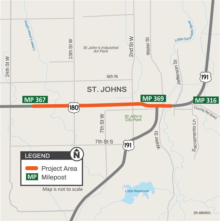
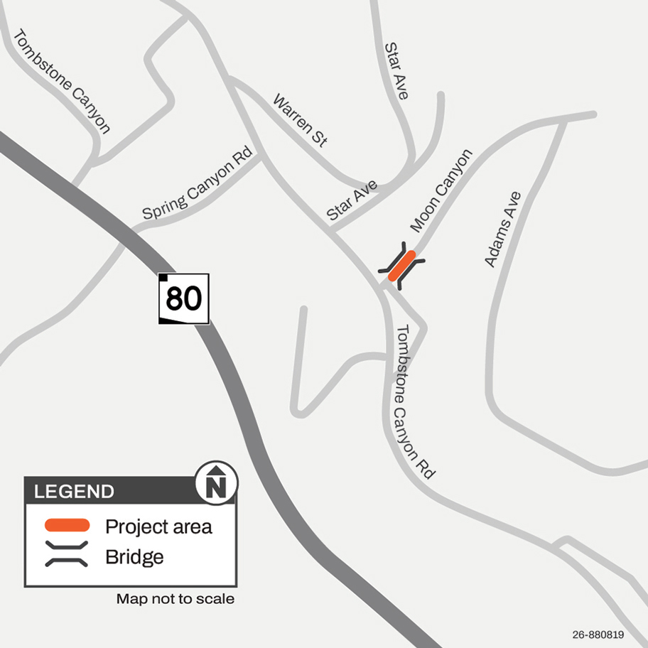
The Arizona Department of Transportation is currently working on a pavement rehabilitation project along US 180, locally known as Cleveland Street, and US 191, locally known as Commercial Street, in the City of St. Johns.
The Arizona Department of Transportation has initiated a construction project to replace the worn pavement surface along a 16-mile section of US 93 north of the junction with State Route 71 in Yavapai County (mileposts 156-172).
Drivers should prepare for nighttime lane restrictions and delays on US 93 north of Wickenburg as a project starts Monday, Jan. 26, to improve pavement on a 16-mile segment of the highway.
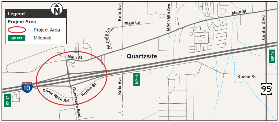
The Town of Quartzsite, in collaboration with the Arizona Department of Transportation, has initiated design improvements for the West Quartzsite Traffic Interchange at milepost 17, in the Town of Quartzsite.
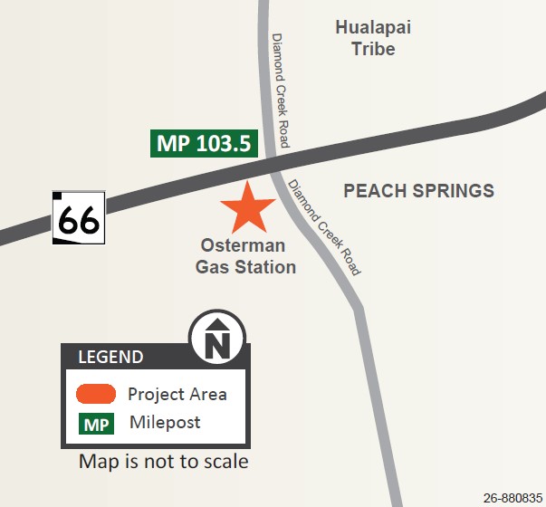
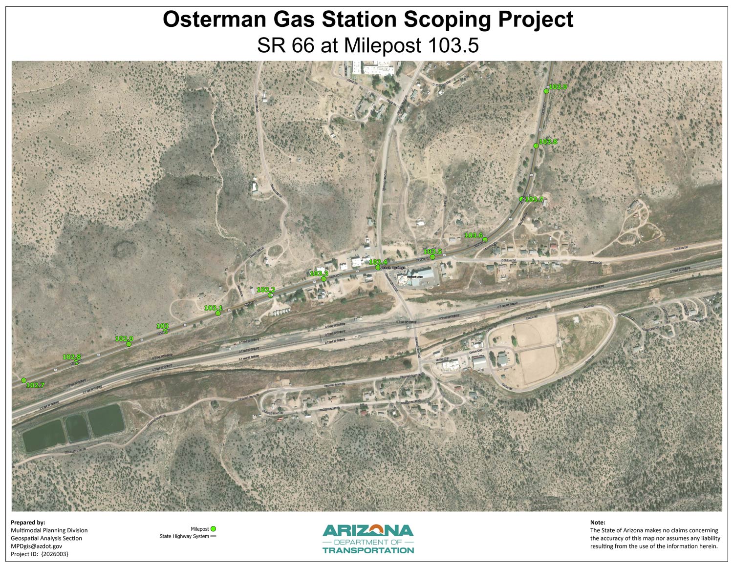
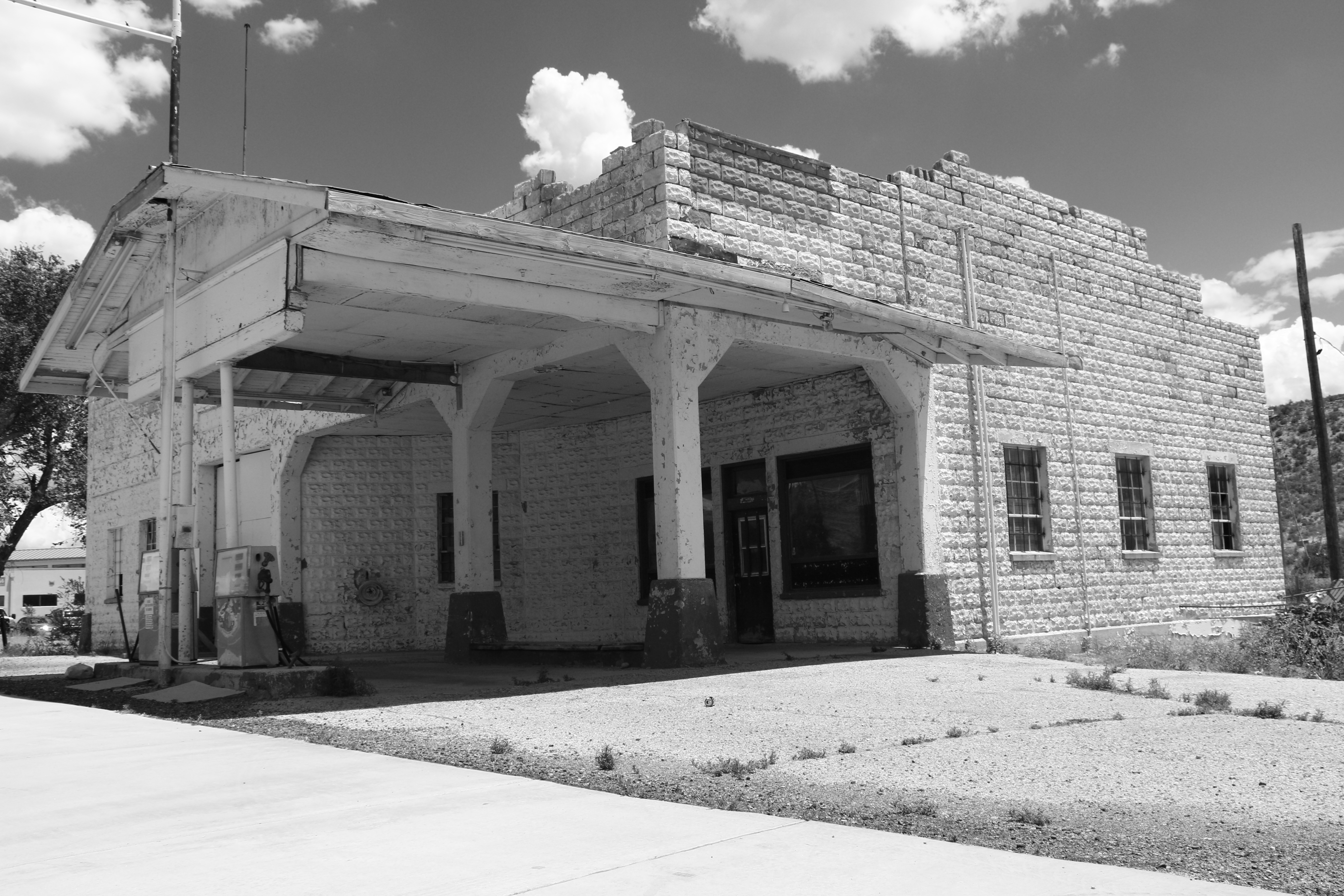
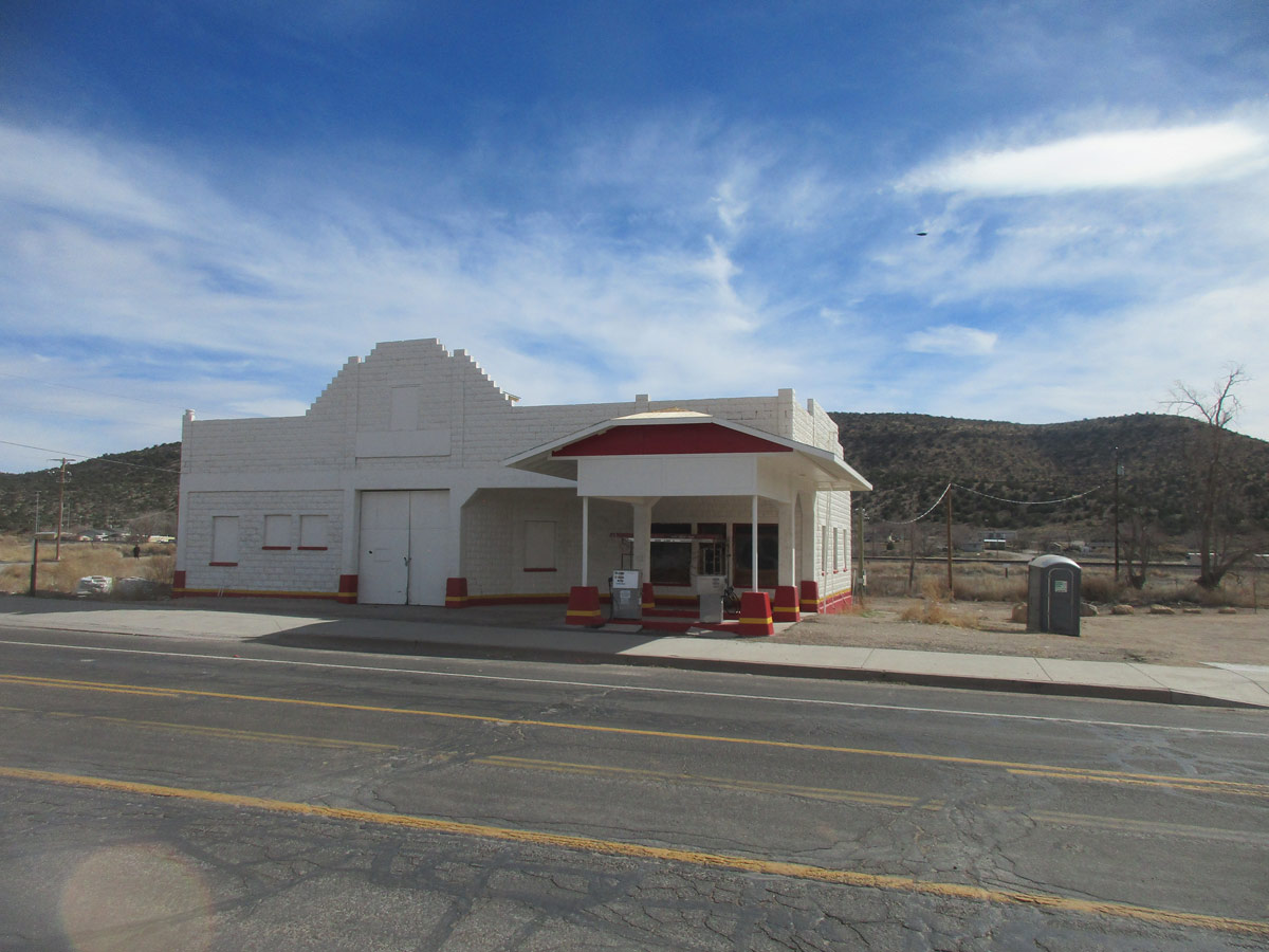
The Arizona Department of Transportation, in collaboration with the Hualapai Tribe, has initiated a project to document existing conditions and prepare a conceptual design report for the John Osterman/Shell Gas Station, which is listed on the National Register of Historic
Southbound SR 51 closed from Cactus Road to Northern Avenue this weekend (Oct. 30-Nov. 2)
Nightly SR 51 lane restrictions scheduled Nov. 2-6
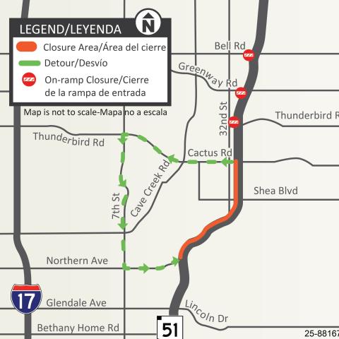
Southbound SR 51 will be CLOSED between Cactus Road and Northern Avenue from 9 p.m. Friday, Oct. 30, to 5 a.m. Monday, Nov. 2. The following ramps also will be closed:
The southbound SR 51 on-ramps at Bell, Greenway and Thunderbird roads.
DETOUR: Drivers may consider taking westbound Cactus Road/Thunderbird Road to southbound Seventh Street and using eastbound Northern Avenue to access SR 51 south of the closure.
Map showing the detour route for the southbound SR 51 closure planned between Cactus Road and Northern Avenue
UPCOMING OVERNIGHT LANE RESTRICTIONS
Northbound SR 51 will be narrowed to one lane between Indian School and Bethany Home roads nightly from 9 p.m. to 5 a.m. starting Monday, Nov. 2, and ending Friday morning, Nov. 6.
Southbound SR 51 will be narrowed to one lane between Northern Avenue and Indian School Road nightly from 9 p.m. to 5 a.m., starting Monday, Nov. 2, and ending Friday morning, Nov. 6.
UPCOMING CLOSURE
Southbound SR 51 is scheduled to be CLOSED between Northern and Highland avenues (south of Camelback Road) from 9 p.m. Friday, Nov. 6, to 5 a.m. Monday, Nov. 9.
NOTE: The current, uneven pavement conditions on SR 51 bridge decks are temporary and do NOT represent the finished freeway surface. Crews are making interim repairs to improve and maintain driving conditions until permanent improvements can be made. ADOT appreciates your patience as the project progresses over the next several months.
ADOT advises drivers to use caution and be prepared to slow down and merge safely when approaching and traveling through all work zones.
Enrolled members of federally recognized tribal nations can now receive driver licenses, instruction permits and ID cards bearing a Native American designation. Those who choose this option will have