State Route 187: SR 387 to SR 87 Improvement Project
State Route 187: SR 387 to SR 87 Improvement Project
State Route 187: SR 387 to SR 87 Improvement Project
State Route 187: SR 387 to SR 87 Improvement Project
Overview
The Arizona Department of Transportation is tentatively scheduled to begin a project to improve State Route 187 on the Gila River Indian Community in summer 2025. These improvements will include pavement preservation, shoulder widening, and adding new turn lanes, which will reduce congestion and improve mobility.
Project Fact Sheet
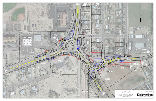
Project elements
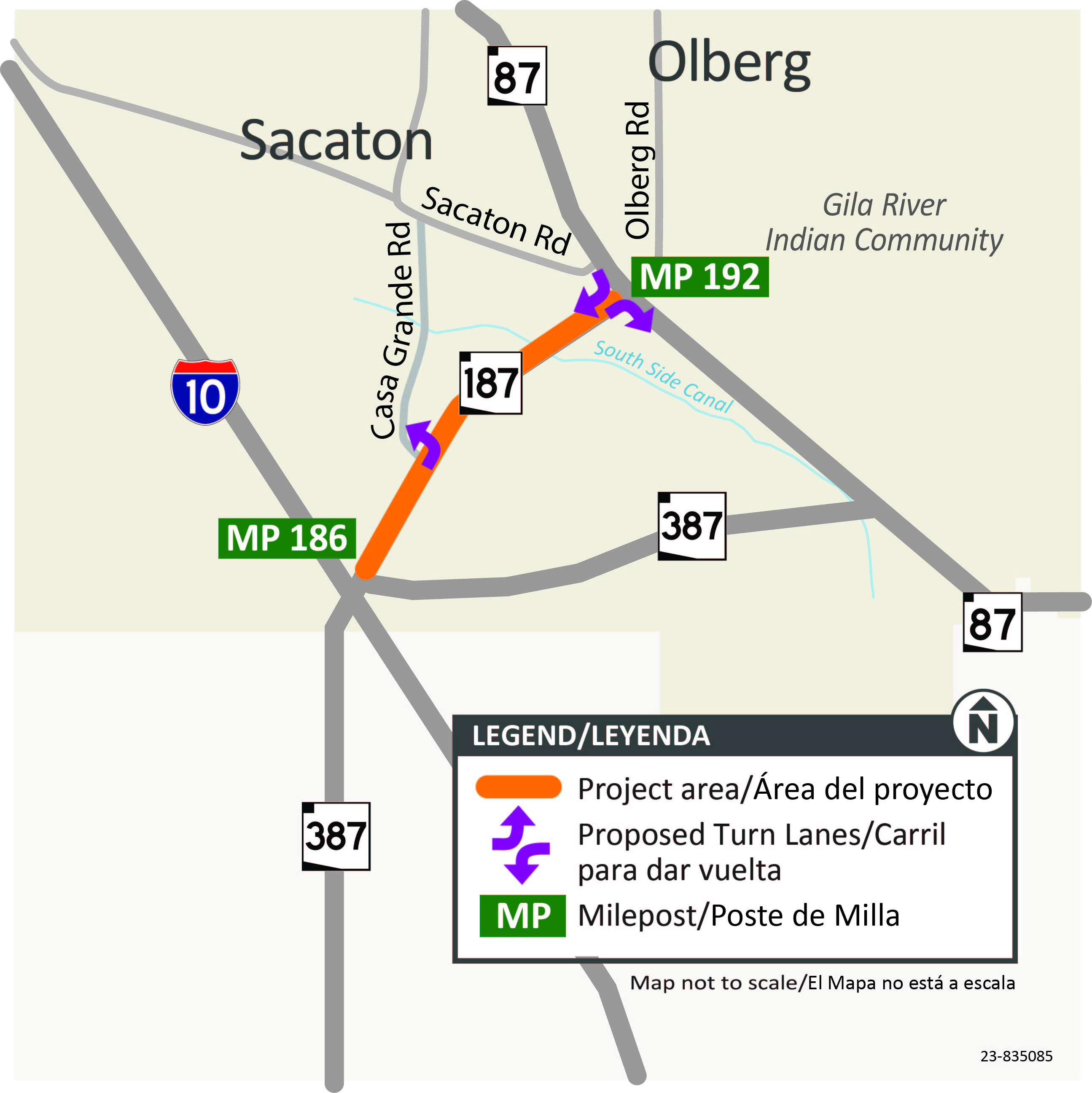
- Adding a new right-turn lane on SR 187 approaching SR 87
- Adding a new right-turn lane on SR 87 approaching SR 187
- Adding a new left-turn lane on SR 187 approaching Casa Grande Road
- Widening SR 187 to accommodate 8-ft shoulders on both sides
- Removing and replacing the asphalt
- Constructing drainage improvements
- Replacing bridge railing
- Relocating traffic signal equipment at the SR 187/SR 87 intersection
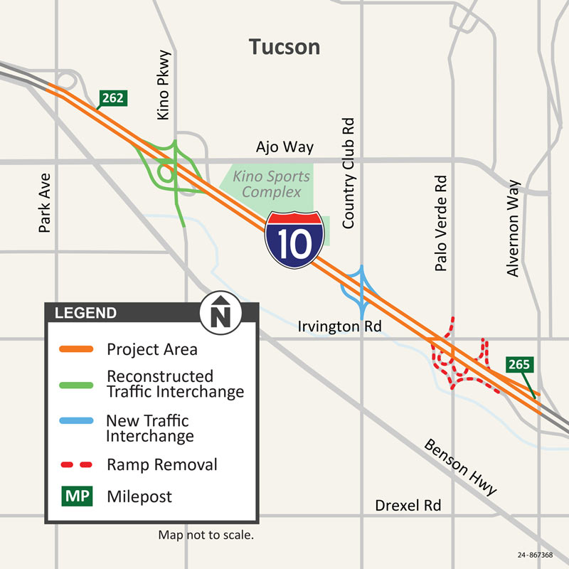
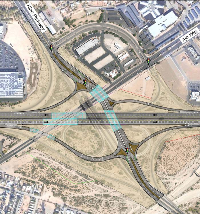
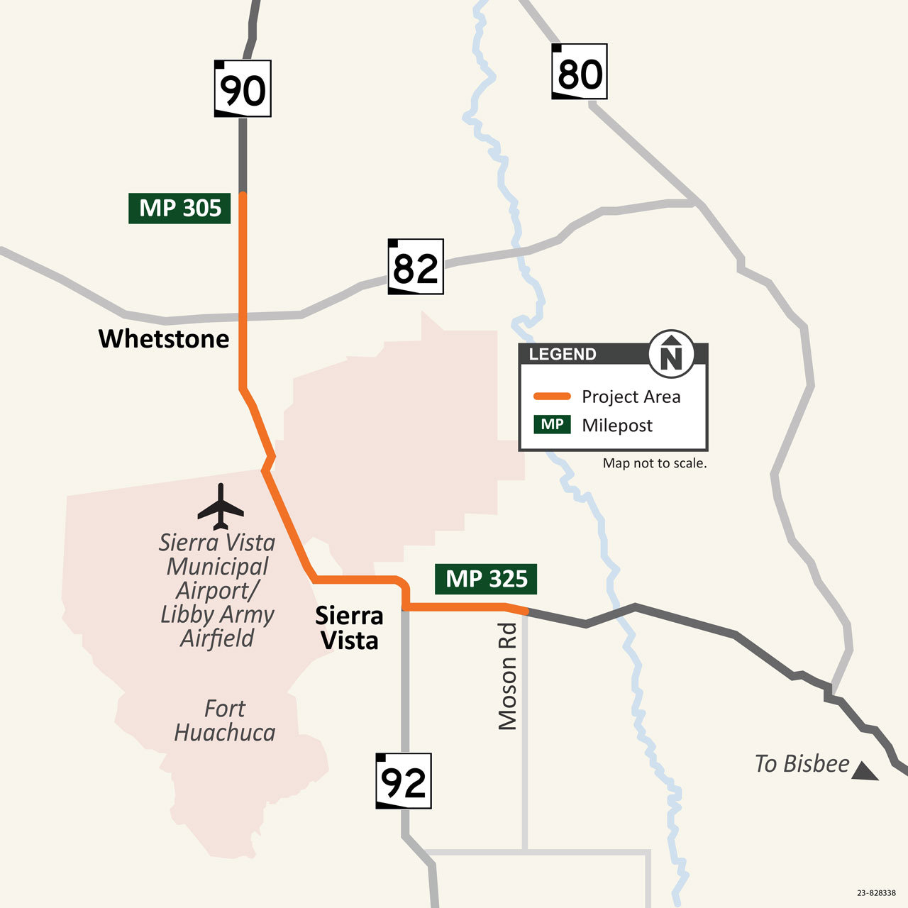
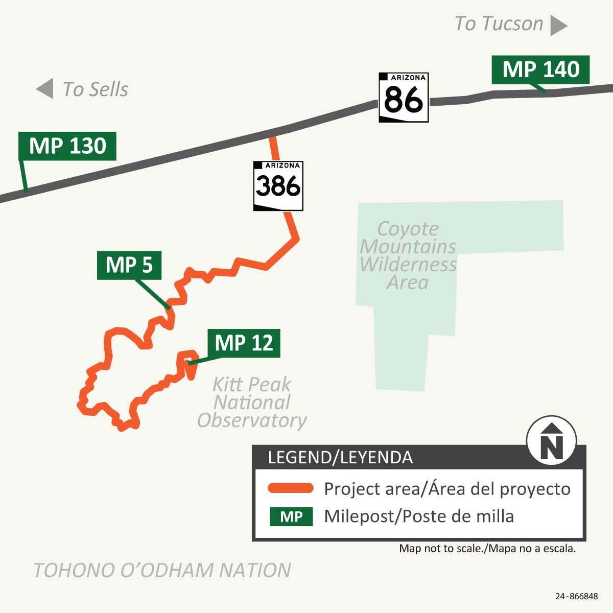
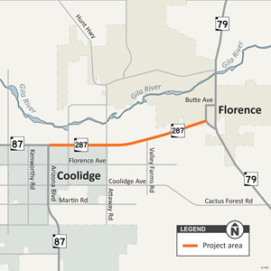
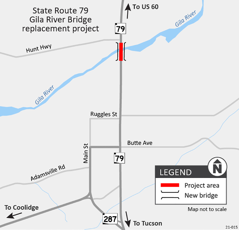
Project Area Map
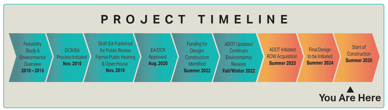
Project Schedule
The project is anticipated to begin summer 2025 and is projected to be completed in spring 2026. ADOT will provide advance notice of restrictions and closures once construction starts. Schedules are subject to change due to weather and other unforeseen circumstances.
What to Expect
- Traffic control devices will guide motorists through the construction area.
- Construction work is tentatively scheduled from 6 a.m. to 6 p.m. Monday through Friday.
- Expect temporary delays as traffic is redirected through a single travel lane.
- ADOT will provide advance notice of restrictions and closures to email subscribers.
Stay Informed

- By email: Subscribe to receive traffic alerts and project updates directly to your email.
- By phone: Call the ADOT Project Information Line at 855.712.8530
- Online: Submit a question or comment to Dulce Maria Rojo at [email protected].
For real-time highway conditions statewide, visit ADOT’s Traveler Information Site at www.az511.gov, follow ADOT on Twitter @ArizonaDOT or call 511, except while driving.