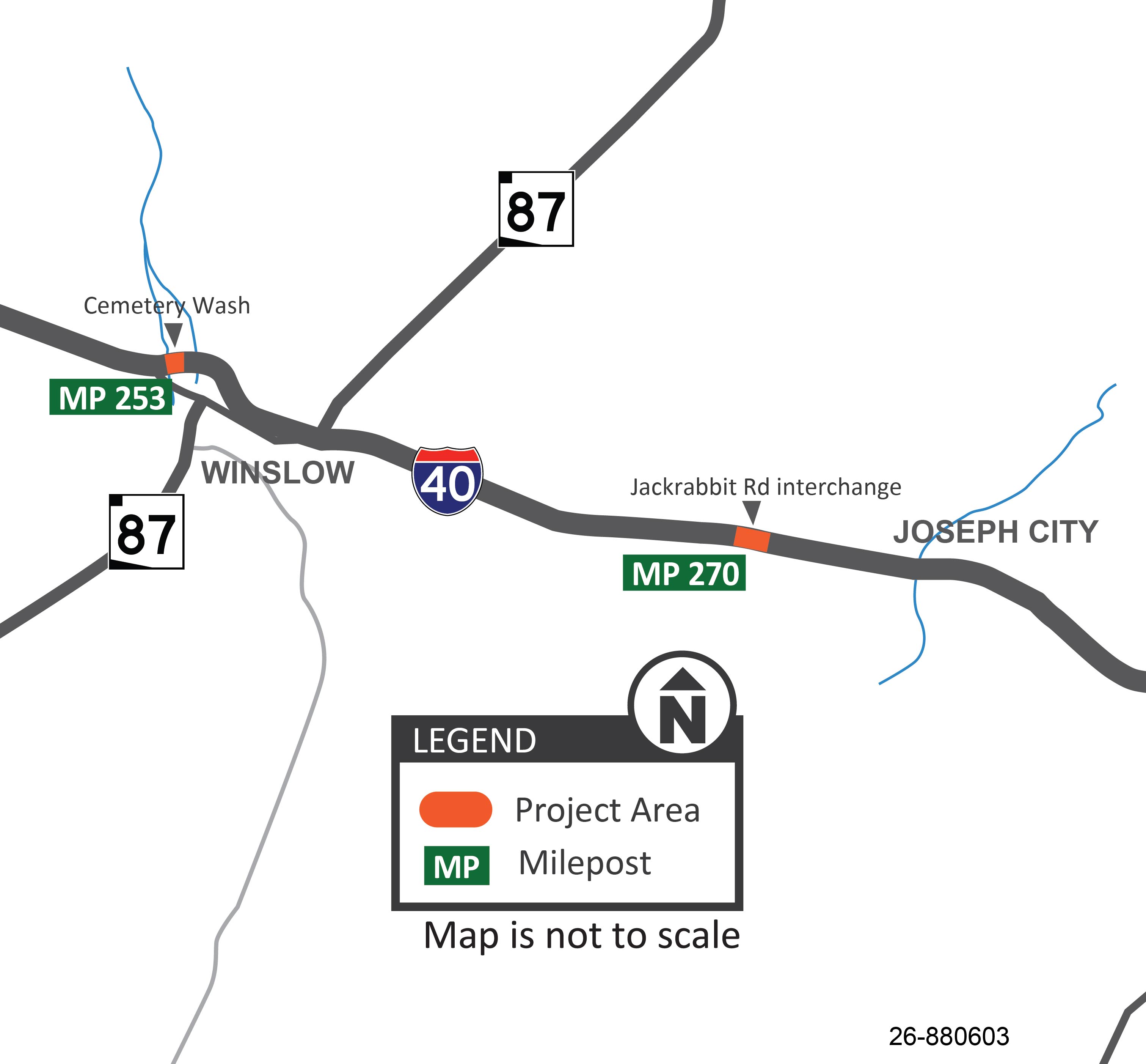
The Arizona Department of Transportation has initiated a rehabilitation project on two bridges along Interstate 40: the Cemetery Wash Bridge (eastbound only) in Winslow (milepost 253) and the Jackrabbit Road Bridge near Joseph City (milepost 270).
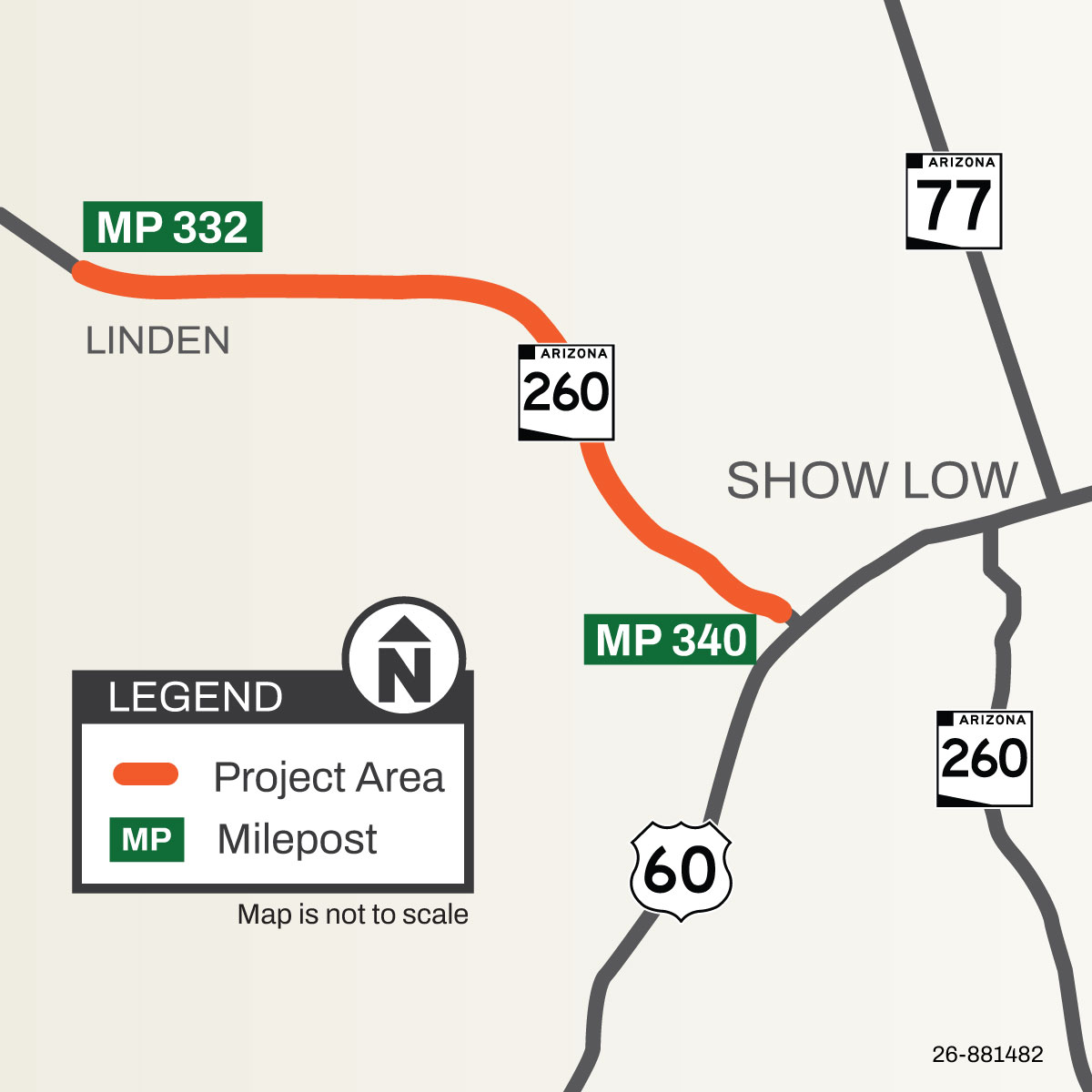
The Arizona Department of Transportation is currently working on a pavement rehabilitation project along State Route 260 between Linden and Show Low (mileposts 332-340).
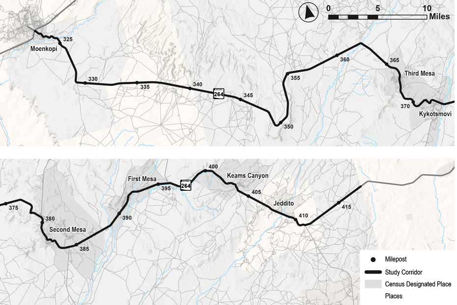
The State Route (SR) 264 corridor in northeast Arizona serves as a major highway for the Hopi Tribe and Navajo Nation, which includes several population centers such as Moenkopi, Third Mesa, Kykotsmovi, Second Mesa, First Mesa, Keams Canyon, and Jeddito.
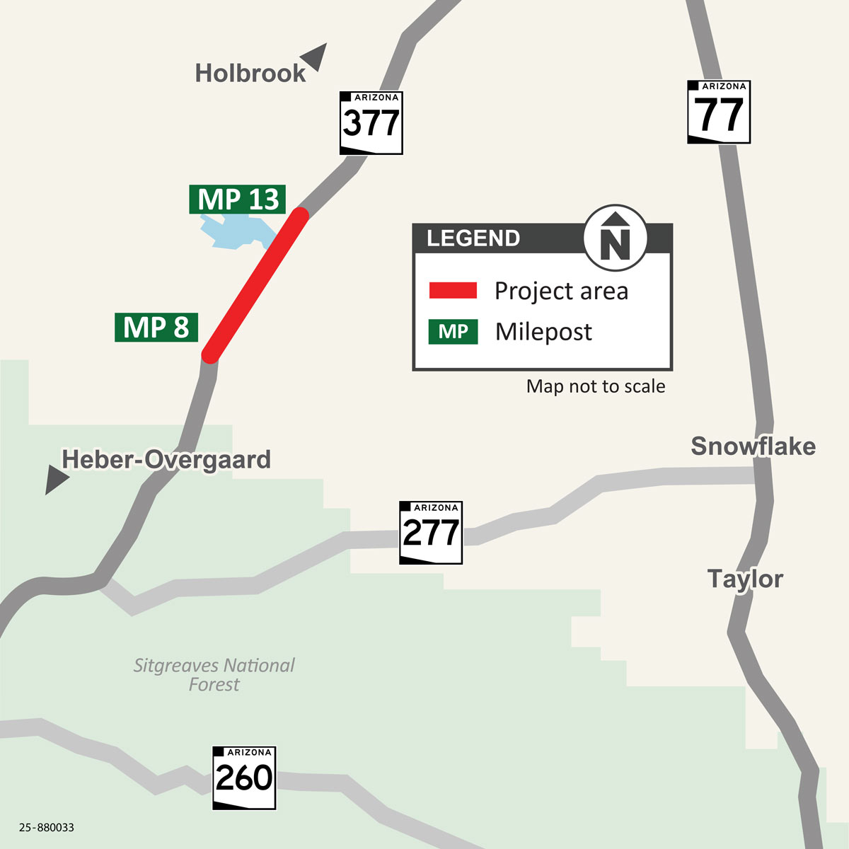
The Arizona Department of Transportation is currently working on a shoulder-widening project along State Route 377 between Heber-Overgaard and Holbrook. The 5-mile-long project begins at milepost 8, about 13 miles north of Heber-Overgaard, and ends at milepost 13.
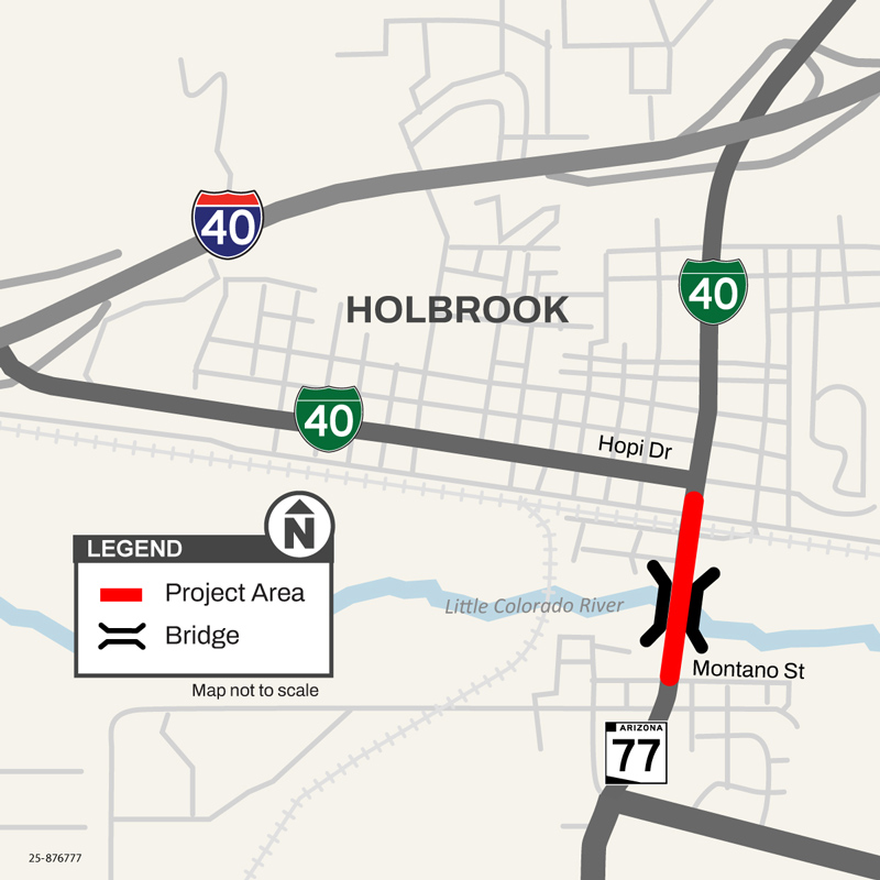
The Arizona Department of Transportation is currently working on a project to rehabilitate the Little Colorado Bridge and roadway pavement along State Route 77 in Holbrook. The bridge is located south of Holbrook’s downtown area on the way to Snowflake.
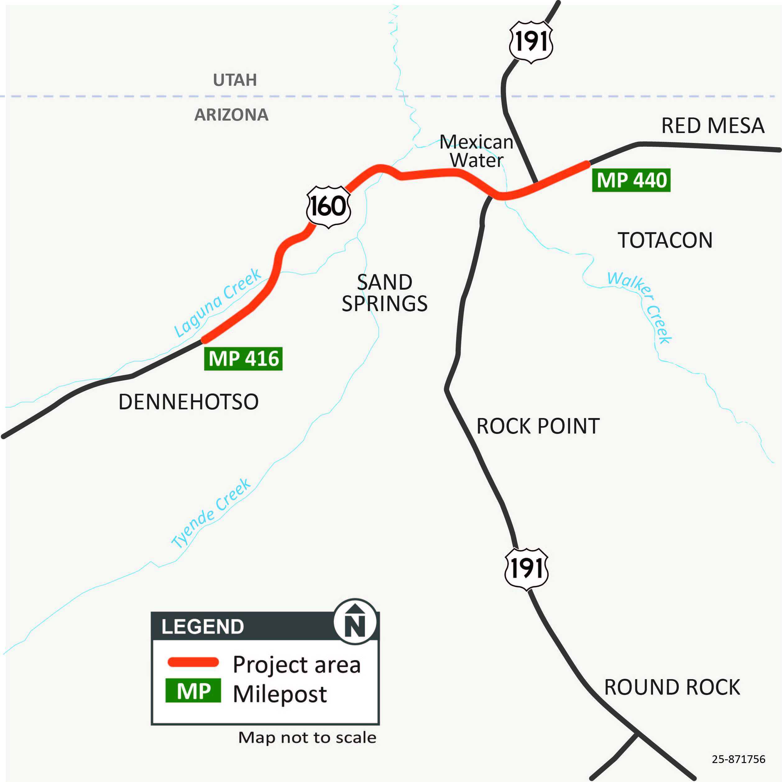
The Arizona Department of Transportation, in partnership with the Navajo Nation, is currently working on a pavement project along US 160 in far northeast Arizona. The 24-mile-long project is roughly between the communities of Dennehotso and Mexican Water.
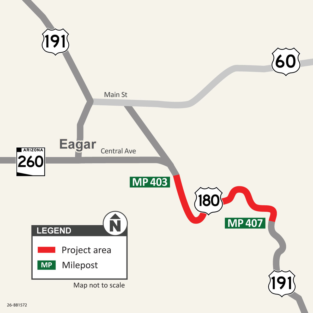
The Arizona Department of Transportation has initiated a pavement rehabilitation project along US 180 south of Eagar. The 4-mile-long project is between Apache Drive (milepost 403) and milepost 407.
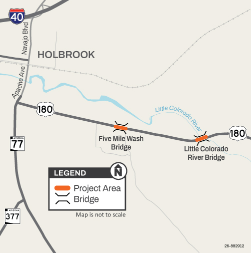
The Arizona Department of Transportation has initiated a project to replace the Five Mile Wash Bridge and the Little Colorado River Bridge along US 180 near Holbrook. The project is expected to begin in September 2026 and be completed by fall 2027 with a winter hiatus.
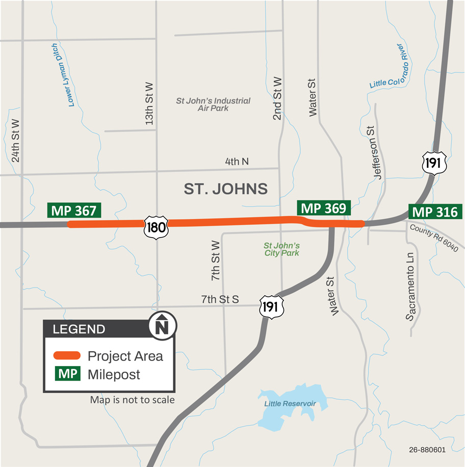
The Arizona Department of Transportation is currently working on a pavement rehabilitation project along US 180, locally known as Cleveland Street, and US 191, locally known as Commercial Street, in the City of St. Johns.