State Route 24 (SR 24), also referred to as the Gateway Freeway, is currently a 5-mile interim roadway between Loop 202 and Ironwood Drive. This section features two lanes in each direction with a center median, bridges over Ellsworth and Mountain roads and at-grade intersections at the following locations:
The Arizona Department of Transportation (ADOT), in cooperation with the Federal Highway Administration (FHWA) and the Maricopa Association of Governments (MAG), has initiated a project to build a new freeway in the southwest valley, State Route 30 (Tres Rios Freeway). The new freeway will serve as a traffic reliever and alternate route to Interstate 10, crossing the cities of Buckeye, Goodyear, Avondale and Phoenix.
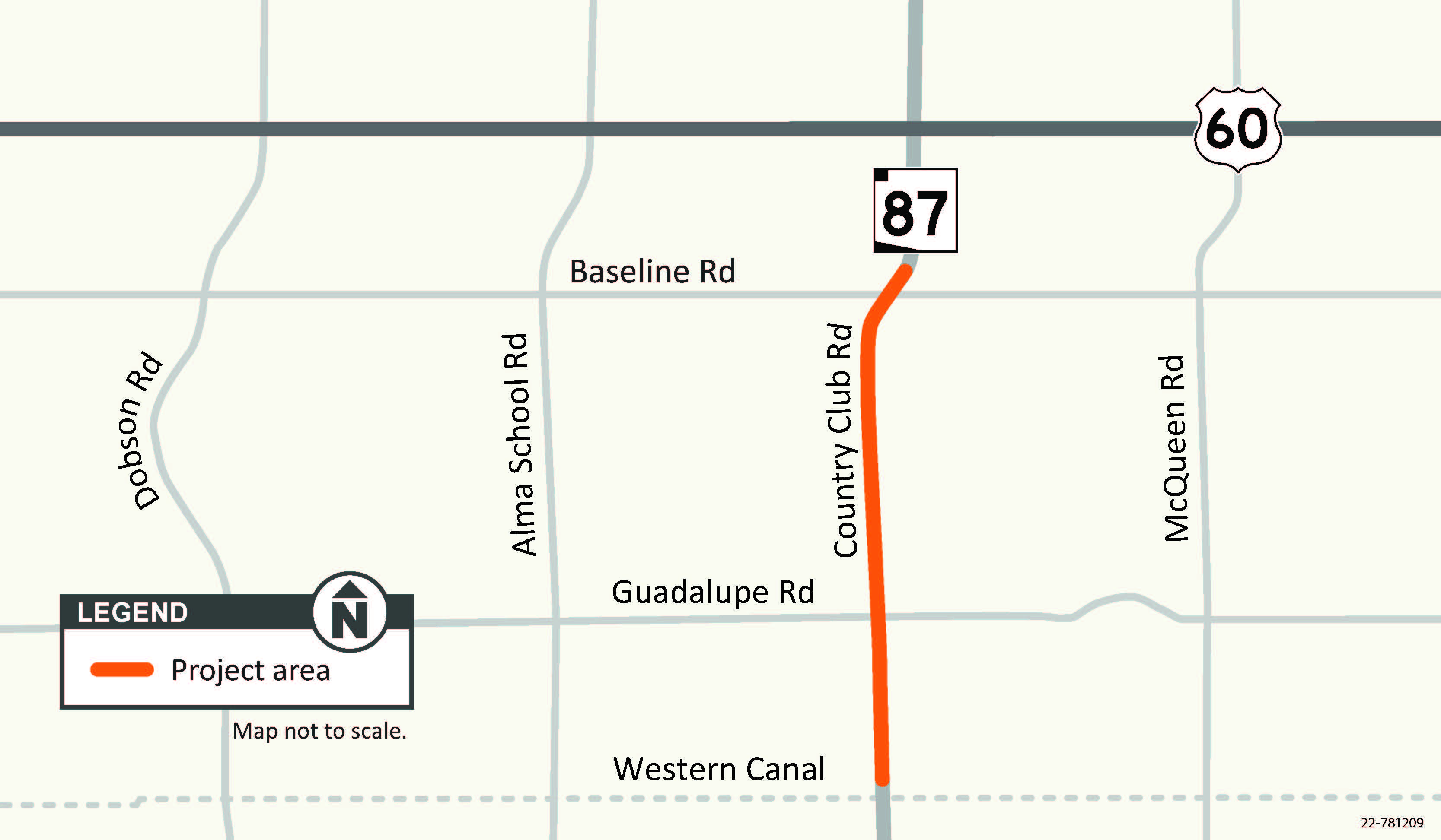
The Arizona Department of Transportation is improving the pavement on SR 87 from the Western Canal to Baseline Road. The purpose of the project is to extend the life of the pavement and to improve safety and the driving experience on the roadway.
The Arizona Department of Transportation (ADOT), in coordination with the City of Phoenix and Maricopa Association of Governments, is designing improvements to the intersection of US 60 (Grand Avenue), 35th Avenue and Indian School Road.
The Grand-35 Project will reconstruct the intersection of
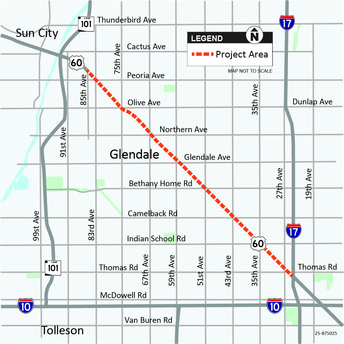
The Arizona Department of Transportation will be conducting a pavement rehabilitation project along an 11-mile section of US 60 (Grand Avenue) from 85th Avenue to Interstate-17. The project will replace the worn pavement to improve the driving experience and safety.
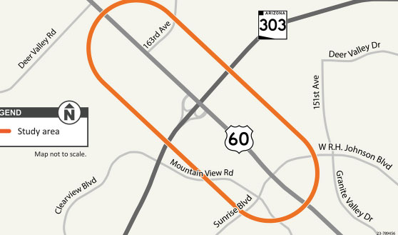
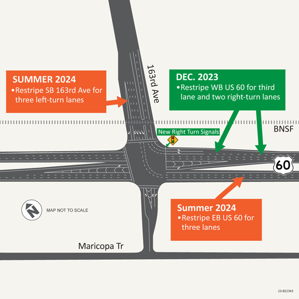
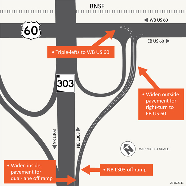
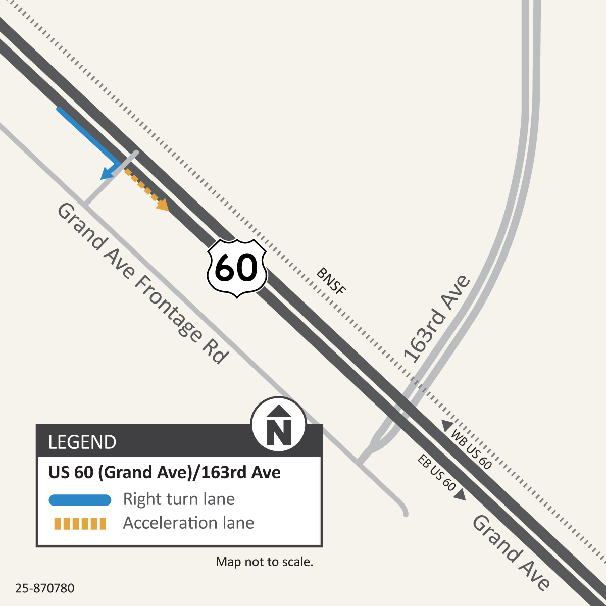
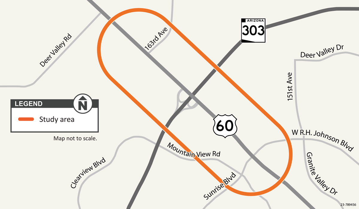
The Arizona Department of Transportation completed a feasibility study in 2022 to assess the US 60 and Loop 303 (Estrella Freeway) interchange and other intersections along US 60 from 163rd Avenue in Surprise to RH Johnson Boulevard in Sun City West.
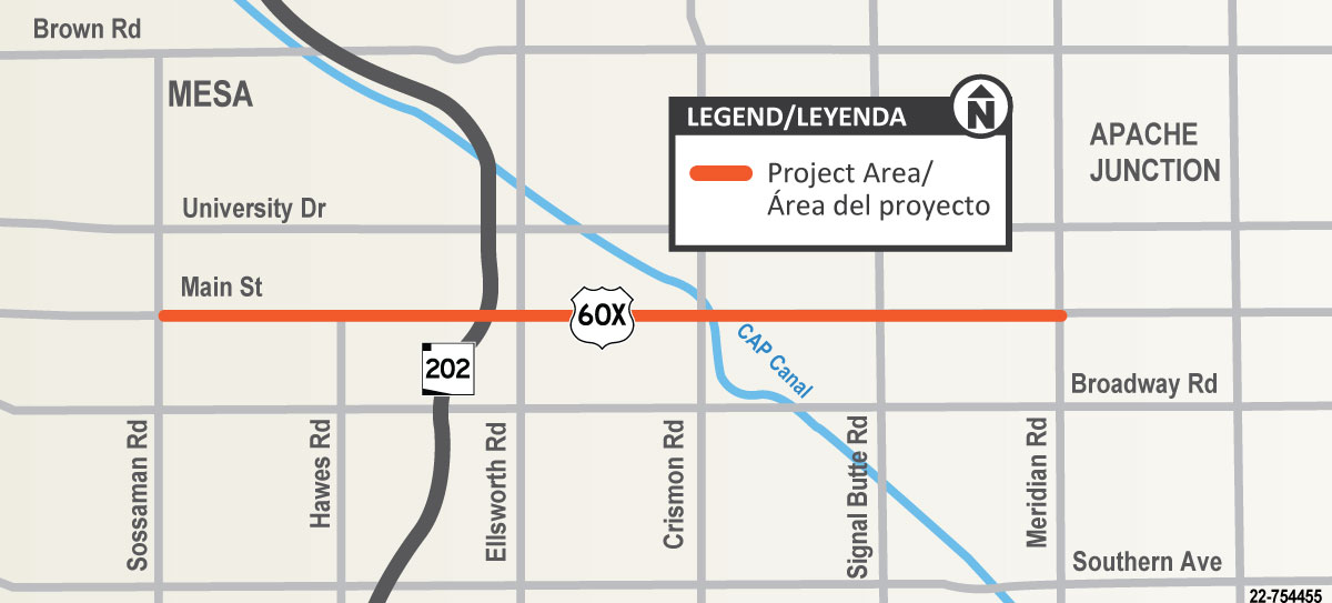
The Arizona Department of Transportation has started a construction project to improve US 60X (also referred to as Old US 60, Apache Trail or Main Street) between Sossaman and Meridian roads.
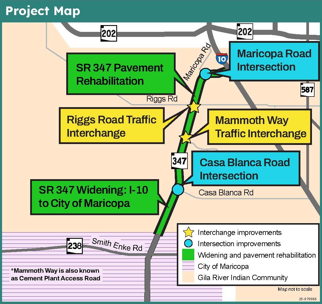
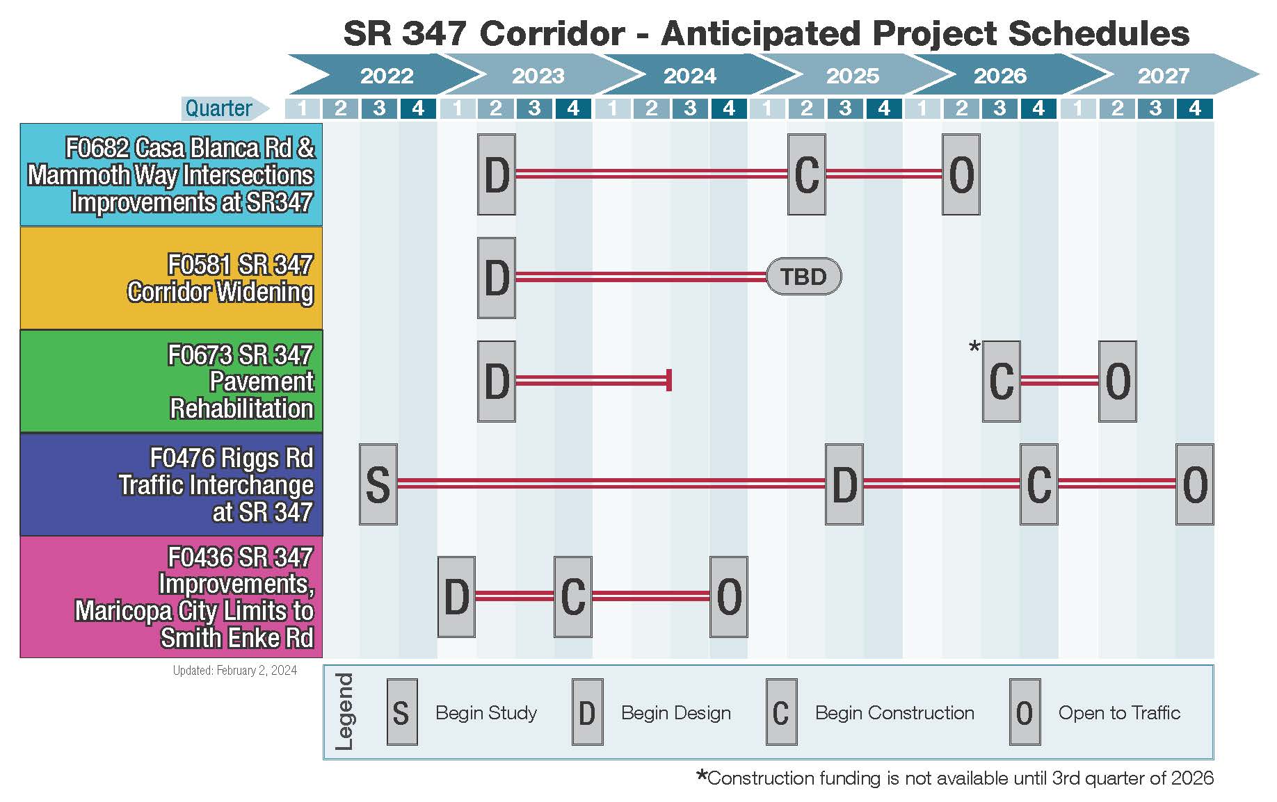
Design is currently underway for the SR 347: I-10 to the City of Maricopa Roadway Improvements Project. There are four main elements of this major corridor improvement project, which is located along SR 347 between Interstate 10 and the City of Maricopa.
