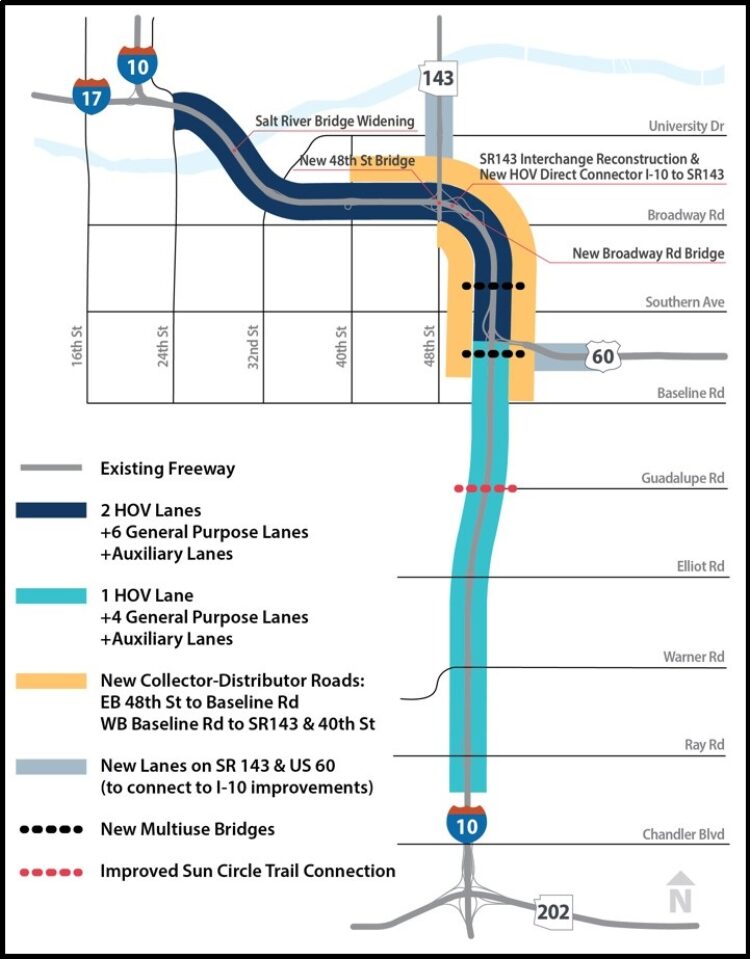
The I-10 Broadway Curve Improvement Project runs along 11 miles of Interstate 10 between the Loop 202 (Santan/South Mountain Freeway) and I-17 near Phoenix Sky Harbor International Airport.
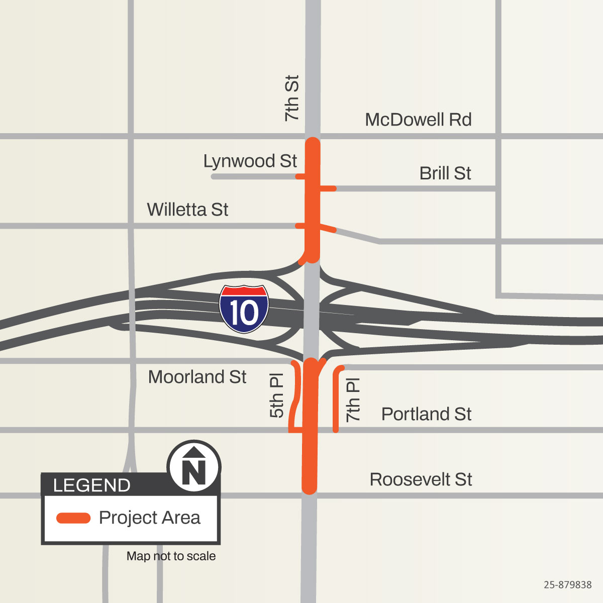
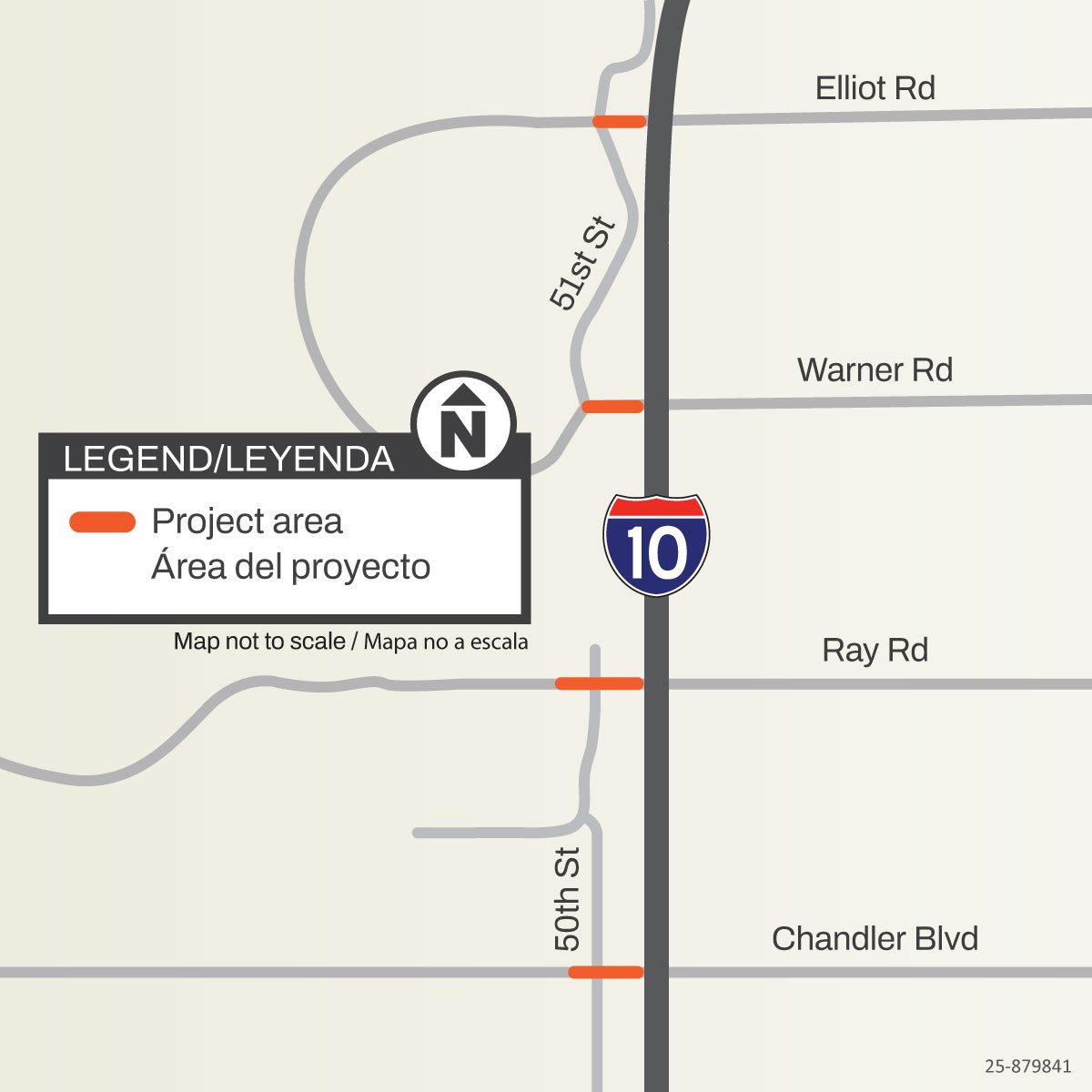
The Arizona Department of Transportation began work in January 2026 on improvements to several cross streets along I-10. There are two areas of Phoenix where the work will take place:
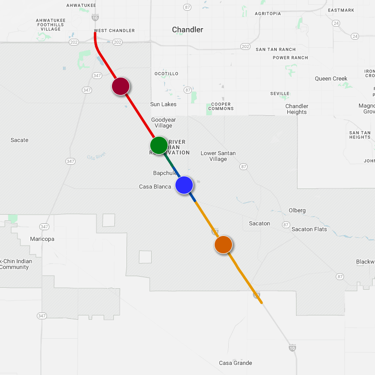
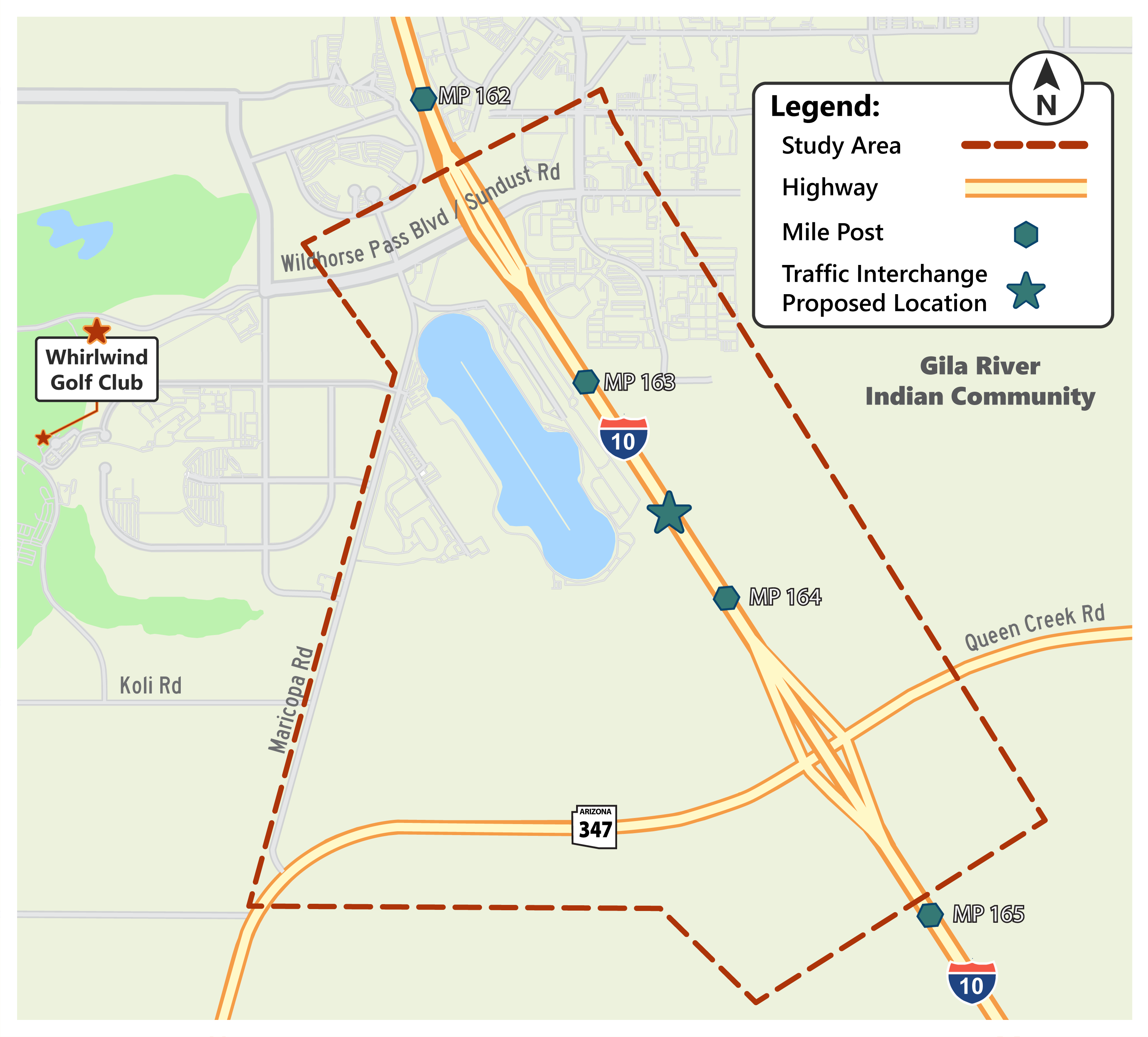
The 26-mile Wild Horse Pass Corridor, part of Interstate 10 from Loop 202 in south Phoenix to State Route 387 near Casa Grande, serves as a crucial commuter and freight link, connecting the Gila River Indian Community to essential services in Maricopa and Pinal Counties.
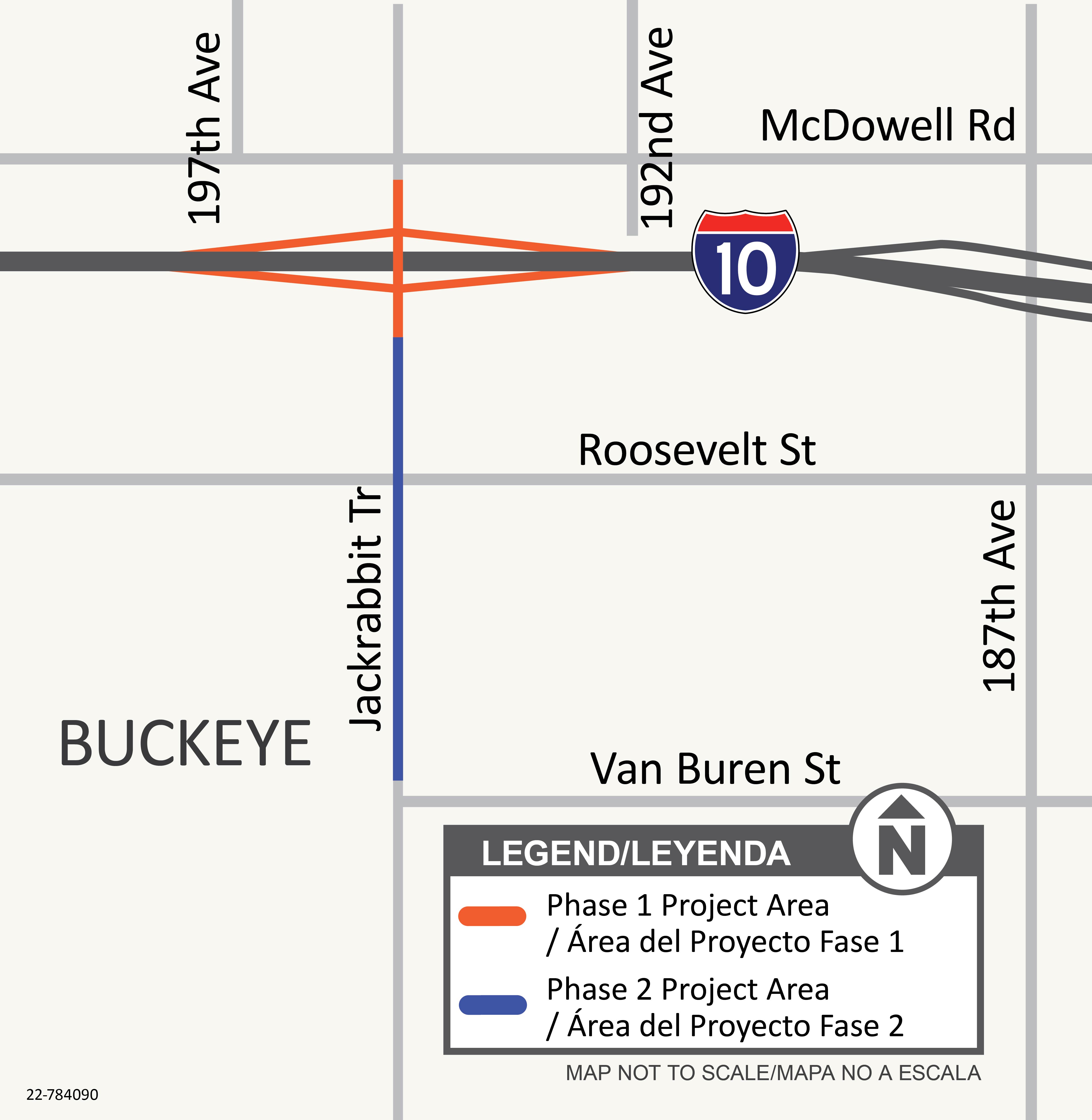
ADOT, in coordination with the Maricopa Association of Governments and the city of Buckeye, will be constructing a project to improve the interchange at I-10 and Jackrabbit Trail.
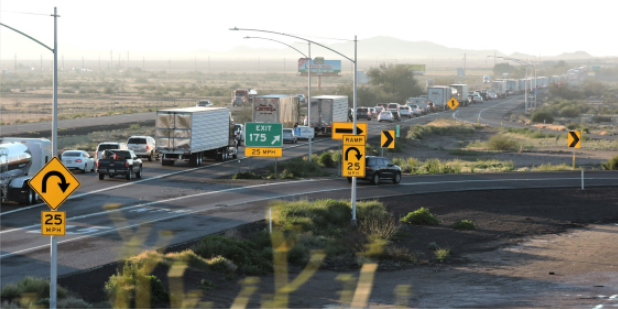
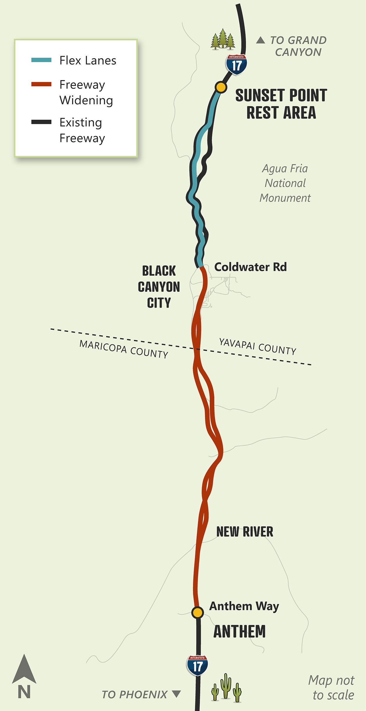
The work includes widening 15 miles of roadway, replacing two bridges and widening 10 others, and constructing approximately eight miles of flex lanes.
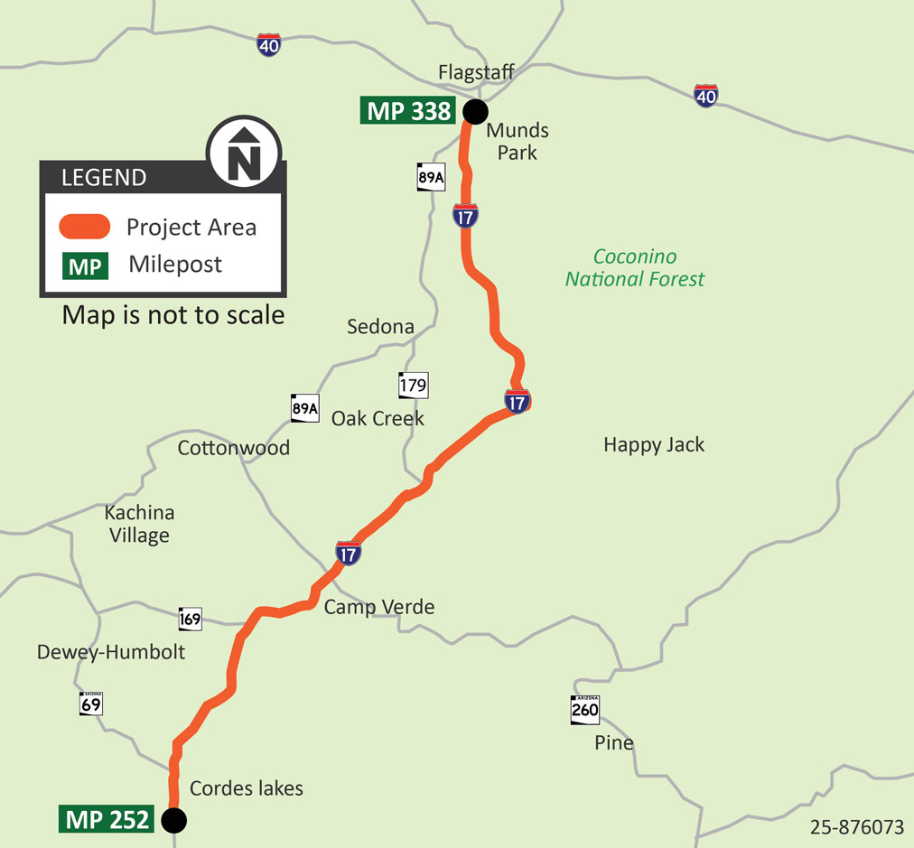
ADOT has initiated a project to install more than 250 miles of closed-circuit television cameras, thermal cameras, fiber optic cable, dynamic message signs, butterfly sign structures, a road weather information system, and other related work along Interstate 17 between Cordes Lakes and Flagstaff (mileposts 252-338).
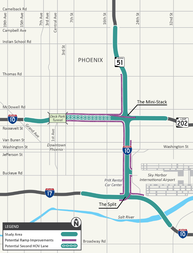
The Arizona Department of Transportation (ADOT), in cooperation with the City of Phoenix and the Maricopa Association of Governments (MAG), has begun a study of Interstate 10 (I-10) from the Deck Park Tunnel to the I-10/I-17 interchange, also known as the “Split” interchange, near Phoenix Sky Harbor International Airport, also known as Sky Harbor.
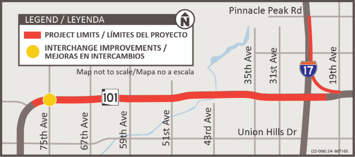
The Arizona Department of Transportation, in cooperation with the cities of Glendale, Phoenix and Peoria, the Federal Highway Administration and the Maricopa Association of Governments, has initiated a project to widen and make other improvements to the Loop 101 (Agua Fria Freeway) between 75th Avenue in Glendale and Interstate 17 in Phoenix.