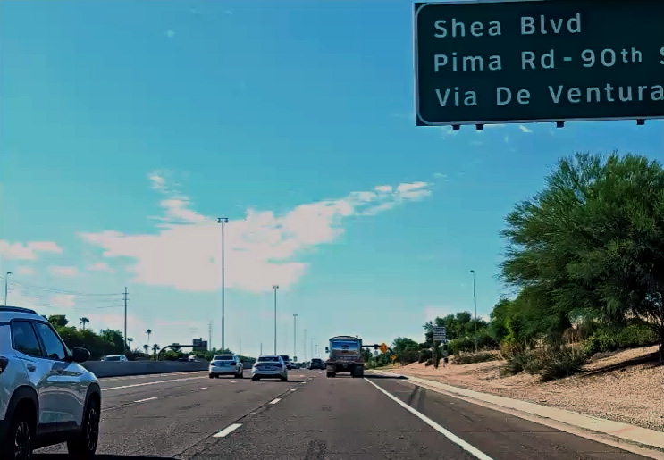
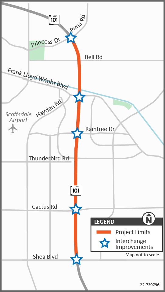
The Arizona Department of Transportation, in partnership with the City of Scottsdale, widened Loop 101 (Pima Freeway) between Princess Drive/Pima Road and Shea Boulevard by one general-purpose lane in each direction and modified existing interchanges to improve traffic flow on Loop 101 and the cross streets.
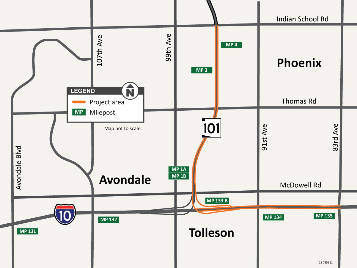
The Arizona Department of Transportation completed a study in 2023 that evaluated improvements to the Loop 101 (Agua Fria Freeway) and Interstate 10 system interchange in the West Valley, producing a Design Concept Report.
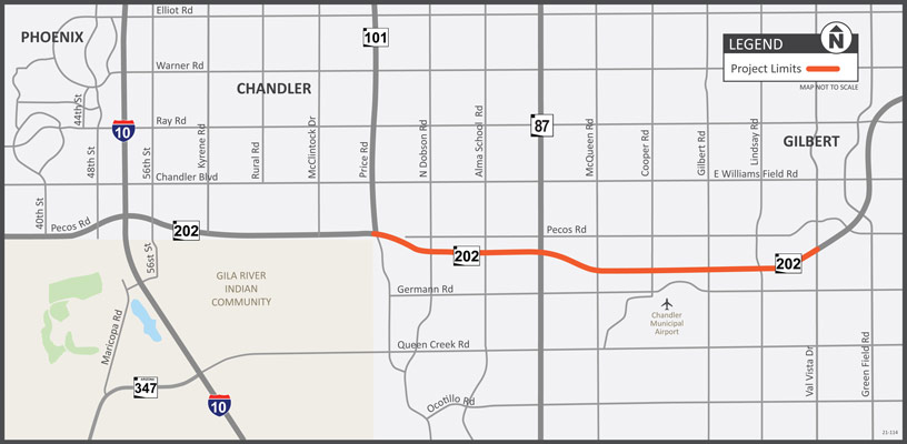
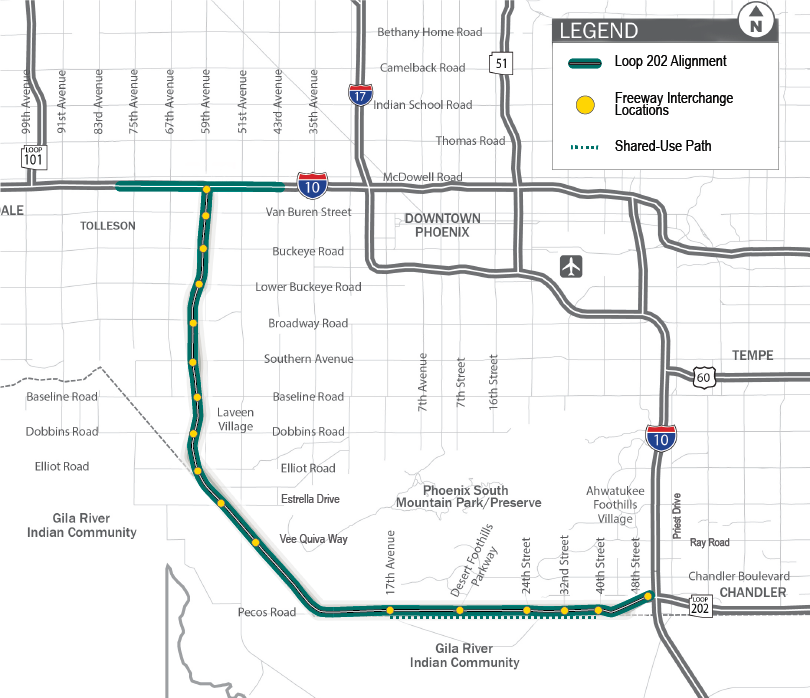
ADOT has initiated a project to widen and make other improvements to the Loop 202 between Loop 101 and Val Vista Drive in the city of Chandler and town of Gilbert.
The Loop 202 (South Mountain Freeway) adds 22 miles of freeway to the existing Phoenix metropolitan transportation system. The freeway connects the east and west valley while providing much needed relief to existing freeway corridors and local streets.
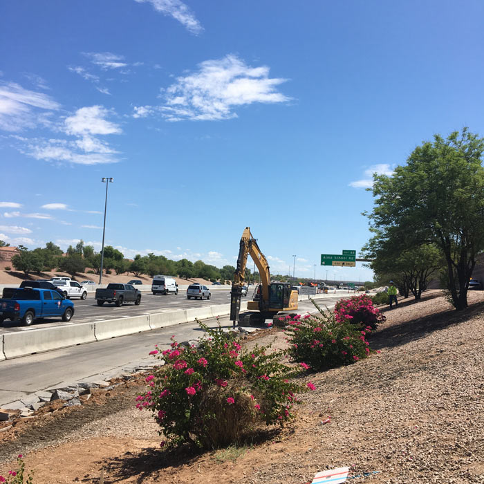
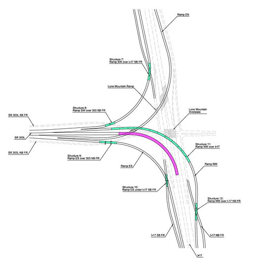
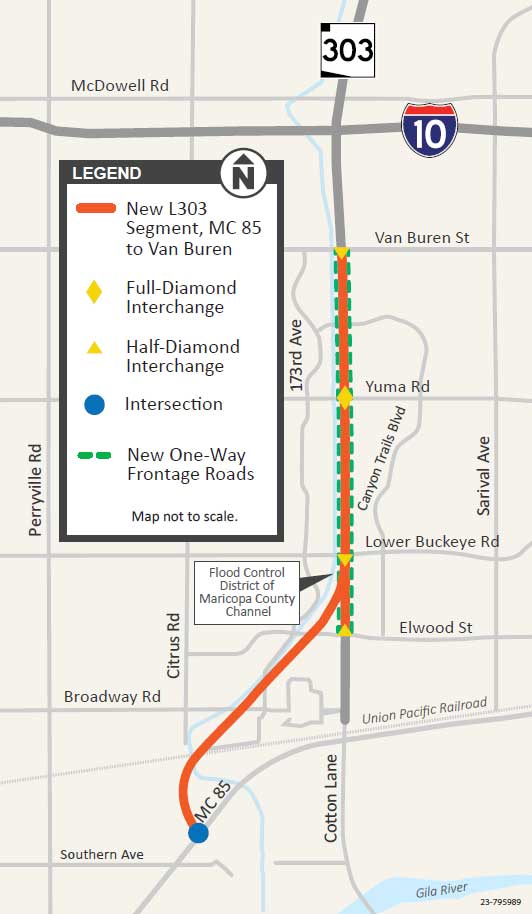
ADOT, in coordination with the Maricopa Association of Governments and the cities of Phoenix and Peoria, is improving Loop 303 between Lake Pleasant Parkway and I-17. The project seeks to address growing traffic demands on Loop 303.
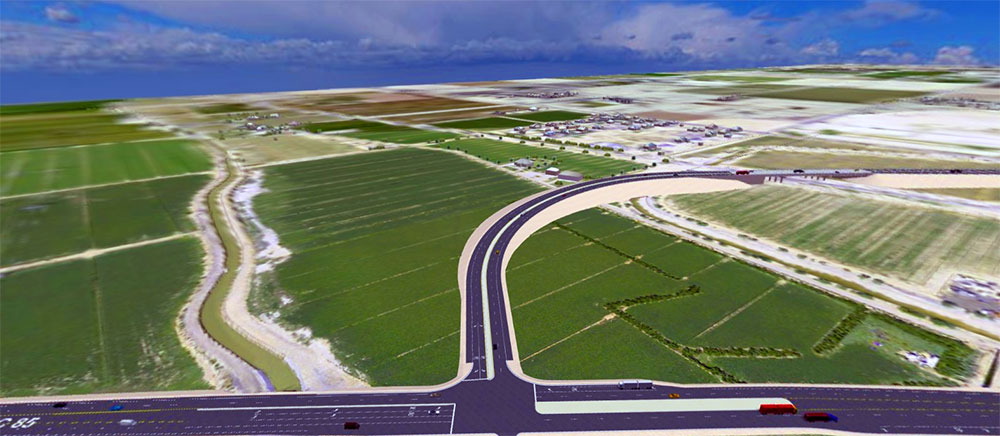
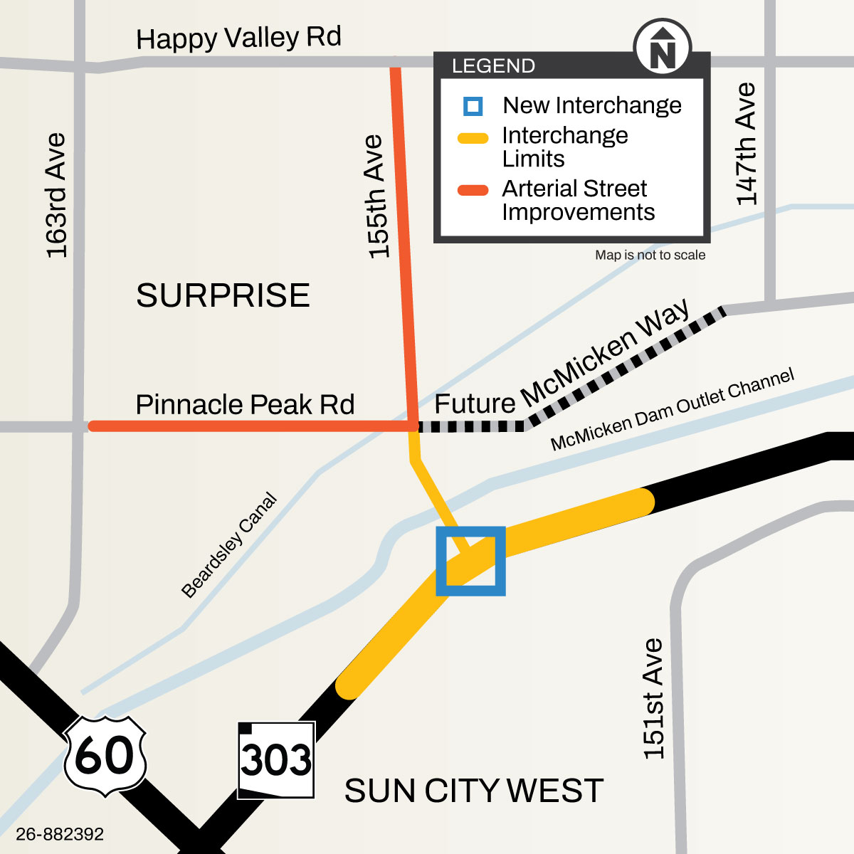
This project seeks to address growing traffic volumes in the Surprise and Sun City West areas and alleviate congestion at the existing US 60/Loop 303 interchange and the US 60/163rd Ave intersection.
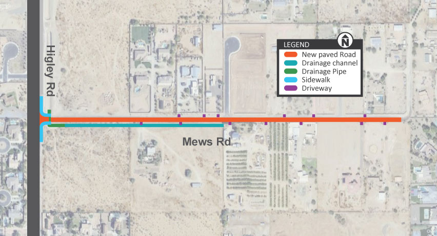
The Arizona Department of Transportation, in partnership with the Maricopa County Department of Transportation and the Town of Gilbert, is improving Mews Road between Higley Road and 172nd Street.
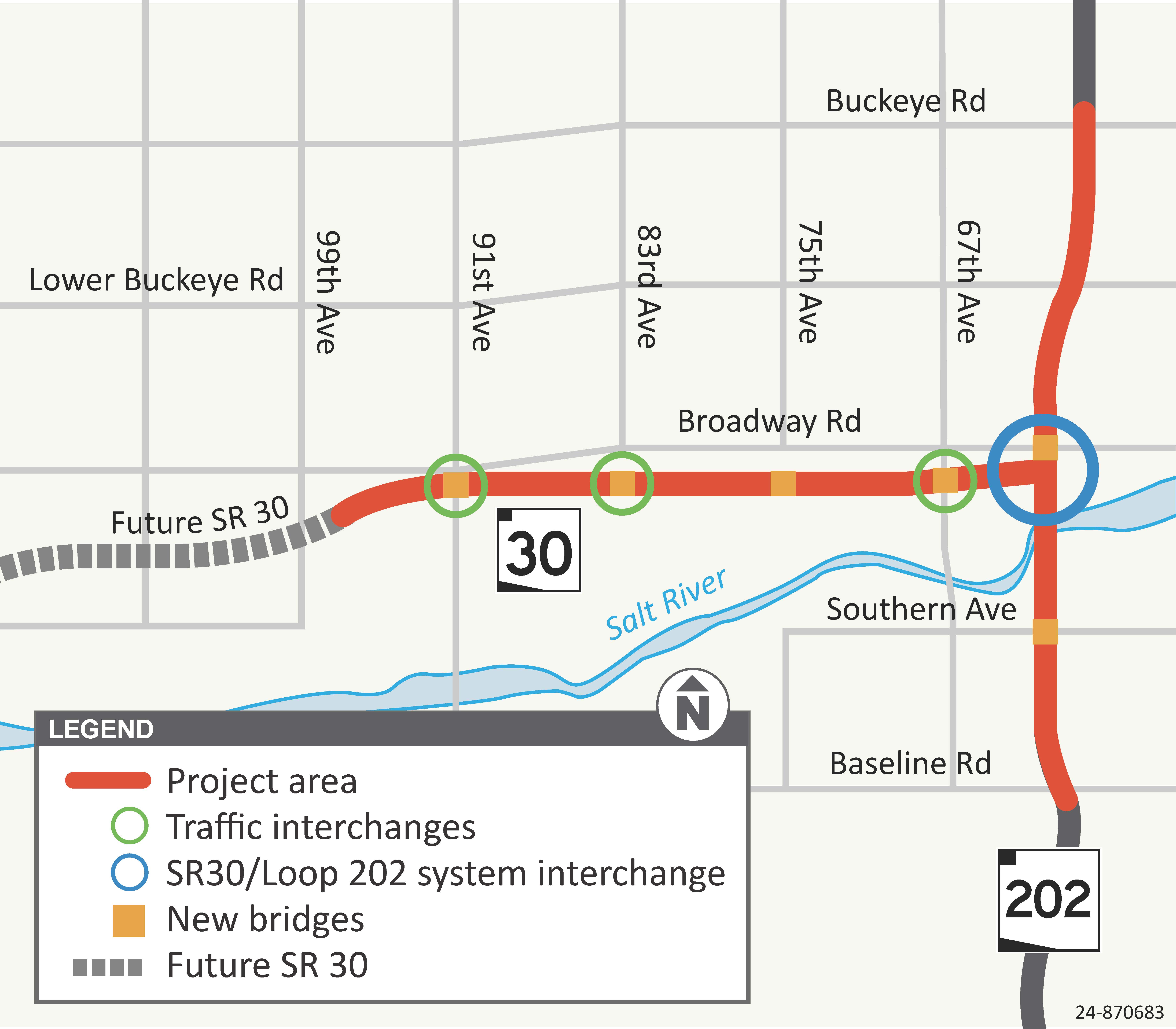
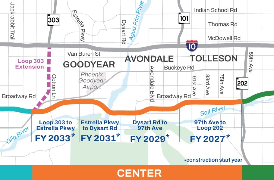
State Route 30 (Tres Rios Freeway) is a new freeway planned in the southwest valley crossing the cities of Buckeye, Goodyear, Avondale and Phoenix. The center section of SR 30, between Loop 303 and Loop 202, will be constructed first due to its potential to serve as a traffic reliever and alternate route to Interstate 10.
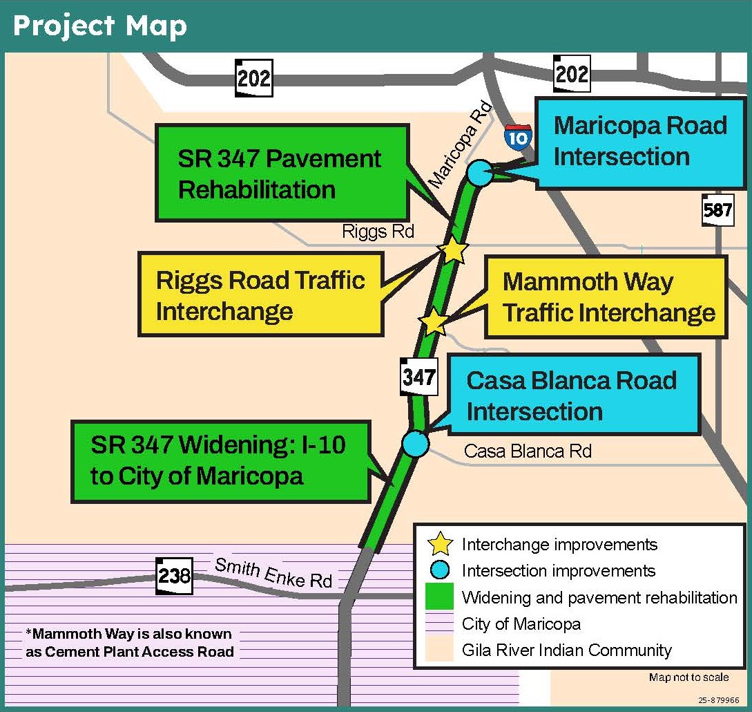
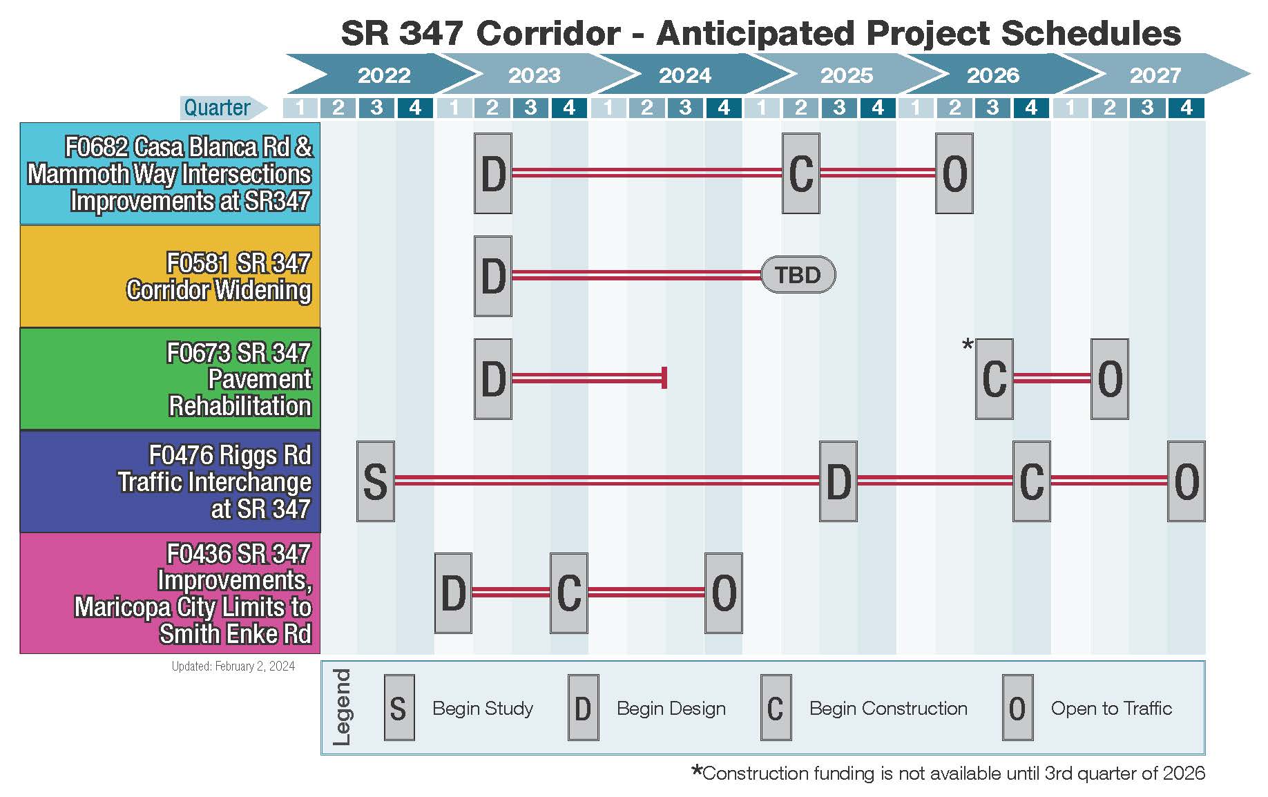
Design is currently underway for the SR 347: I-10 to the City of Maricopa Roadway Improvements Project. There are four main elements of this major corridor improvement project, which is located along SR 347 between Interstate 10 and the City of Maricopa.
